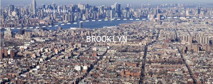
Aerial view of Brooklyn, viewing northwest towards Manhattan. Image via absre.com
Sharing Cities is an early phase of the development of urbanization.org, an online database (and, eventually, design tool) for the public space of cities around the world. The hope for the future is that enough cities can be homogeneously compiled that designers may compare them side by side and use the lessons of one to inform projects in another. Each of the MaCT students spent the semester documenting various streets from their cities of origin, using architectural plans & sections, photographs, and data parameters from the internet. I come from Brooklyn, New York, in the United States of America.
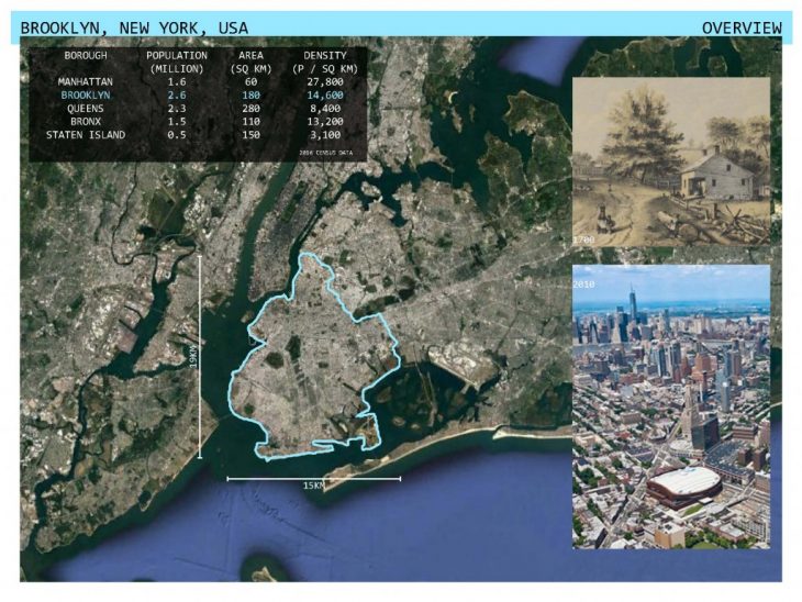
If New York City were split into its 5 counties, Brooklyn would be the 3rd-largest city in the United States.
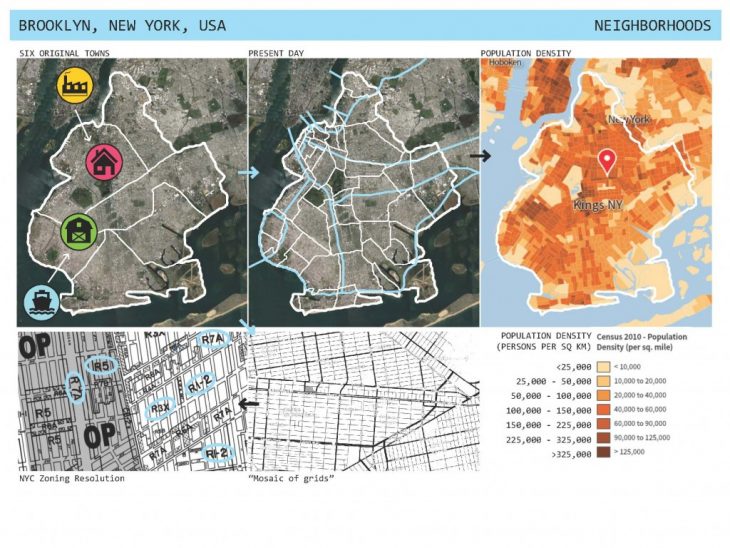
Diagrams showing Brooklyn’s growth history, neighborhood mosaic, and population density.
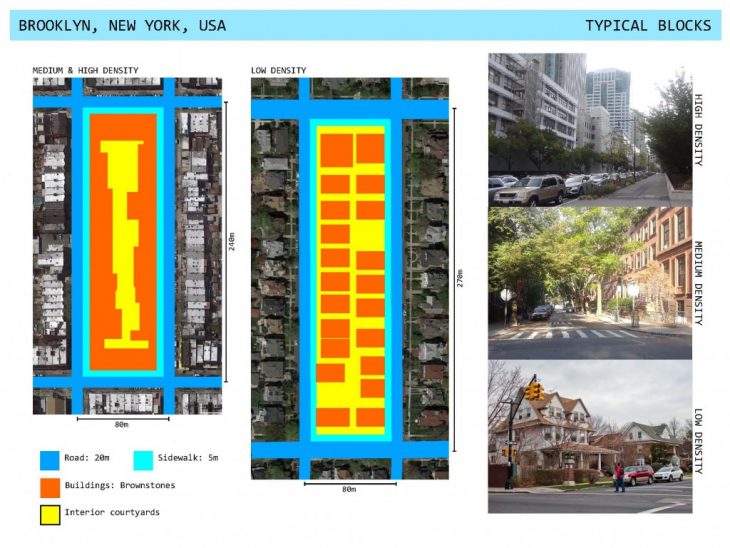
The typical Brooklyn block measures about 80m x 250m. Densities range from low density detached single-family houses to the quintessential medium density contiguous brownstones to high density apartment buildings.
Brooklyn has been characterized throughout its existence as a suburb of Manhattan. It is almost entirely made up of low-density residential sprawl, combining the city-scale dominion of automobiles with walkable neighborhoods. Roads are fairly uniform in composition regardless of their location and function. The benefit of this uniformity is that busier, denser areas retain pedestrian space, green space, and admit light & air. The downside of this uniformity is that even the quietest, lowest-density areas save most of their public space for automobility.
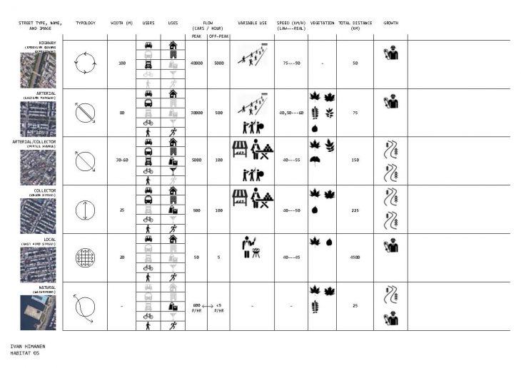
Using the Functional Classifications outlined by the New York State Department of Transportation as a basis, four street types were identified: 1) the Highway; 2) the Arterial Road; 3) the Collector; 4) the Local Road.
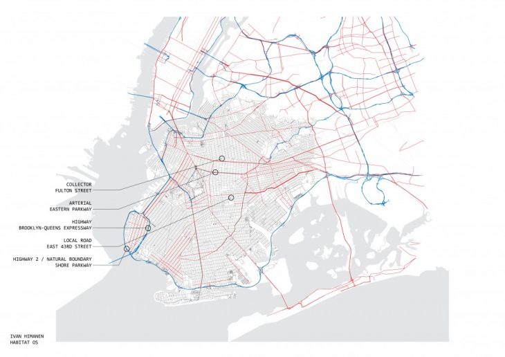
Highways are the highest speed roads, used for crossing the entire county of Brooklyn and arriving at adjacent counties. The name is telltale: Brooklyn-Queens Expressway. Its section is independent of the surrounding city fabric: at times the highway is sunk below street level and buffered by greenery, at times it is elevated above the street entirely. This changing profile is linked to Robert Moses’ controversial planning in the mid-20th century.
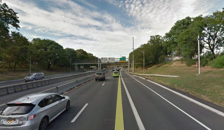
Highway. Brooklyn-Queens Expressway. Image via Google Earth.
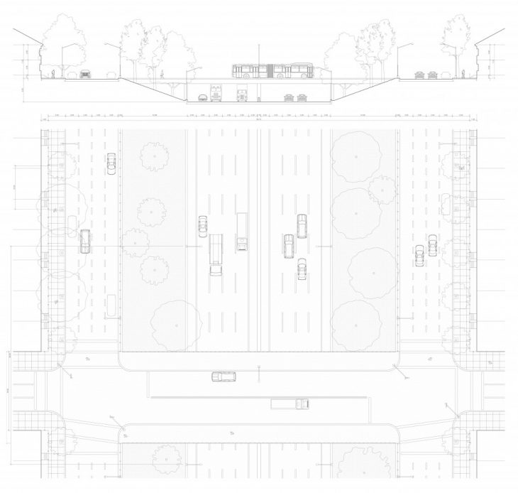
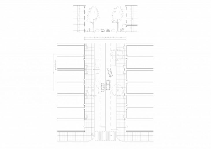
Arterial Roads are a conglomeration of semi-high-speed road, local road, pedestrian paths, bicycle paths, and green space. They are the New York version of European boulevards like Champs-Elysees or Avinguda Diagonal, only without the commercial activity.
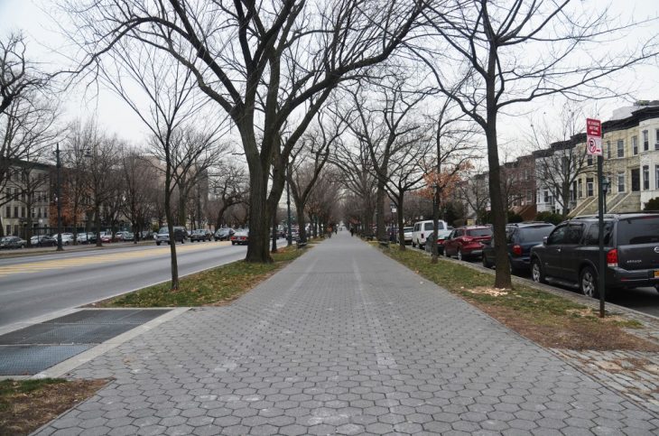
Arterial. Eastern Parkway. Image via newyorkyimby.com
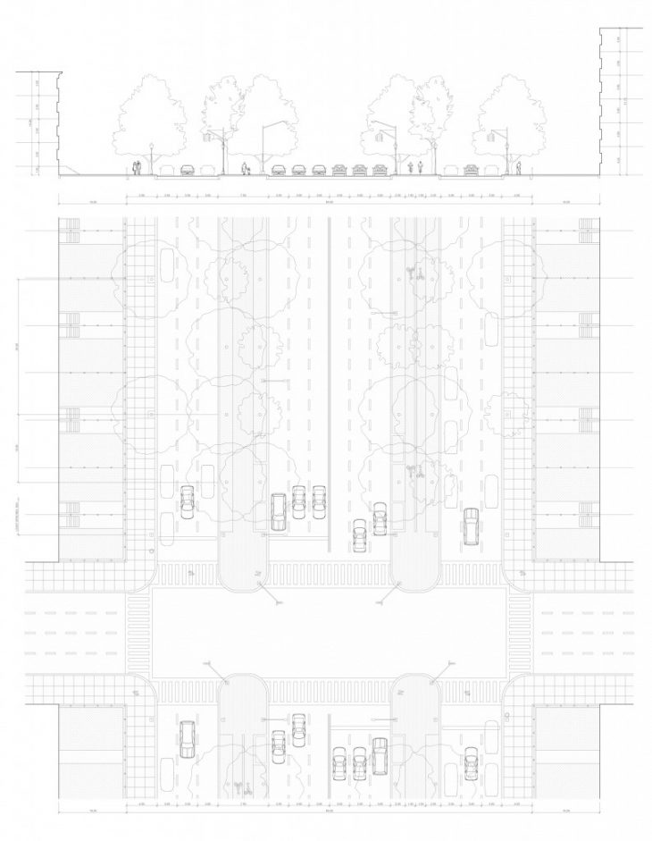
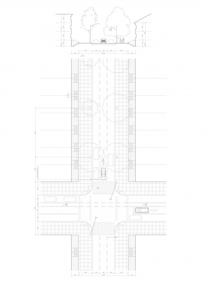
Collector roads separate neighborhoods and are where most of Brooklyn’s commercial activity and night life is situated. Since they are usually only 4 lanes wide, however, the coexistence of pedestrians, private cars, public transportation (buses), shipping trucks, and the occasional bicyclist often results in traffic and chaos.
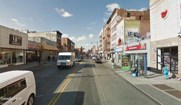
Collector. Fulton Street. Image via Google Earth.
Local Roads make up approximately 90% of all the streets in Brooklyn, and are most often one way streets with parking on either side. The housing is typically set back from the property line, leaving room for private gardens and barbecue space while giving a sense of openness to the street.
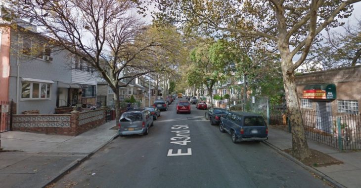
Local Road. East 43rd Street. Image via Google Earth.
Variation on the Highway type: Shore Parkway, where the Brooklyn-Queens Expressway bifurcates and follows the waterfront. Here, the greenery buffer zone remains on the inland side, while on the water side there is a pedestrian and bicycle way for local residents. Shading is minimal and wind is usually strong, but it is nonetheless important to note that at this natural boundary, safe separate space is maintained for people.
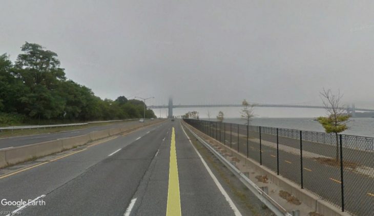
Highway variation: Natural Boundary. Shore Parkway. Image via Google Earth.
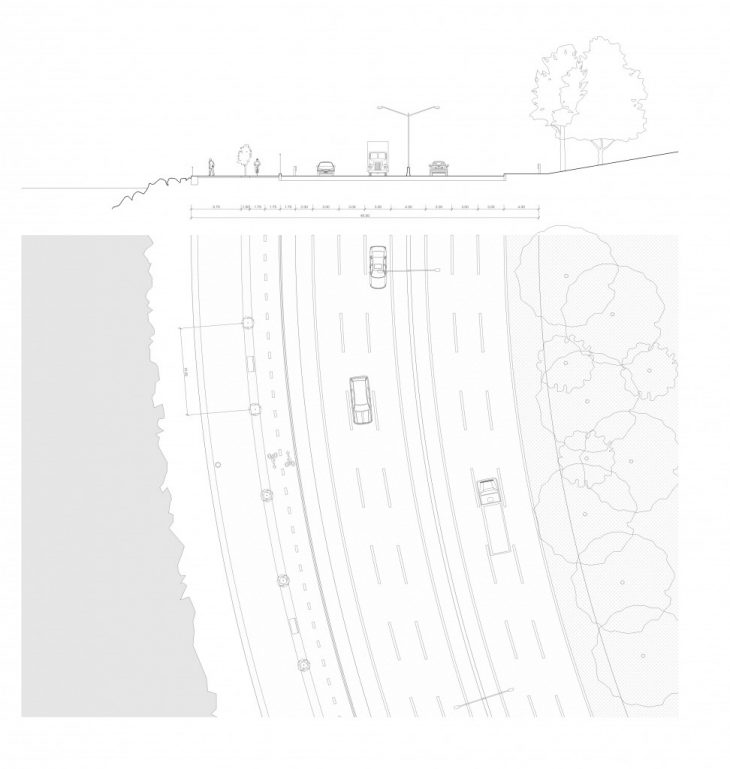
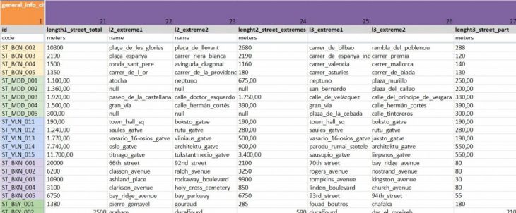
In addition to drawings and photographs, early steps were taken to break each street down into quantifiable parameters. Early versions emphasized more general information and communication through graphics, which were discarded in favor of a more systematic approach and a spreadsheet which could be used for visualizations.
Example of early parameter representation for Brooklyn.
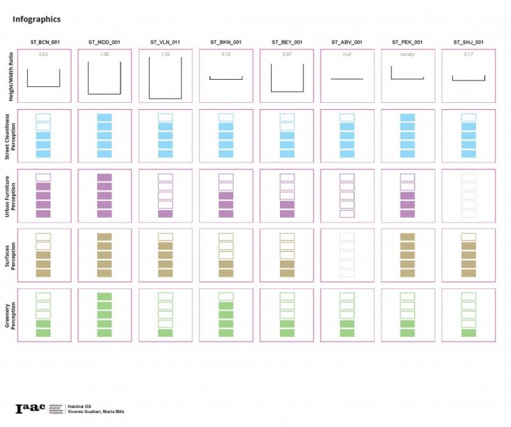
Early ‘infographic’ visualizations were attempted based directly on the extracted parameters. In the example below, one can contemplate the relationship, or lack thereof, between street height/width ratio and various perceptions such as greenness, cleanliness, and quality of furniture.
This project hopes to grow into a veritable Wikipedia for public space.
Brooklyn: Sharing Cities is a project of IAAC, Institute for Advanced Architecture of Catalonia, developed at MaCT (Master in City & Technology), 2017-18 by:
Students: Ivan Himanen
Faculty: Vicente Guallart, Marta Milà