Can we engage Hyper Regions with Slow Cities?
How do we approach urban barriers and connection corridors?
Rio de Janeiro is a Mega City; a complex organism with certain characteristics coming to the extremes. The entire metropolitan area is home to some 12,2 million people, becoming a urban management challenge. To that it is a city made of completely different urban fabrics (mosaics, block compositions, linked assemblies, collisions, clusters, field vectors, patchworks and various grids) with equally diverse actors standing behind them. This diversity is visible even when zooming to a 1×1 km area. This strangeness becomes something very delicate and appealing. It is what constitutes an interesting paradox; a gigantic Mega City that however is knitted of delicate and sensitive fabric.
/// ANALYSIS
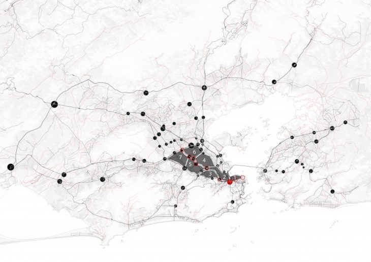
The project area is a designated perinode. This may be understood as a node of communication and various activities, located very close to the city center, but at the same time, very far from a city center reality. In this unique situation, the rivalry between a Hyper Region and a Slow City is even more emphasized.
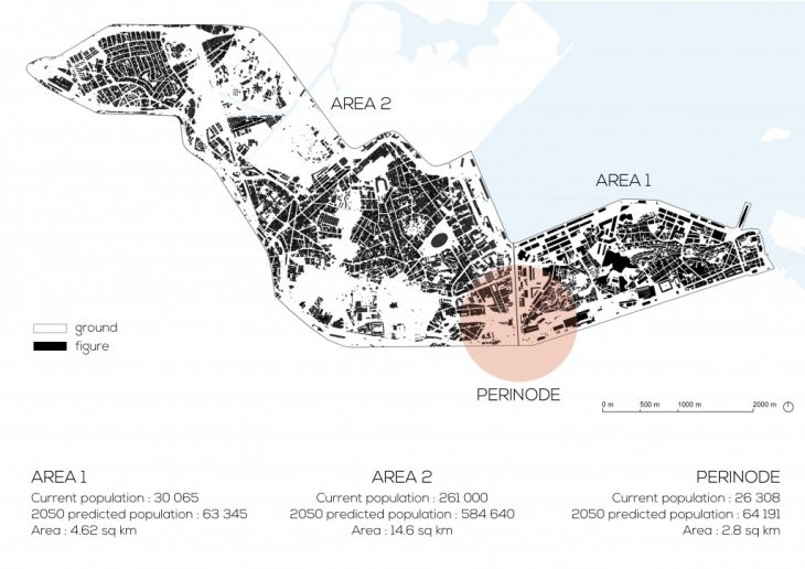
Perinode A is located in the downtown area of Rio de Janeiro, more precisely at the intersection of Sao Cristovao, Santo Cristo, Estacio and Maracana neighbourhoods. The Perinode is the project area of the group members who analysed and collected data about area 1 and area 2.
The analysis, together with data collection, data visualisation and on field trip, deals with different aspect of the city, which can be listed as:
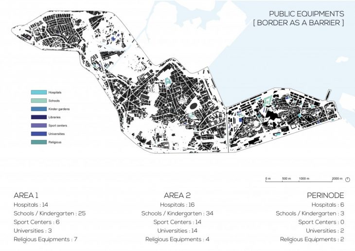
- Public Equipments
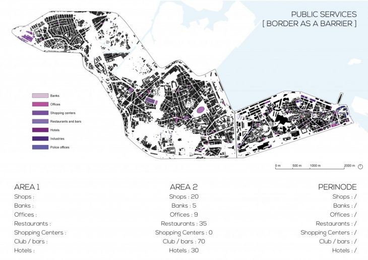
- Services
- Mobility Networks
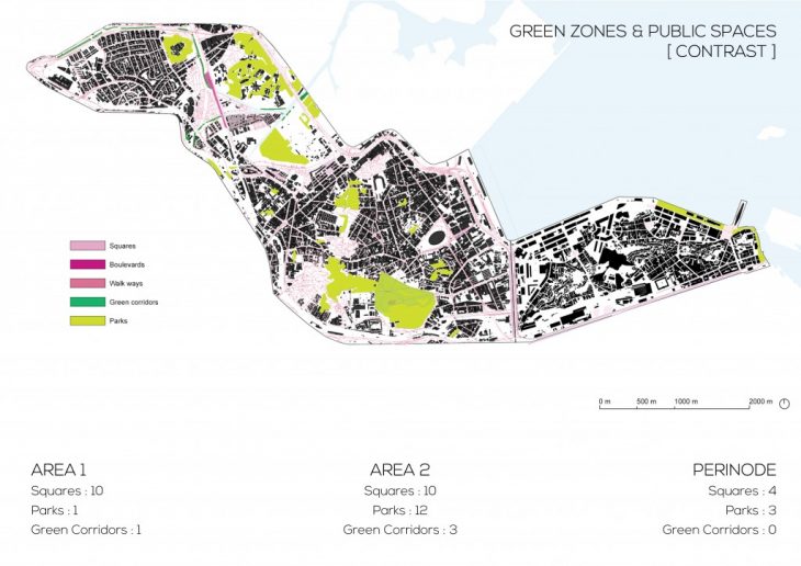
- Public Spaces
- Green Zones
- Demography
- Residence
Area 1 and Area 2 analysis.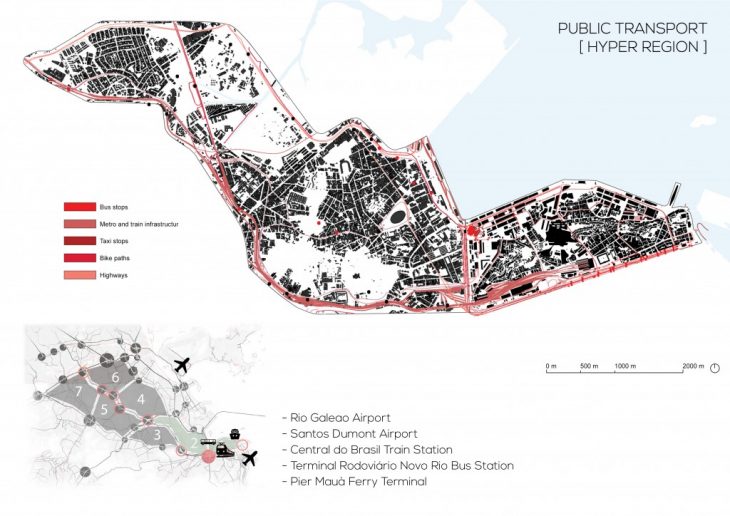
HYPER REGION – SLOW CITY
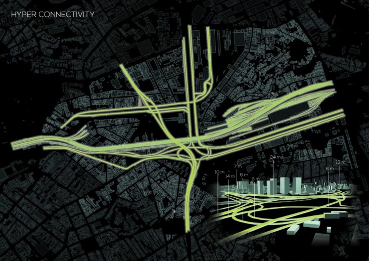
[ HYPER REGION ] The main feature of this area is its hyper connectivity to the rest of the city/country, being the obligatory path towards both national and international destination. Major highways, railway lines and metro run at different speed and scale on the perimeter of the area. [ SLOW CITY ] While the Hyper Region develops on the perimeter, what happens inside the area is the Slow City, almost “dead”. Informal settings alternate to regular residences, villas, and some new CBD skyscrapers, creating isolated realities which can’t coexist one with the other.> The resulting argument is the necessity of creating a cooperation between the two extremes, a co-living situation for both the stationary and nomads passing by the area.
BREAKING THE BARRIERS
As the infrastructure are a strength to the area, creating movement, speed and connectivity, they also act as barriers from one side to the other one. Their development and construction happened so urgently and fast, that the pedestrian paths were not considered, becoming impossible for pedestrians to cross.
The resulting argument is the necessity of improving the different layers of connectivity including and priorities pedestrian and bicycle paths.
Perinode A is located in a zone where these two arguments are emphasised the most.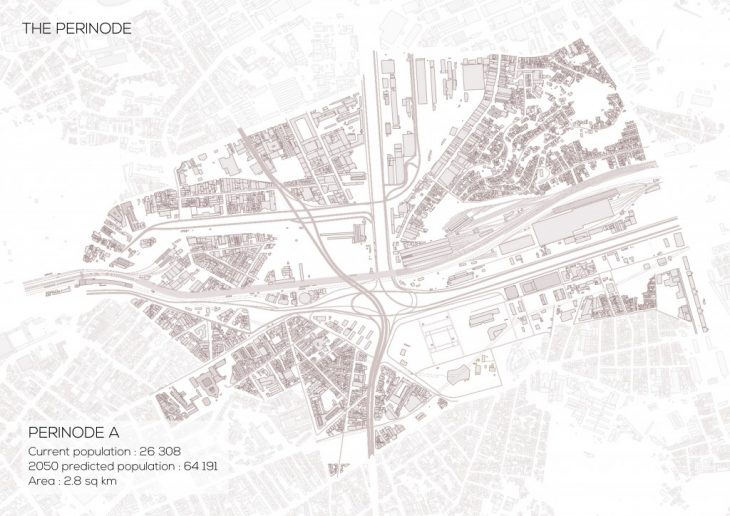
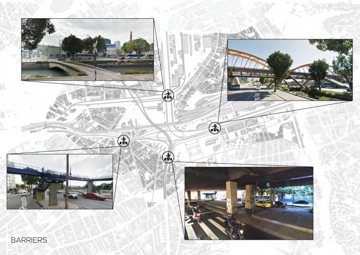
As shown in the map, 4 pedestrian passages exist, 2 of them are very unsafe. People can’t cross straight to reach the other side, demotivating walking or cycling as a type of transportation.
An analysis of the main features and functions acting in the perinode, which will cooperate with the new functions given by the project.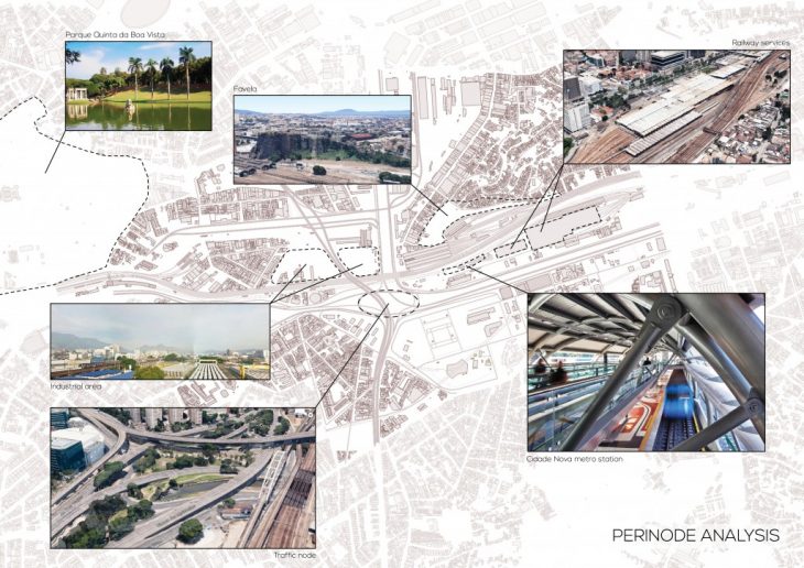
/// DESIGN
Hyper Regions are areas of extreme speed, complexity and grand scale, both in use and communications, while Slow Cities are its opposite, areas where life is more slow and simple. In daily life, these two need each other, like magnets searching for balance.
This project begun as a research in how these may work together.
When a residential district mixed with degradation of industry has characteristics of a Slow City and a business district mixed with infrastructure cores resembles a hyper region, how do you make these work together? It is a delicate task, requiring delicate and focused interventions.
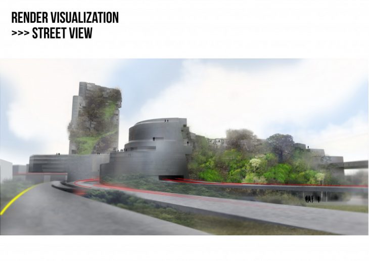
Hyper Regions and Slow cities are usually connected to certain infrastructures that allows for their characteristics, these objects as highways, rail communication, cycle ways or piazzas are enablers, however to other actors may become barriers.
The second theme of this project became an inquiry into how urban barriers may be broken without disturbing their activities. How can we transform a limitation into a new possibility of public contact? In the close future, can we condense transport into a series of super efficient veins and make pedestrian movement better?
This project represents an educated speculation, being based on research, of how the situation and urban scenario of Rio de Janeiro will look in 2050.
It is not exuberant, but a series of smaller but strategic conclusions that deal with the way we may come to live, work, move and experience urban participation.
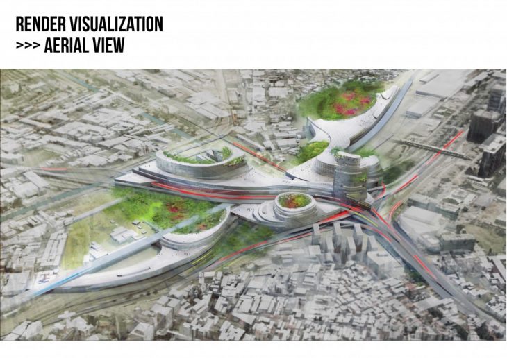
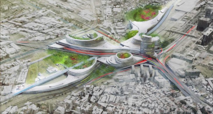
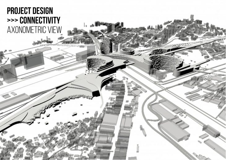
The way to look at this project is considering it as a “smart urban monster”. A object that connects areas of high intensity with those of low. In a sensitive manner, provides necessary functions in a most adequate way, fostering cooperation and openness. To that, not only in the strict project area, but with a greater strategic scale.
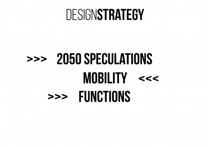 Since the project is for a 2050 Rio de Janeiro, the first step taken, was to approach and speculate about what the city will look like, what will be the needs and lifestyle in 33 years from now.
The second step was to study more deeply the main feature of our assigned Perinode: the infrastructures. And understand, according to the speculations, how to maintain/demolish/reuse it.
The final step was to analyse the existing functions, trying to understand how deeply set they are in the area.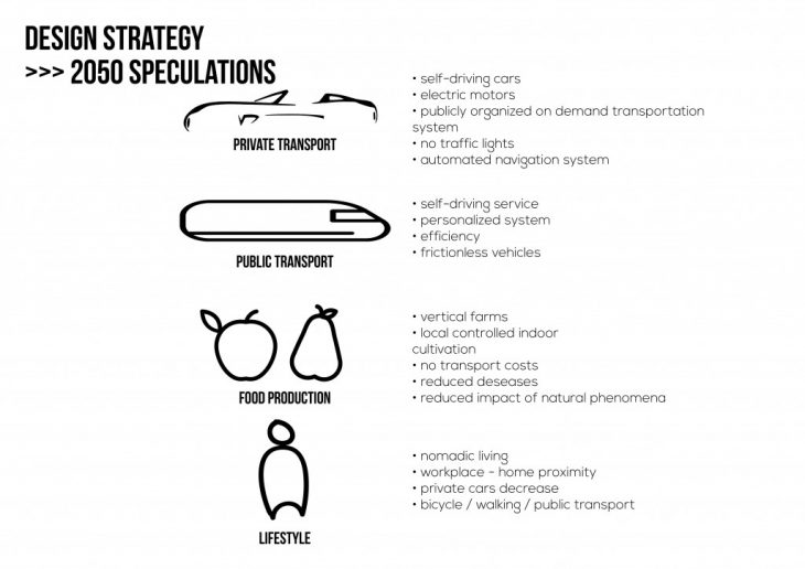
</p>
</p>
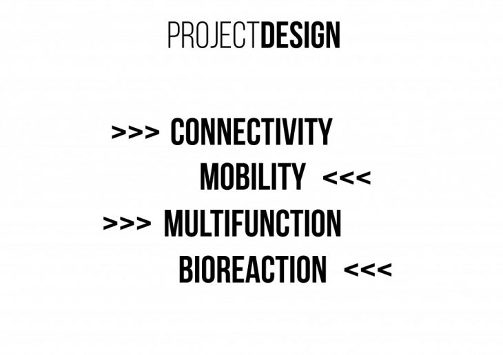
4 main function axis were highlighted in the study, becoming the 3rd starting point for the design.
 The approach towards designing was an immediant resultant of the analysis made:
- how to overcome the blocking barrier caused by the heavy infrastructure
- how to treat mobility according to the speculations previously made
- how to treat the existing multi-functionality emphasising their coexistence
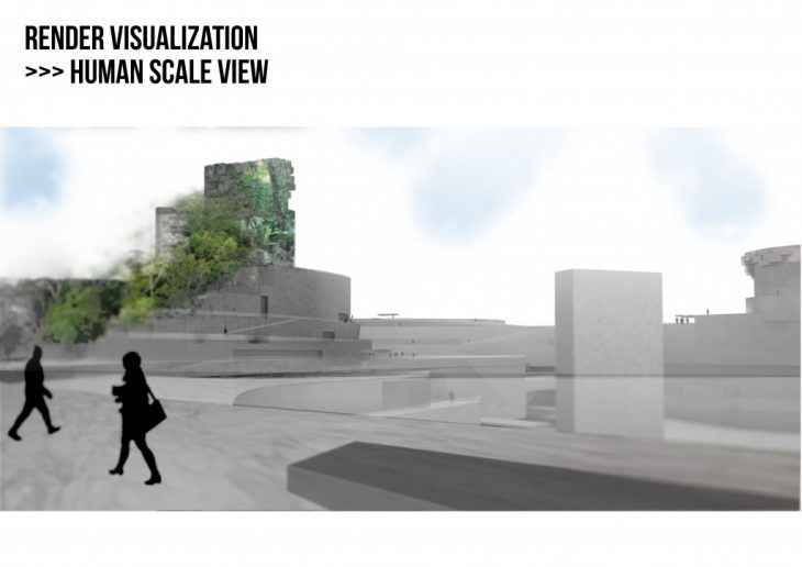
- how to create open public spaces to connect different functions, different zones, different realities.
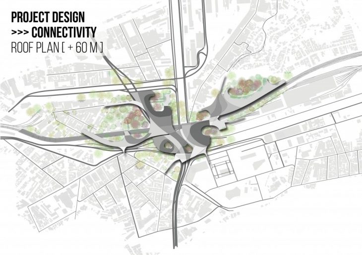 The shape taken by the project recalls the speed of mobility, the spreading out of different functions towards the existing context, inglobating part of it.
The idea was to use the different plan floors to achieve the various purposes that were crucial for the design concept.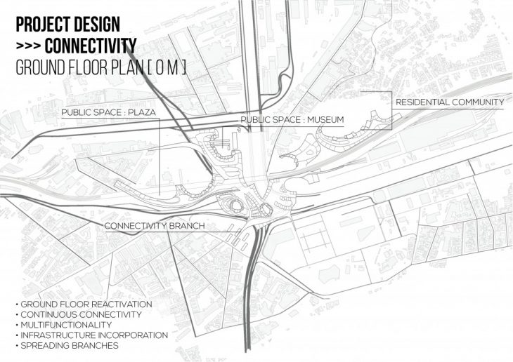 The ground floor is one whole plan. All volumes are connected in these level, spreading out, outreaching the existing surrounding on all sides.
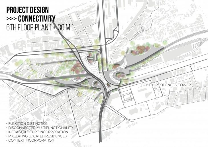 As the levels increase, the volumes slowly start to differentiate, separating functions and activities.
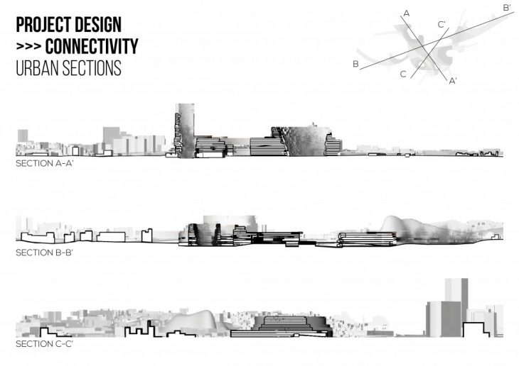
</p>
According to our speculations, private cars ownship will decrease, while car sharing will be preferred as a more efficient service. The main roads were maintained as they are now.By decreasing the velocity in the project zone, hop on-hop off platforms were added, in order to support the mobility towards the rest of the city. The metro lines and stops were maintained, while some of the railway tracks were removed, maintaining the main ones.
A pedestrian and bicycle path was introduced, connecting the project to the surrounding through its spreading branches.
Where the different mobility connections meet, vertical platforms were introduced. Different scales depend on the number of functions they are going to serve.
</p>
The strategy taken was to break the barriers of the infrastructures, in different ways, depending on the function.
Offices and schools are located on CBD and residential axis, creating a bridge to the -interrupted- existing axis.