Abstract
Barcelona is a highly populated city where green spaces are very important. Analyzing how this green spaces are distributed in each barrio and confronting with the population density values we can compare in each areas with lower or higher population density the existence of green areas. This way creating a lens that can move around the map of Barcelona with a dashboard with the barrios ordered by surface area, a graph with the relation between number of green spaces and population density in each barrio. Then choosing the parameters on the graph a catalogue is created with the summary of the information of the chosen area of interest.
Problems/questions
- How green spaces are distributed in Barcelona according to population density of barrios?
- Are the areas of higher density the ones with less green spaces?
Goals
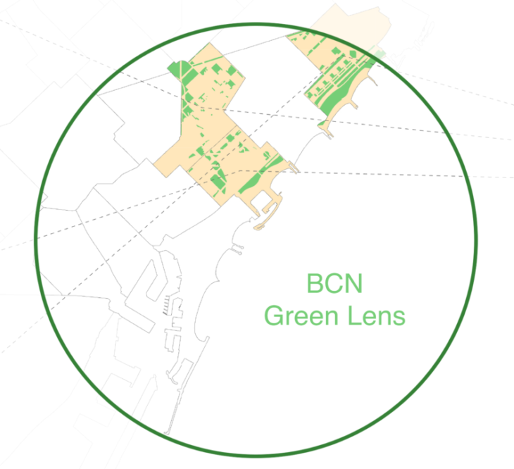
- Creating a focal lens for the green spaces of Barcelona
- Identifying barrios as areas of interest for creating new green areas by adjusting the location and the values for green areas and population
Methodology

Outcome
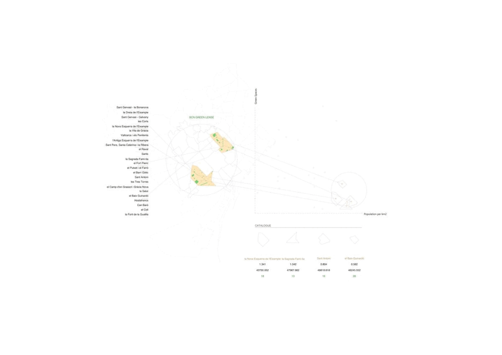
With this interactive catalogue is possible to easily select a area of the city and then filter according to population density and the number of green spaces in each barrio. After applying the filters, the chosen area appears highlighted in the map and the catalogue above shows some data of the selected barrios, name, population density, surface area and number of green spaces.
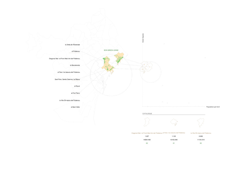
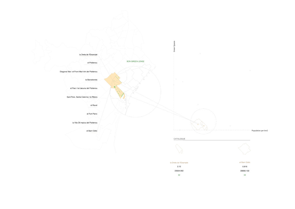
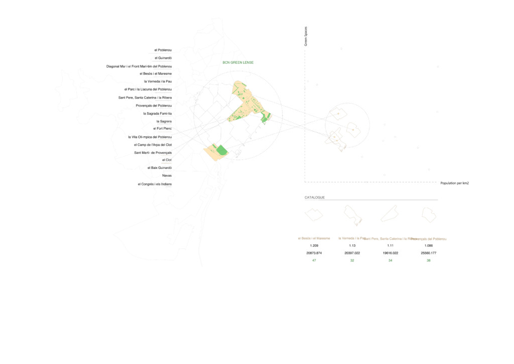
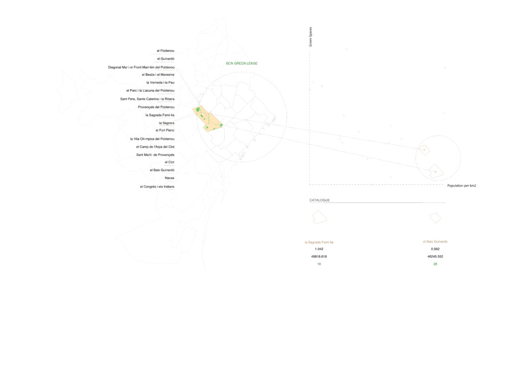
This way, if we want to implement more green spaces in Barcelona we can easily consult this dashboard and identify the areas where they lack the most and relate them with the population and the size of the barrio.
BCN Green Lens is a project of IAAC, Institute for Advanced Architecture of Catalonia developed at Master in City & Technology in 2021/22 by students: Júlia Veiga and faculty: Eugenio Bettucchi and Iacopo Neri