BARCELONA ITINERARY – Make the most of your trip
Abstract
Barcelona is positively overflowing with rare gems, all ready to be unearthed by the intrepid explorer. Where to Stay in Barcelona for a First Time Visit? The project aims to study and find accommodation for a tourist in a central location. The following analysis focuses on generating Grasshopper scripts to find different paths from the tourist’s place of stay to their destination of visit, guiding them to plan their travel in the city.
Methodology
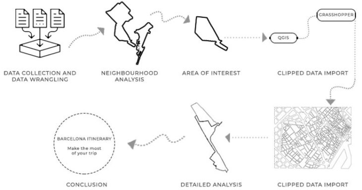
Data Collection and Data Wrangling
– Download the shapefiles of the neighborhoods (barris) of Barcelona.
– Gather all the points of tourist interests.
– Collect information on available accommodations in the city for a tourist.
– Filter the aforementioned data from the point shape file to identify tourist apartments in the city.
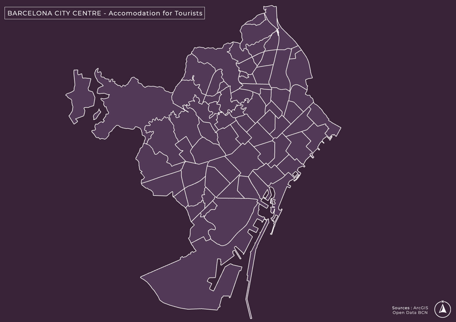
Barri Analysis
– Analyze the neighborhoods on the basis of the number of tourist attraction points in each barri identifying three barris with a large number of attraction points.
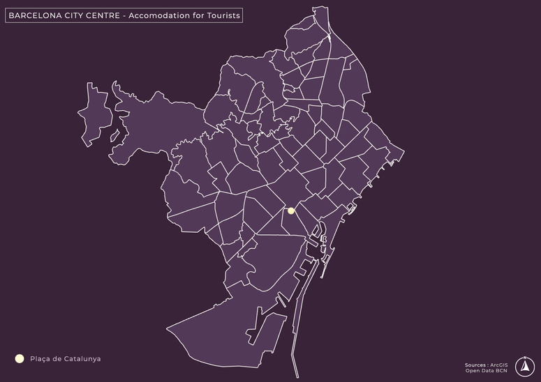
Area of Interest
– Select an area/apartment based on the proximity to the city center.
Data Import
– Clip the data on QGIS and export it as shape files to import in grasshopper.
Detail Analysis
– Evaluate three different paths from point A to point B based on the defined typologies.
Conclusion
– The analysis is studied to understand different potential ways of how a tourist can make the most of their trip in the city of Barcelona.
Analysis // Stage 1
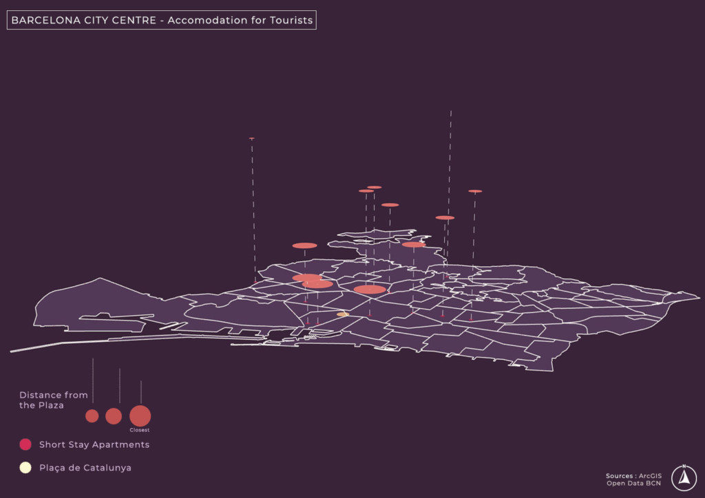
In Grasshopper, from the shapefiles, a base map is developed with all the neighborhoods of Barcelona. The first objective is to obtain different types of accommodations and filter the data to find tourist apartments in the city. The key parameter in the selection of the accommodation is based on it’s distance from the city center.
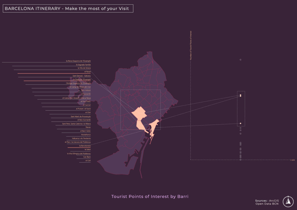
Plaça de Catalunya is a large square in central Barcelona connecting to two renowned boulevards – Las Ramblas and Passeig de Gràcia. Therefore, the next step is to analyze the proximity of the apartments to the square.
Analysis // Stage 2
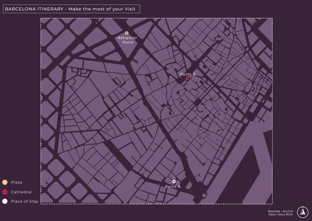
Barcelona has no limits, but the calendar does. The second stage aims at generating a map identifying different paths for the tourist from Point A (apartment) to Point B (Gothic Cathedral) whilst covering all the tourist attractions in the vicinity including the attractor point (Plaça de Catalunya)
The first definition created focuses on generating the shortest path from the apartment to the Cathedral of Barcelona.
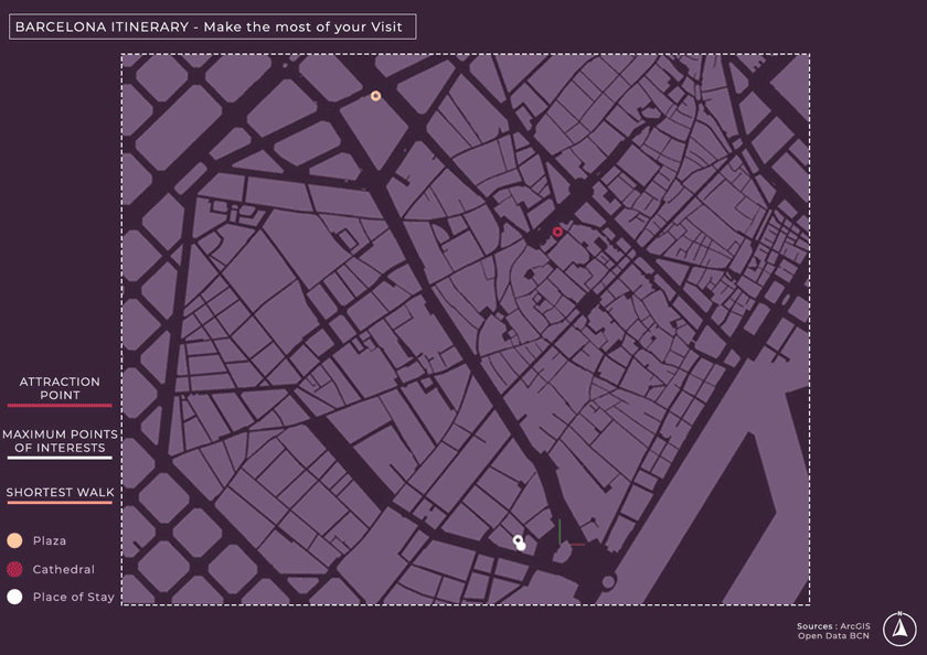
After generating the shortest path, the second definition is set to examine another network focusing on a path that allows the traveller to cover the maximum number of tourist attractions on their way to the destination.
The last part of the definition focuses on creating a script to identify a path from the apartment to the Cathedral via Plaça de Catalunya.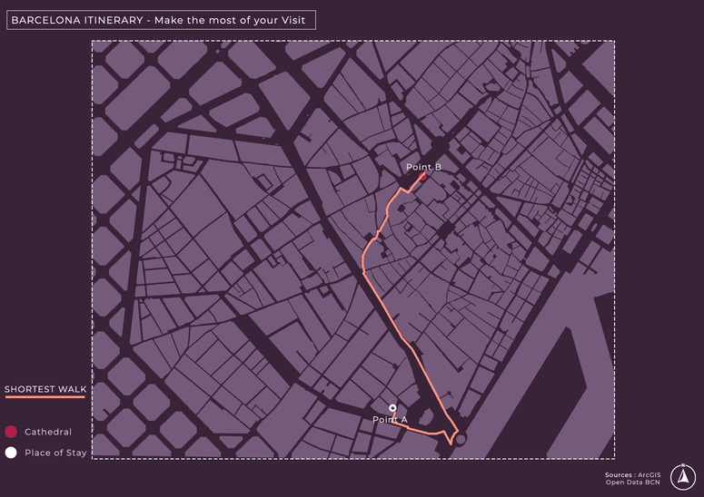
Conclusion
A detailed analysis, understanding correlation between the parameters, and data visualisation can help a tourist in Barcelona make more conscious decisions while making the most of their trip.
Data Source
Open Data BCN
ArcGIS
‘BARCELONA ITINERARY – Make the most of your trip’ is a project of IAAC, Institute of Advanced Architecture of Catalonia developed at Master in City and Technology in 2021/22
Student: Gayatri Agrawal
Faculty: Eugenio Bettucchi and Iacopo Neri