Abstract
Alzette River, meandering through the city of Luxembourg causes major concern on flooding and ecological issues. This analysis mainly focuses on the qualitative and quantitative measures of the river course. The study is done for the specific cantons – Luxembourg and Esch-Sur-Alzette on the structural quality of the river course, man-made interventions, and the water measurement from the stations.
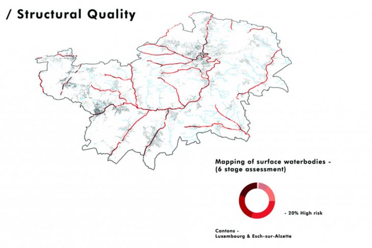
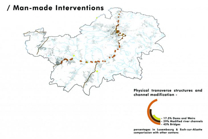
The majority of the river course varies from moderate to high risk in the structural condition. The entire country has many man-made transverse structures over the river causing high tension on the river flow. In comparison with other cantons, these two study areas have the highest numbers.
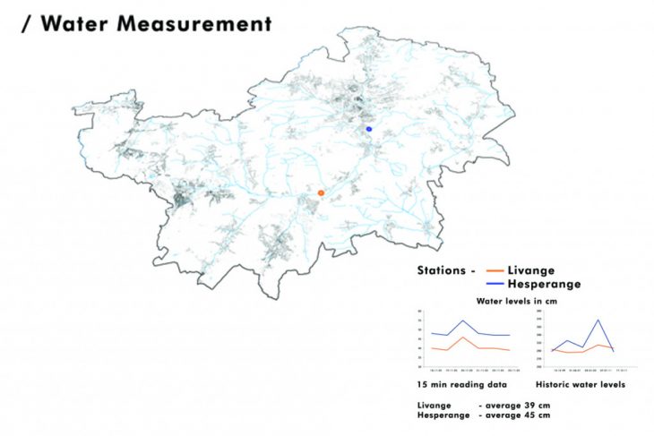
Luxembourg and Esch-Sur-Alzette have two water measurement stations, Livange and Hesperange. The average water level difference shows a similar pattern, whereas during flooding because of the terrain conditions the north station peaks at 370 cm.
Following this study, various analyses were gathered from the geoportal data. Which directed the project focuses on two specific zones on the flood plain – first the upstream, where the water breaks into the large plain and the next is downstream before the city, where it behaves as a bottleneck, creating more pressure on causes.
https://www.geoportail.lu/en/
Qualitative and Quantitative Analysis, Alzette river, Luxembourg is a project of IAAC, Institute for Advanced Architecture of Catalonia developed at Master in City & Technology 2020/21 by student: Sridhar Subramani, and faculty: Diego Pajarito.