Alzette 2.0 – River Re-visioning
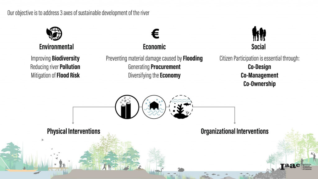
This project studies the implications of human intervention into rivers. People have modified rivers for centuries to fit certain purposes, and facilitate human activities. However, this interventions in many cases has caused damages to ecology, issues with flooding and loss in habitat just to name a few. This has called for river renaturing and restoration projects to help reverse the negative impact of human modifications.
River renaturing , refers to a number of different strategies and techniques applied to enhance the natural state and functioning of rivers and catchments.
Complete recovery of river processes and functions is often not possible to achieve.
However, rivers are dynamic and have a remarkable ability to recover. The aim of river restoration is to assist this recovery and increase resilience by addressing hydrological, morphological, biological, chemical and societal issues within the catchment.
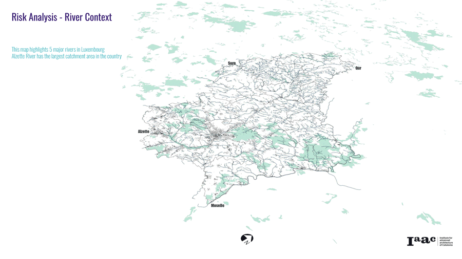
Identifying Risk Areas
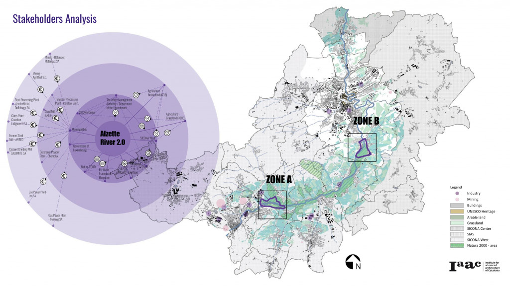
In order to identify areas of highest risk in Luxembourg, and those with the most attributes related to issues caused by river modifications. We carried out an extensive analysis of the entire country and river basins. These were concerned with flooding, ecological status, water and soil pollution, population and settlement densities, economic activities, agricultural uses and all stakeholders relevant.
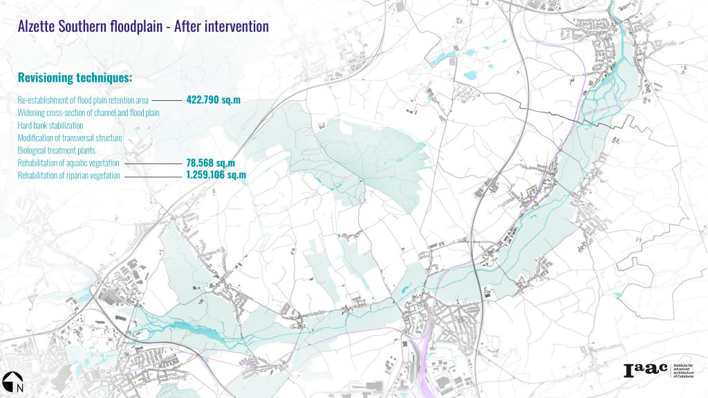
The series of maps below highlights our findings. After overlaying all the layers of risk we were able to identify two main cantons of highest risk attributes. These are Luxembourg and Esch-sur Alzette in which our proposals will take place.
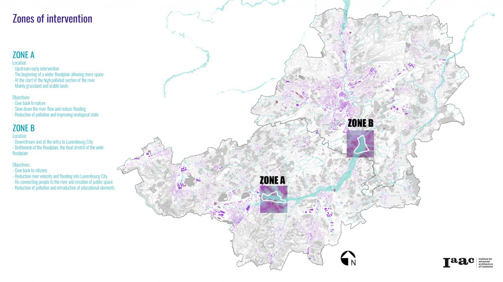
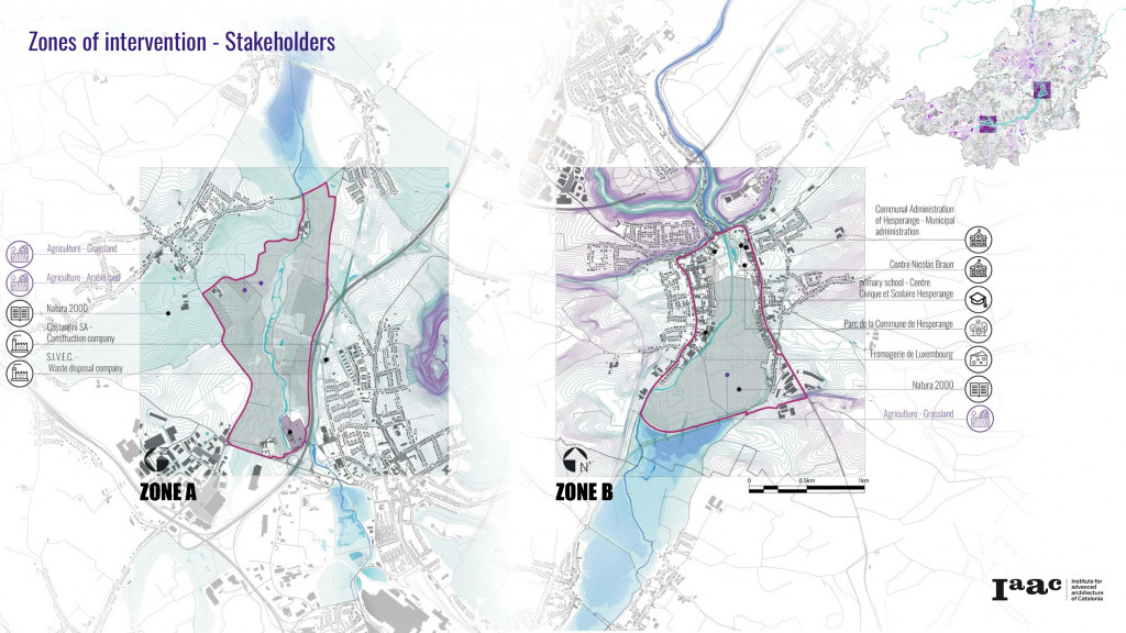
For further detailed studies and proposals, 2 zones of intervention were selected. Zone A in the upstream marks the beginning of the wide floodplain, which we chose to start mitigating pollution and flood as early as possible on the river section. We also chose Zone B downstream as the end of the wide floodplain before the river enters the city of Luxembourg. Also to retain as much water as possible to avoid flooding within the city and to be able to engage citizens to participate in this area as a pilot study
Physical Interventions Kit of Parts
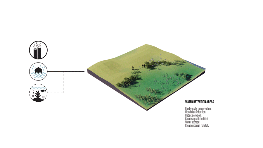
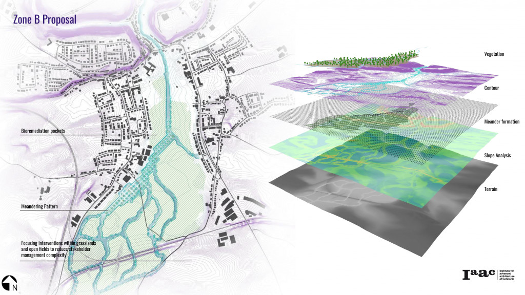
We selected a number of renaturing strategies to apply on the selected river sections. These are a combination of elements such as: Marshlands, added meanders, riparian zones, back waters and channels. Each of these strategies assists in mitigating flooding, pollution and biodiversity.
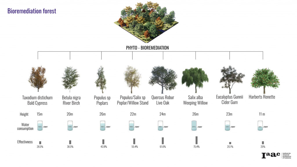
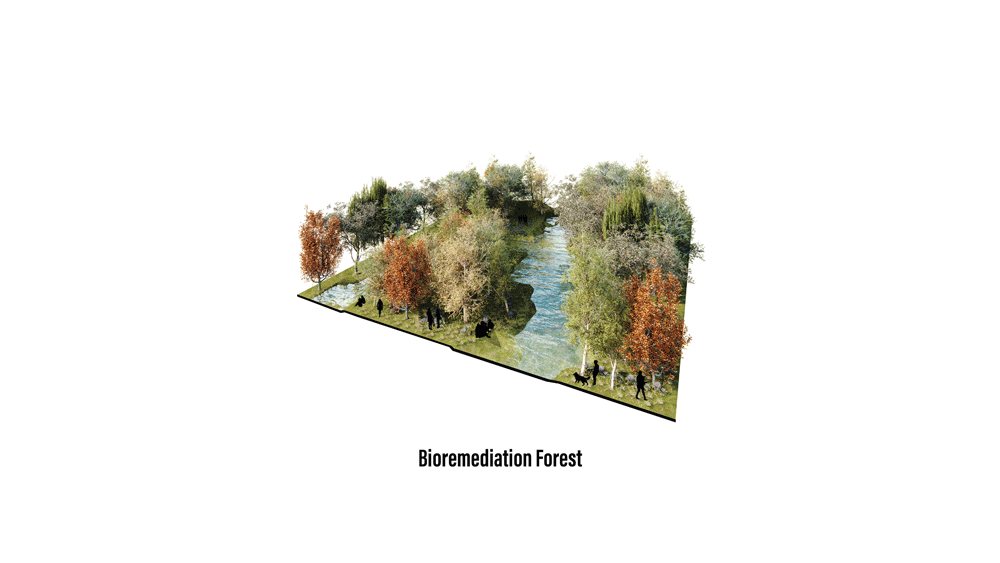
In addition to the strategies applied on the river body, the bioremediation forest assists in reducing pollution in the entire floodplain. We selected a number of trees most suitable for the location and climate. Eight types of trees were selected based on their bioremediation attributes:
Stakeholder Analysis
An in-depth stakeholder analysis was carried out. This identified all relevant authorities, public and private stakeholders and any affected entities in the areas of intervention.
Design Proposals
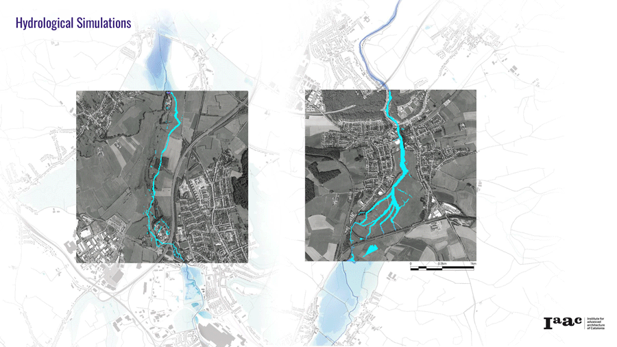
A hydrological simulation was preformed using CAESER to study the behavior of the river. This was tested with different attributes and rainfall data. The analysis helped us achieve the best shape and meanders required to mitigate flood risk in the selected locations.
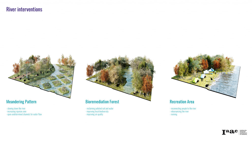
The two proposals looked at introducing new meanders and channels based on the hydrological analysis. A pattern was also introduced on a wider plain to allow the river to choose it’s own path. After several years these shapes will change based on the behavior of the river and will form a shallow wide marshland. Mitigating flood and improving biodiversity in the location.
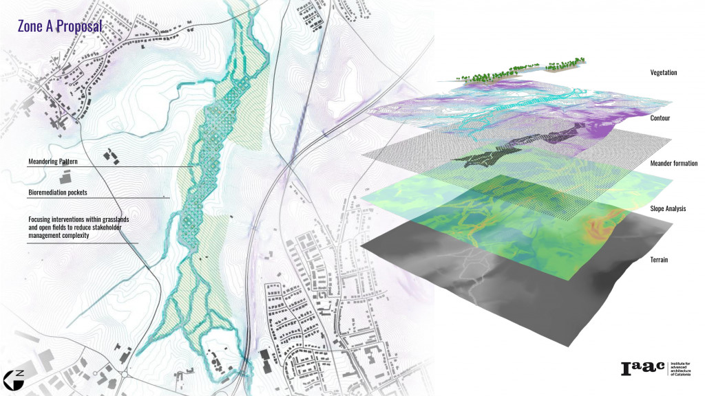
Along both sides of the river, pockets of the bioremediation forest are introduced. Apart from cleaning the soil and water from heavy metals and particles, the trees will assist with reduction of soil erosion and improve biodiversity.
Organizational Initiatives
Following the establishment of the new river design, the second phase of the project is the Alzette Forest. Out vision is for this to be co-designed, co-managed and co-owned by the citizens.
Citizen and Farmers in the Alzette region are identified as the main participants and stakeholders. They will be supported by relevant authorities and community clubs in the process of design and establishment of the forest.
Alzette 2.0 App
The Alzette 2.0 app was designed as design tool to facilitate citizen participation. Through the app, citizens will be able to participate in the design of the forest and the related amenities they wish to include in their community. The proposals made by people will then be reviewed by relevant authorities and approved where appropriate. Following the design of the forest, citizens will have the option of adopting/sponsoring trees in the forest. The aim is for the forest to be designed and owned by the people.
Alzette 2.0 – River Re-visioning ,is a project of IAAC, Institute for Advanced Architecture of Catalonia developed at Master in City & Technology in 2020/21 by students: Leyla Saadi, Marta Maria Galdys, Sridhar Subramani & Ivan Reyes Cano and faculty: Eduardo Rico, Mathilde Marengo & Iacopo Neri