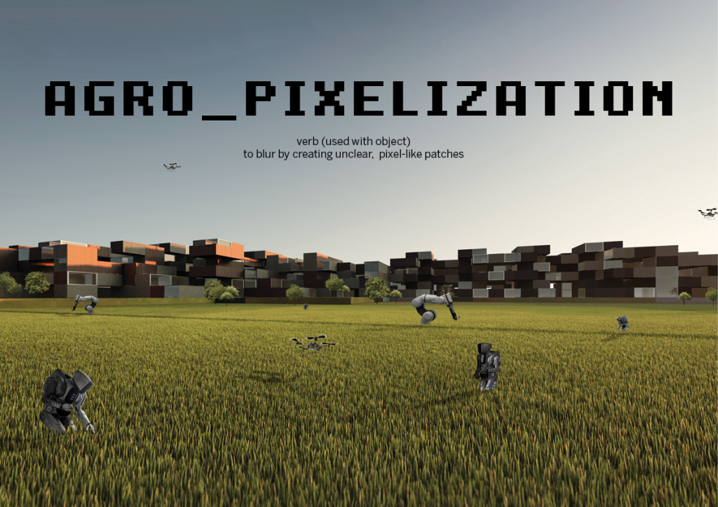
Manifesto
Agro_Pixelization: Fading the Boundary Between Urbanization & Agriculture is a project proposal for Parc Agrari del Baix Llobregat that aims to reconnect the park to the city by dismantling the traditional organization of city, industry, and infrastructure. Furthermore, this project aims to revitalize the agricultural park and scale up its level of production.
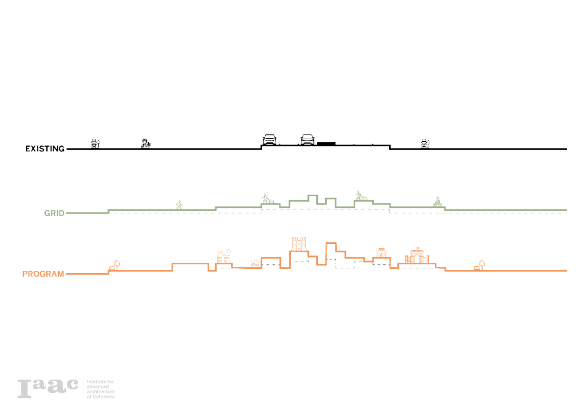
The rapid expansion of urban development has caused a conflict of interests. A hierarchy of land use patterns has formed, bringing agriculture to be at the bottom, causing reduction of scale and neglect of the park. The bordering urban areas have also created a tight barrier with highways and industrialization in between, reducing the physical engagement of the park to the surrounding areas.
By incorporating a concept of point, lines, and surfaces, and creating a pixel that derives from the problems and opportunities of the site, a grid system is formed that allows for developing site-specific solutions to these challenges. With time the urban invasion is reversed through the project development system of protection, restoration, connection, and growth.
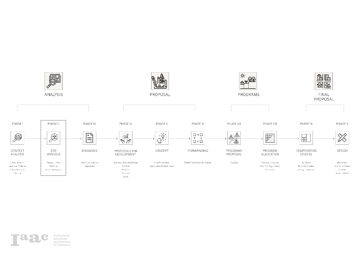
Project Methodology
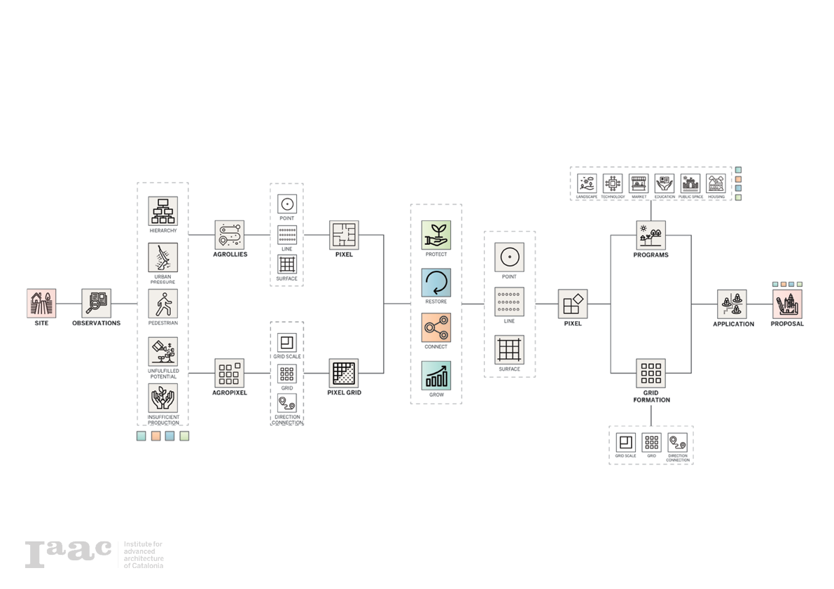
The final project is a merger of two projects, Agrollies by Rosamary Machado and Daniel Soiral and Agropixels by Alexander Dommershausen and Tsvetelina Bogdanove. The diagram below shows the workflow and merger between the two projects. The represented projects had relevance in different aspects in the development of the master plan for Parc Agrari del Baix Llobregat.
The observations made by both groups gave the incentive to work with the land-use patterns existing in the area. Next, a protocol was developed that entailed an attitude towards the park consisting of protection, restoration, connection, and the growth of several elements and points of interest.
Contextual Approach
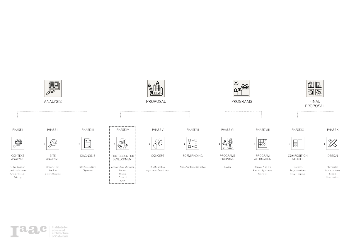
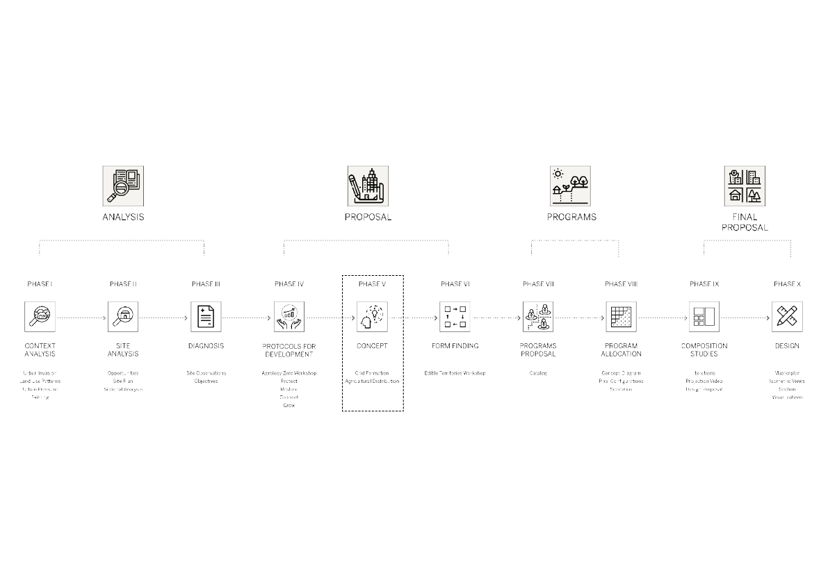
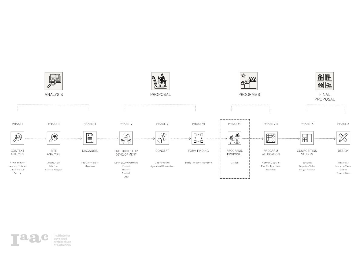
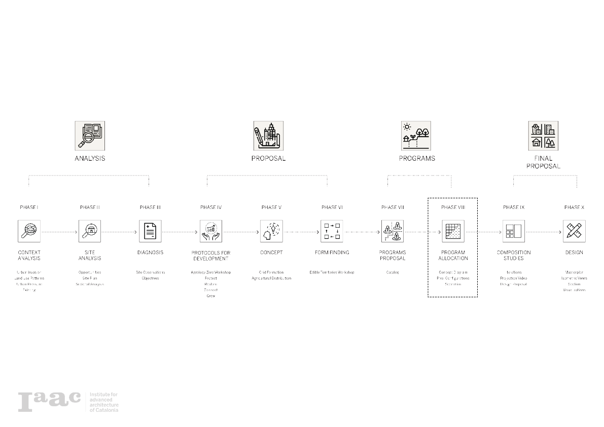
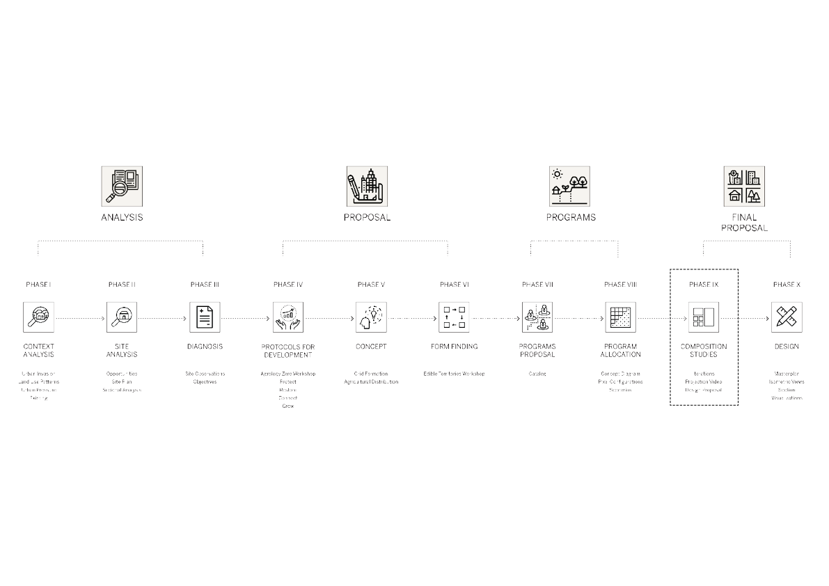
True out the project development, a clear timeline is representative of every major step made in the project. Hereby the projects start with an analysis going into a proposal, program development, ending with the combination in a final proposal.
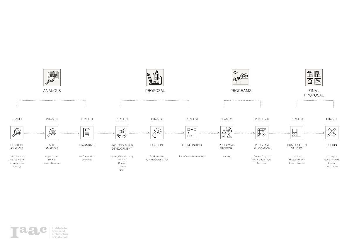
Phase I: Context Analysis

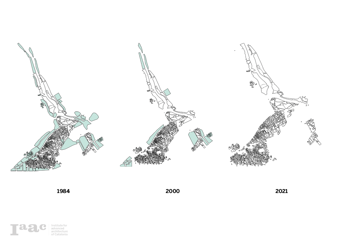
Urban Invasion
Since 1984 the region was used predominantly for agriculture. As time went by the city expansion of Barcelona made that the parc was victim to increasing urban pressure, resulting in the loss and functionality of the parc.
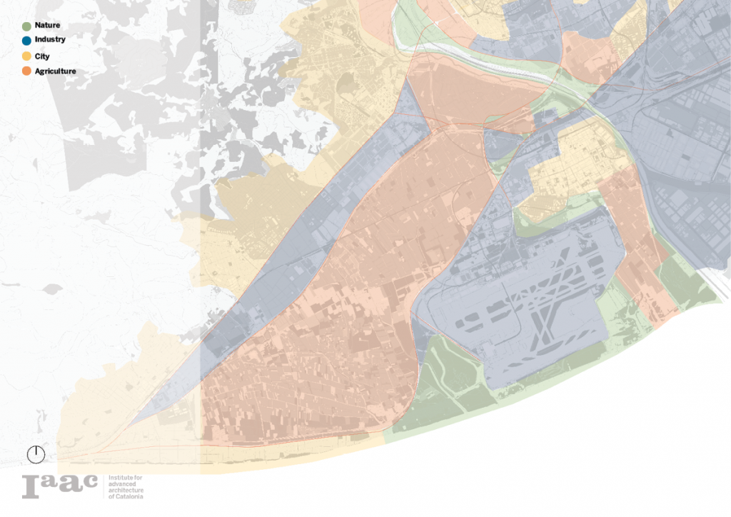
Land-Use Pattern
A land-use pattern study shows the hierarchy between the different land-uses. Herby is the city expansion central and dominantly driven by the political and territorial expansion of Barcelona. This expansion urges a growth in industry and an expansion of infrastructure, resulting in a decline in agricultural land-use.
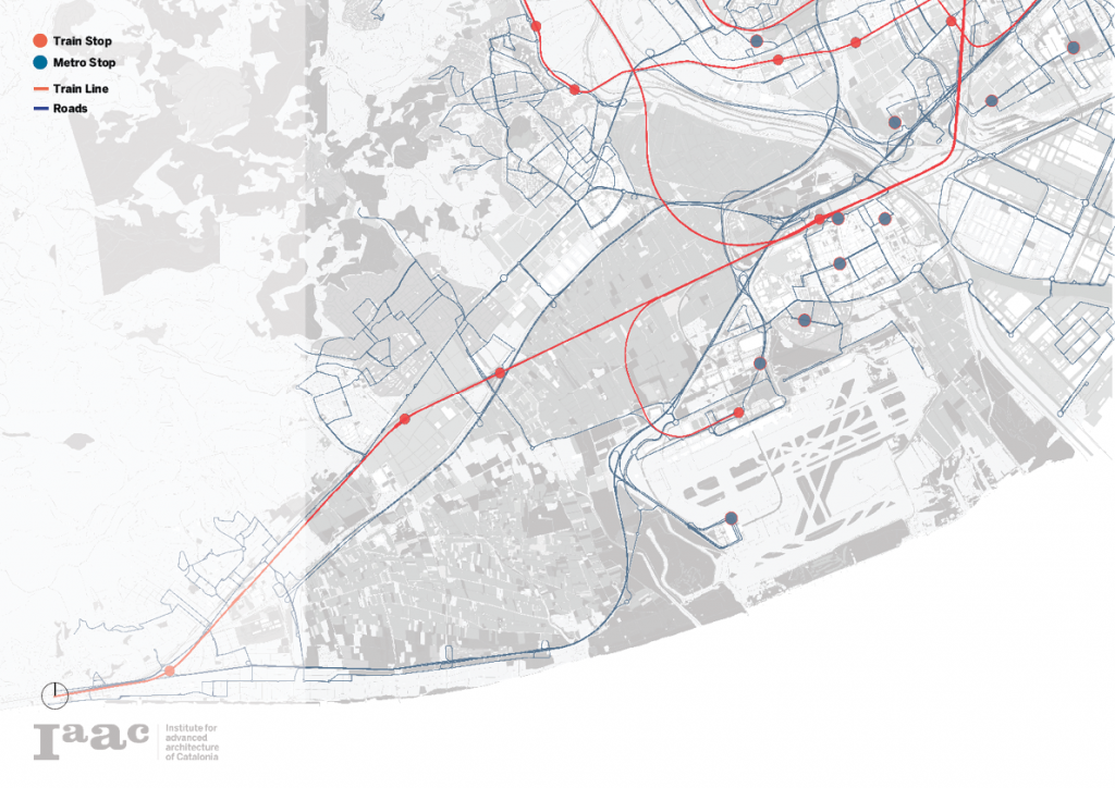
Urban Pressure
This map shows the different aspects that add to the rising urban pressure. High-density infrastructure takes its place at the borders of the park as this is where industry and transport meet. These elements form a barrier between the park and the city. The human iteration with the parc is almost nonexistent.
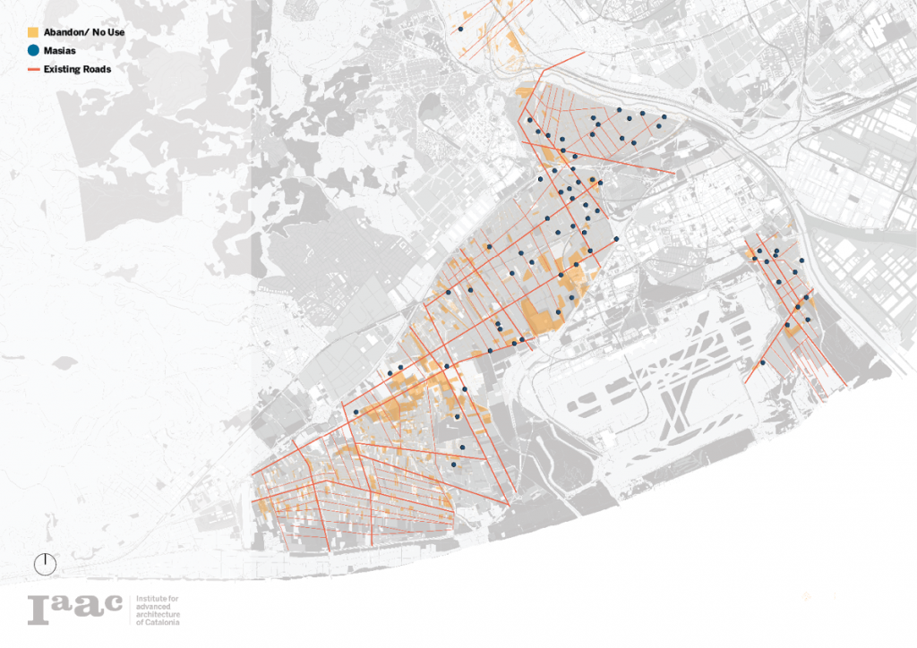
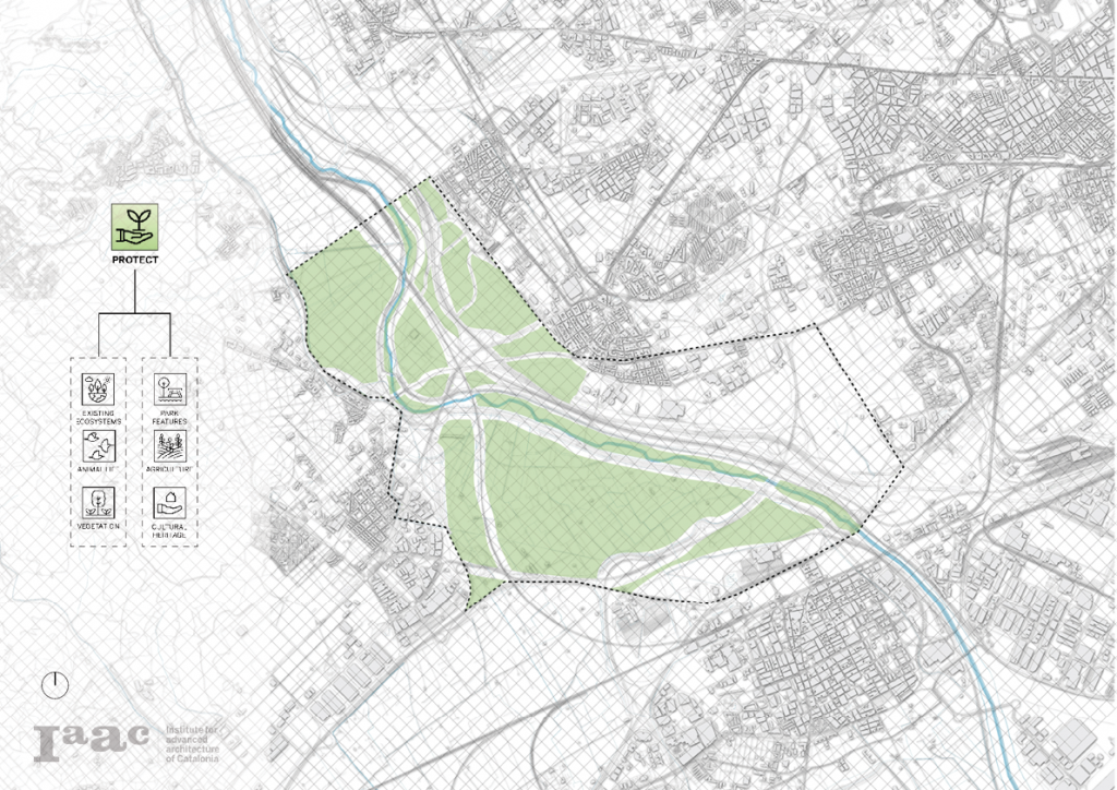
Existing Land
In a study looking inside the parc, several points and lines of interest come forward. A focus on the cultural heritage with the old ruins and abandoned Masias gives the opportunity to restore these old artifacts.
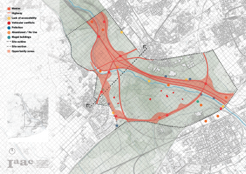
Phase II: Site Analysis
Opportunities
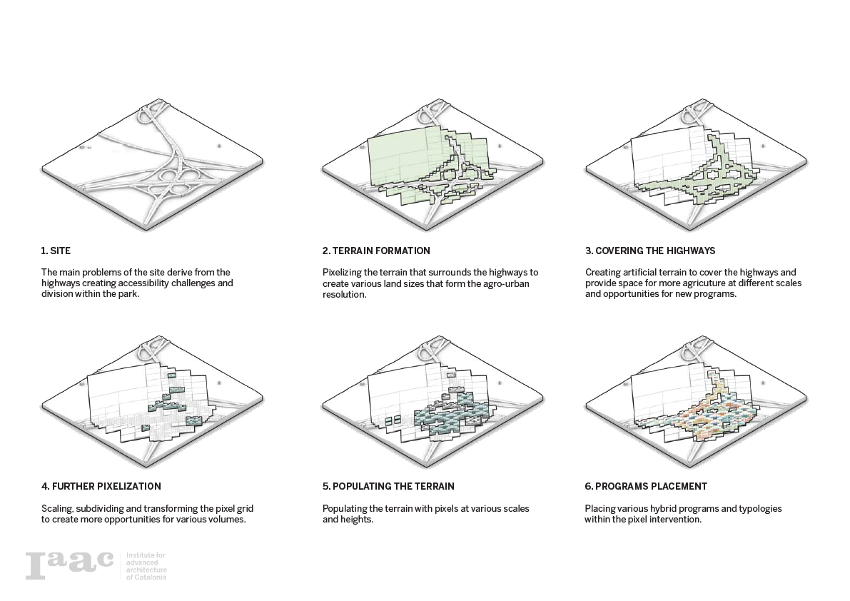
Using a pixelated ground map, and designating the different land uses a merging in colors appears. These different merging colors show an area of major conflict. These areas of conflict form the basis for the project and an opportunity for intervention with the highest impact.

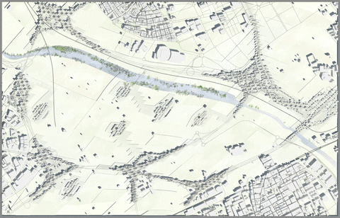
Site Plan
A specific zoom plan that shows the state of the art, with the points of interest and the areas that form the problematic the park experiences. The red zone representing the infrastructural highways and roads, form a bottleneck for the park.
Section Analysis

Phase III: Diagnosis

Observations

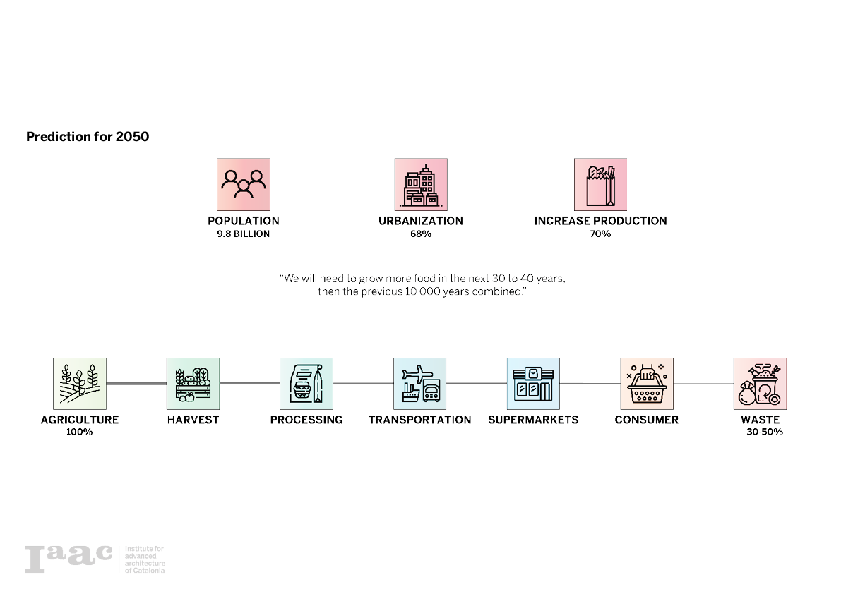
Agriculture Dilemma
Bringing food consumption into the context of the agricultural park there is a direct correlation between agriculture and a city environment. As the projection is made for the future by 2050, the global population is estimated at around 10 billion people of which 68% of these people will live in urbanized areas. This means that a 70% increase in food production is required to avoid shortages.
In relation to the current food cycle, there is a huge loss in consumable food that goes to waste. In this cycle from production, the consumer is estimated to be around 30-50% waste. Even if the global production of food is estimated to be sufficient to feed everybody, still major parts of the world fall victim to starvation.
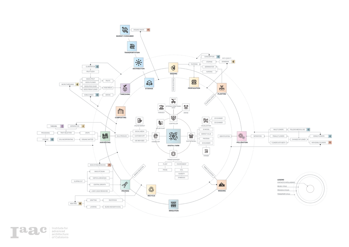
Agrology Zero: Workshop by Jonathan Minchin
Together with an expert in agriculture sciences Jonathan Minchin, and in collaboration with all the students of the studio, a closed farming cycle was developed to stimulate the agriculture practices and to eliminate waste. This cycle shows all the major aspects of farming and places them in relation to each other.
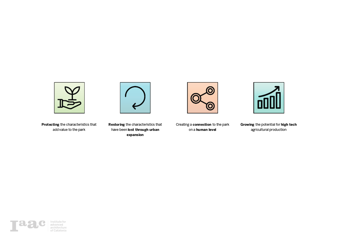
Objectives
The four main objectives as a guide, creating the protocols for development in this project.
Phase IV: Protocols For Development
Protect
Protecting the existing ecosystems, wildlife, park features, agriculture, vegetation, and cultural heritage.
Restore
Restoring the main aspect that was destroyed by the abandonment and urban pressure. Reclaiming the lost and polluted land by the industry, restoring the masias, and revitalizing the unutilized lands.

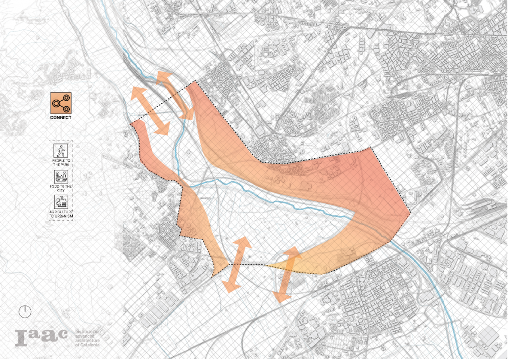
Connect
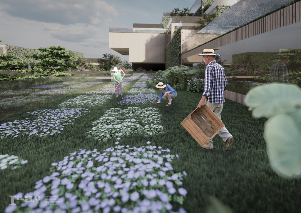
As the boundaries are fading the possibilities to connect the park back to itself and to the city become apparent. people are able to visit the park and enjoy nature. Food production forms a direct connection with the consumers inside the city. A reinforced relation between agriculture and urbanism.
Grow
The possibilities to grow the agriculture industry with new technologies and ways of farming. A reactivation of bare land and optimization of the farming land.

Phase V: Concept
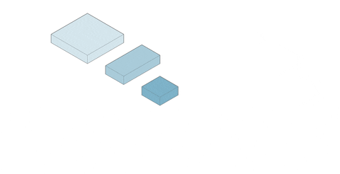
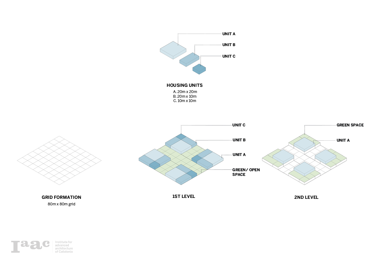
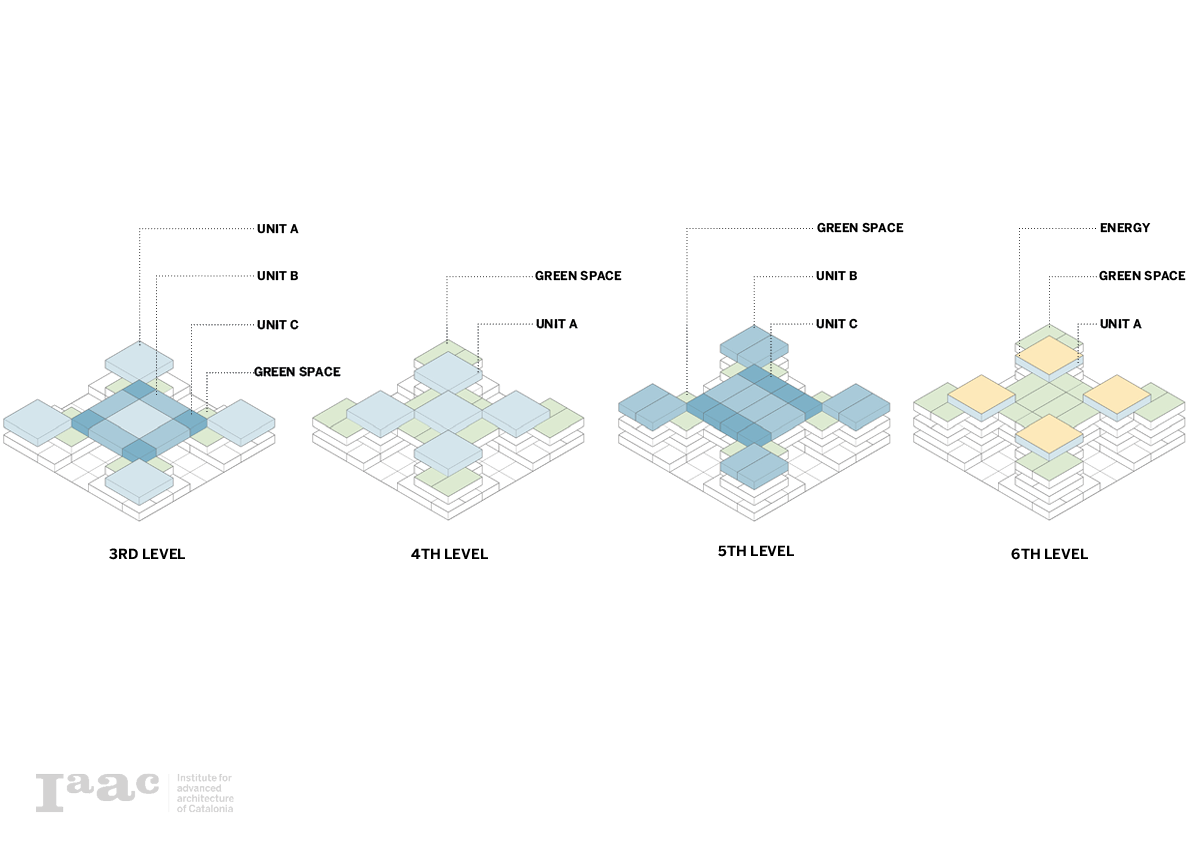
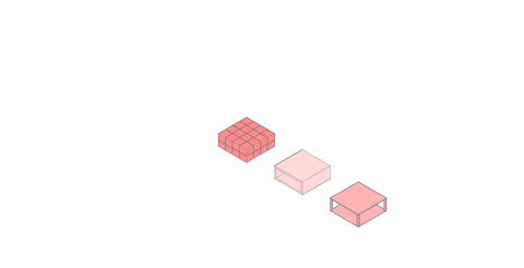
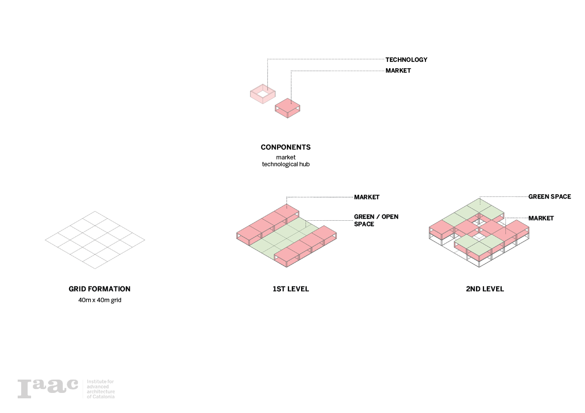
Grid Formation
Using a computational approach to the redevelopment of the park, several points and lines of interest are marked as interactive elements in the computational model. Linking them back to the previously established protocols for development, protection, restore, connect and grow.
These points and lines form the basis for development in surfaces that designate the further development of the pixel. The pixelization of the land will be translated into volumetric extrusions and will be further developed with an AI genetic optimization. This computational model will reflect back at previous elements (points, lines, surfaces, mesh, optimization).

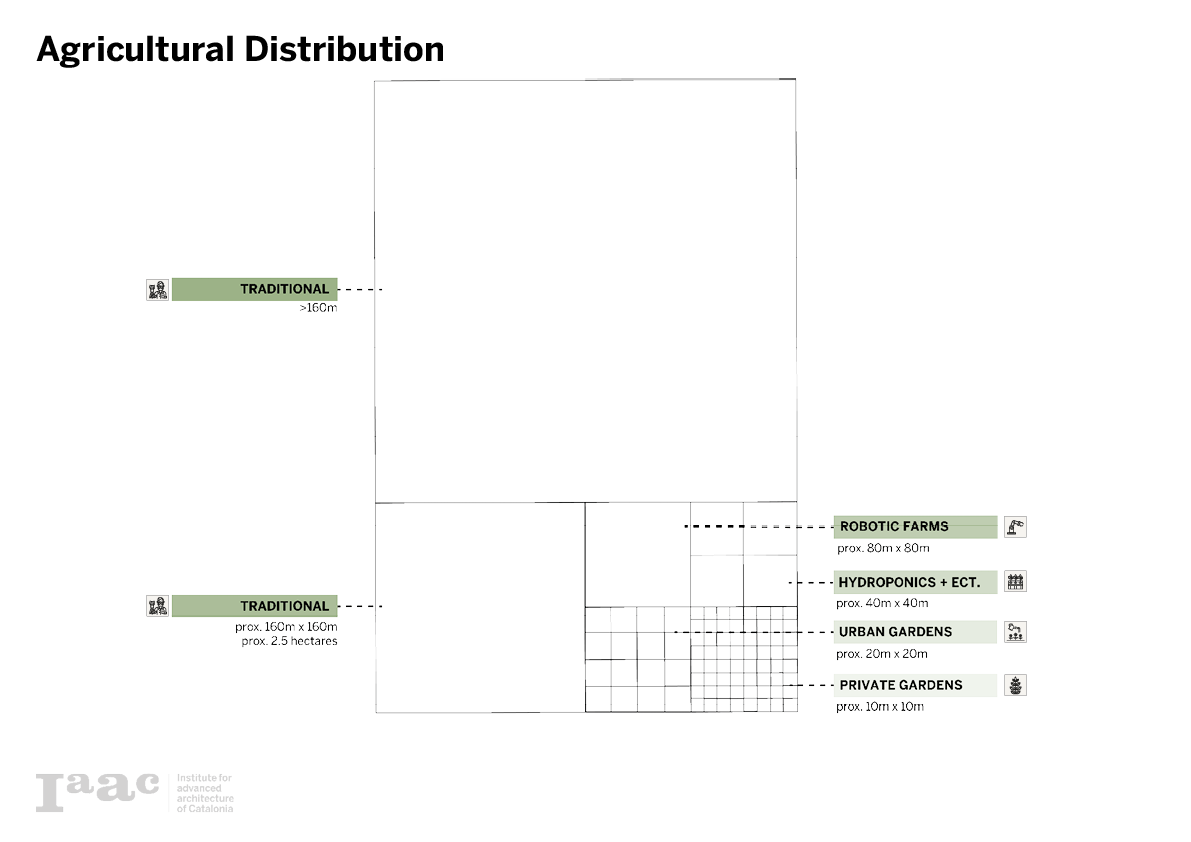
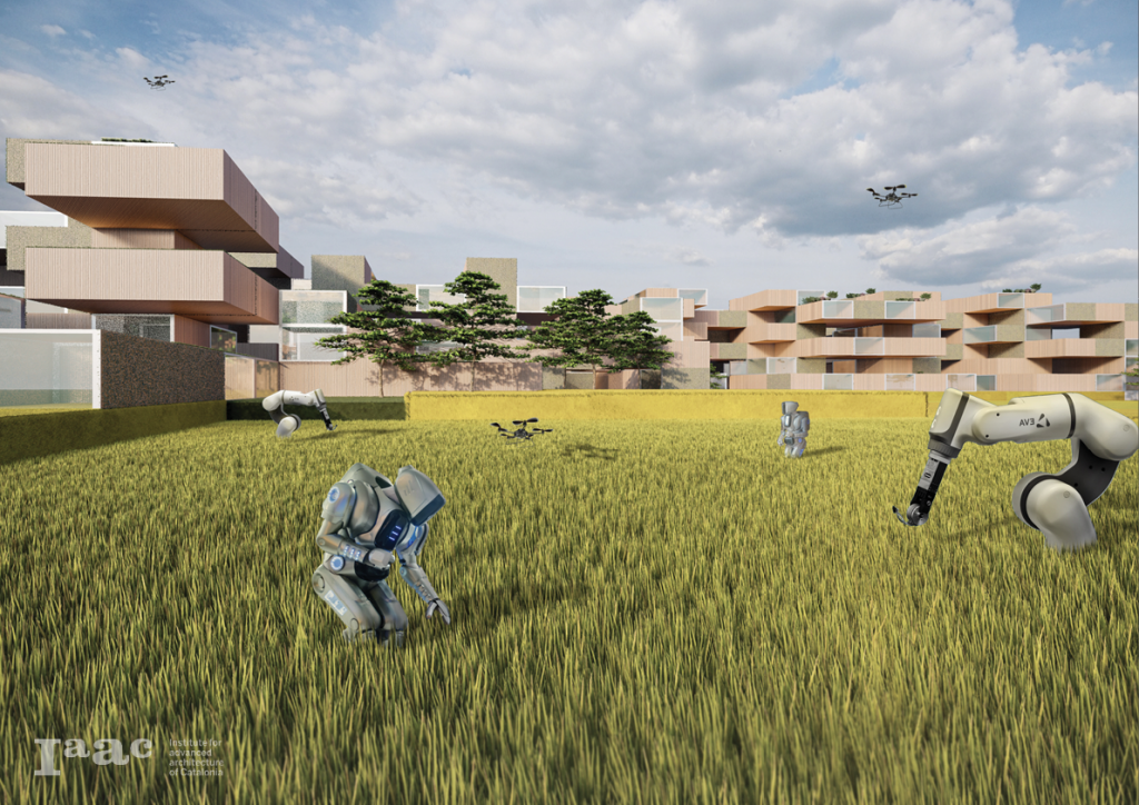
Agriculture Distribution
In the conceptual approach of pixelating, every pixelization step represents a distribution based on land use and size. Going from traditional agriculture to robotic farms, hydroponics, urban gardens, and private gardens. As the pixel size decreases the city typology enables the transition from agriculture to urbanism, or from an urban scale to an architectural scale.
Phase VI: Form Finding

Edible Territories: Workshop by Alejandro Haiek
Working in the workshop with Alejandro Haiek, different computational strategies were developed to address the urban masterplan development of the project. Responding with different pixelizations to manifest the designated results.
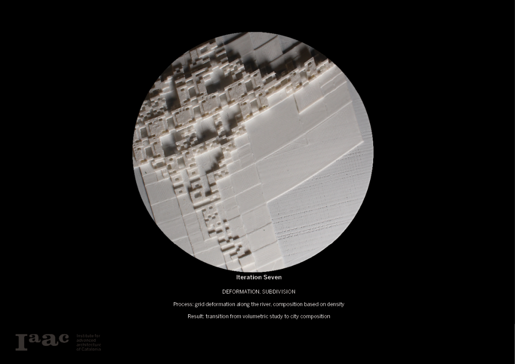
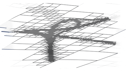
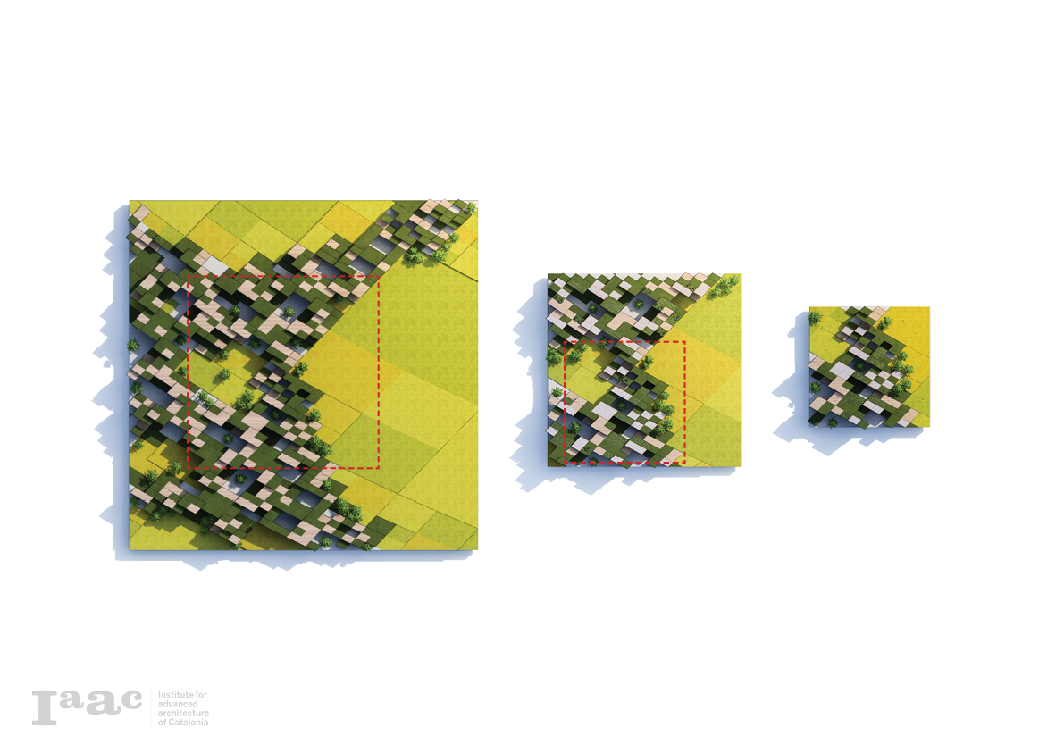
Iteration Process One
The first iteration is a pixel decision without any overlap. The division of the pixels is based on the attractor distance of the highways. In other words, the closer the surface intersects with the highway curves, the more pixel division there will be made. The extrusion of the pixel is based on the same attractor. The closer the pixel is to the highways the higher the pixel will be extruded.

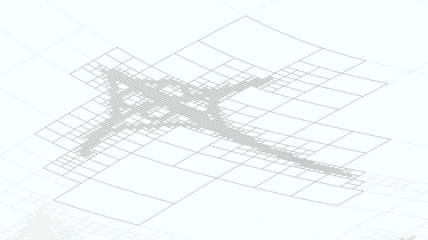
Iteration Process Two
The second iteration is a pixel that is scaled towards its center. The scaling factor is based on the attractor towards the highways. This forms a similar reaction to the previous iteration but in a different way. Pixels close to the highways will start overlapping, creating a certain density. Pixel far from the highway will start detaching and will not be of any importance. The extrusion of the pixel is based on the same attractor. The closer the pixel is to the highways the higher the pixel will be extruded.

Iteration Process Three
The third iteration is experimentation grounded in the morphing of the work surface. Based on a central point of interest the formulated volumes do not longer translate a clear language of the underlying highways.


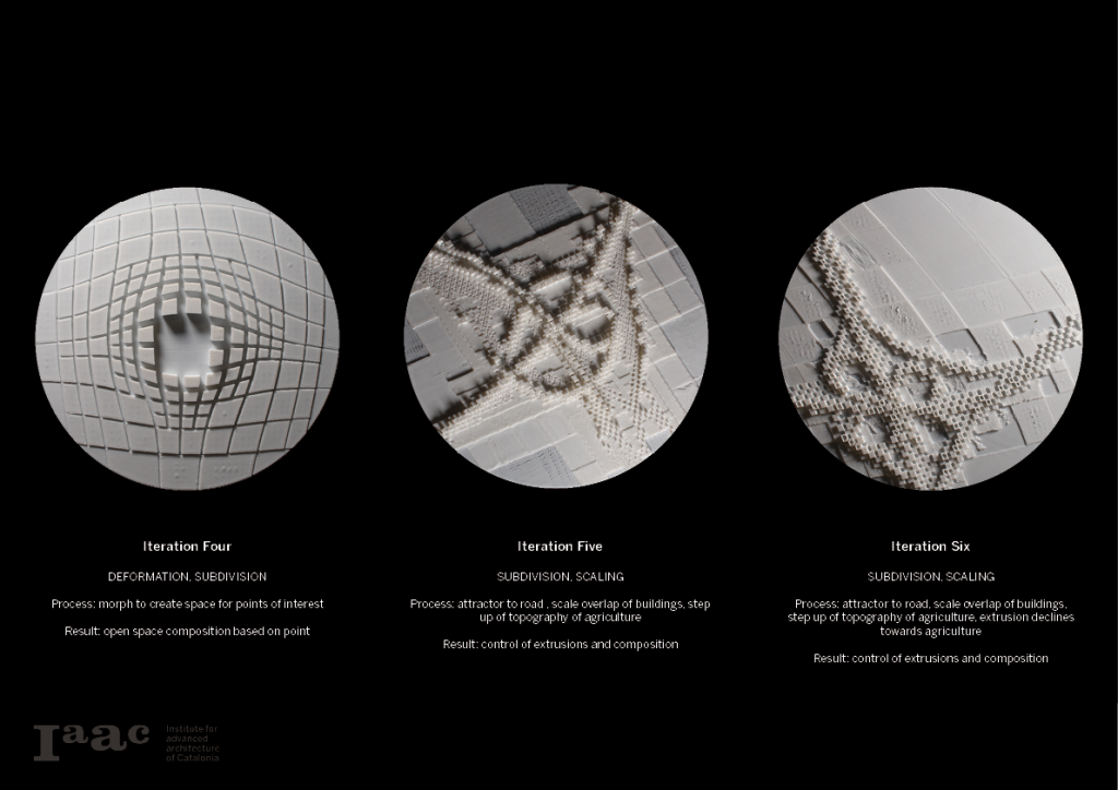 Genetic Optimization
Using artificial intelligence, the model is looking for an optimal relation between scaling extrusion and climate solar analyses. This model enables the designer to control the desired qualities of the agro-city.
</p>
Phase VII: Program Proposal
Programs
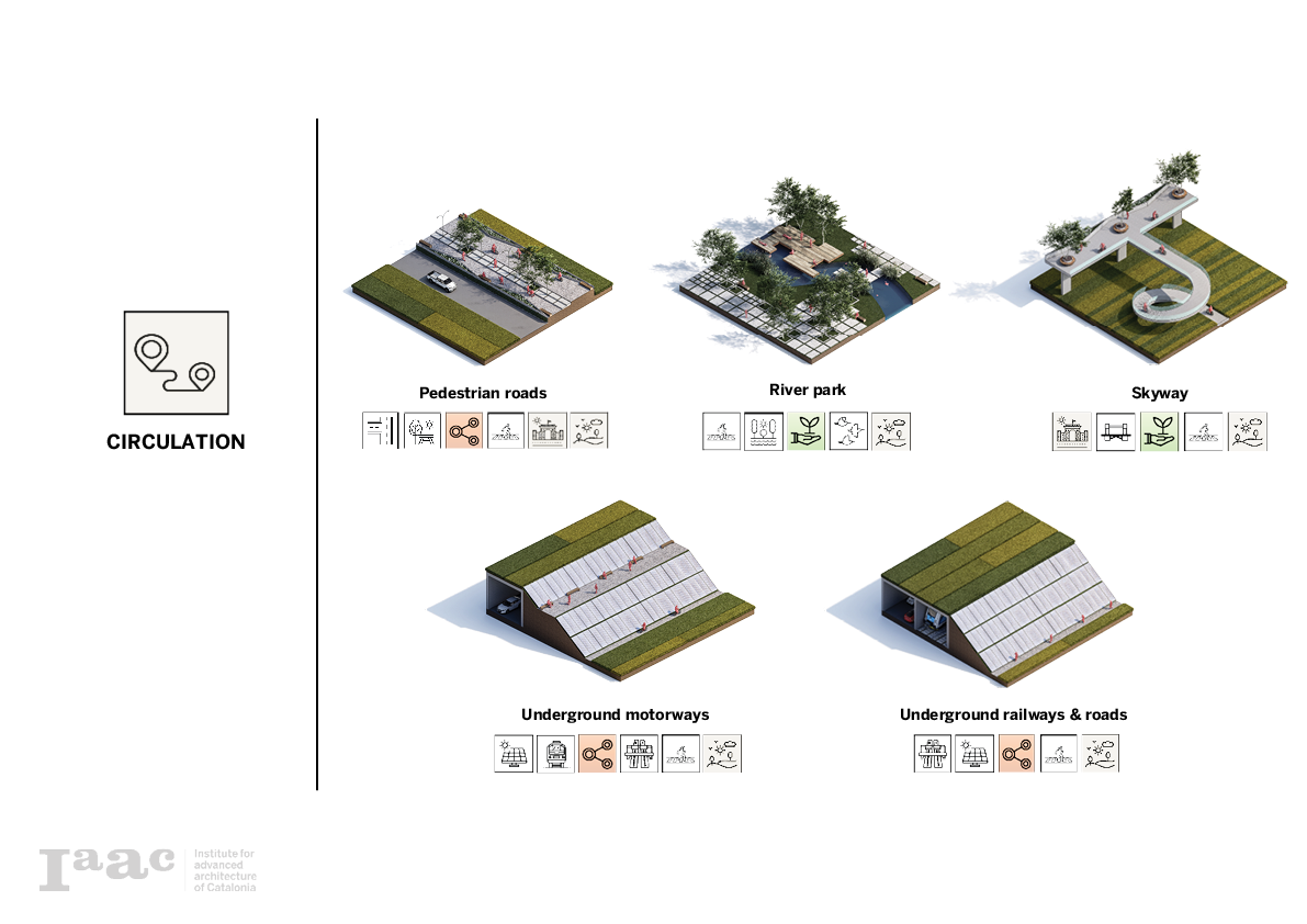
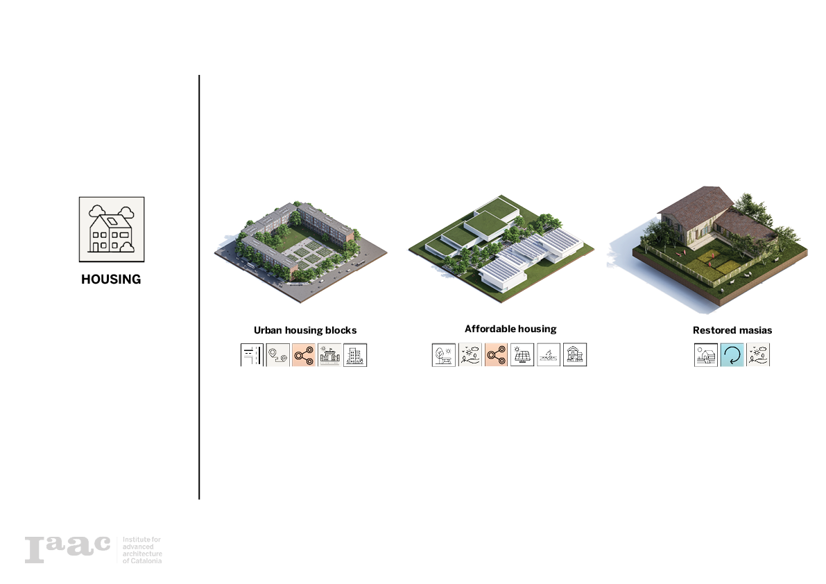
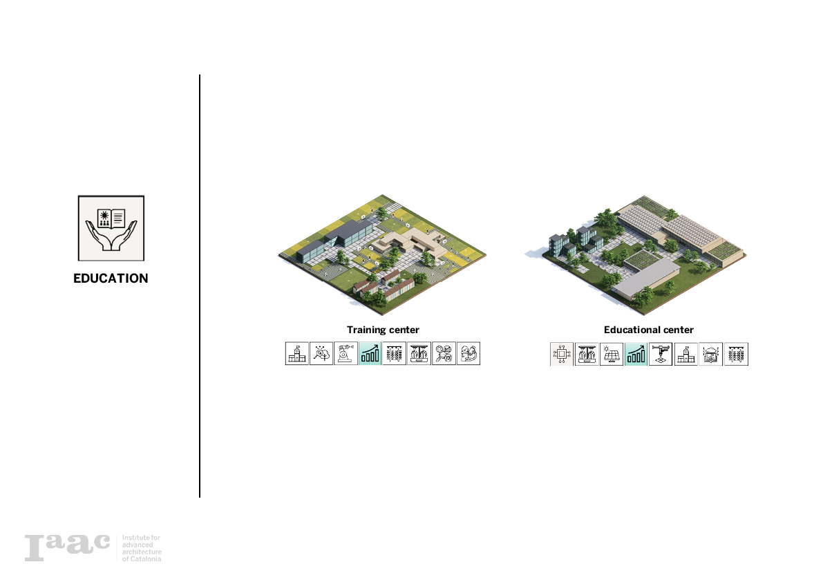
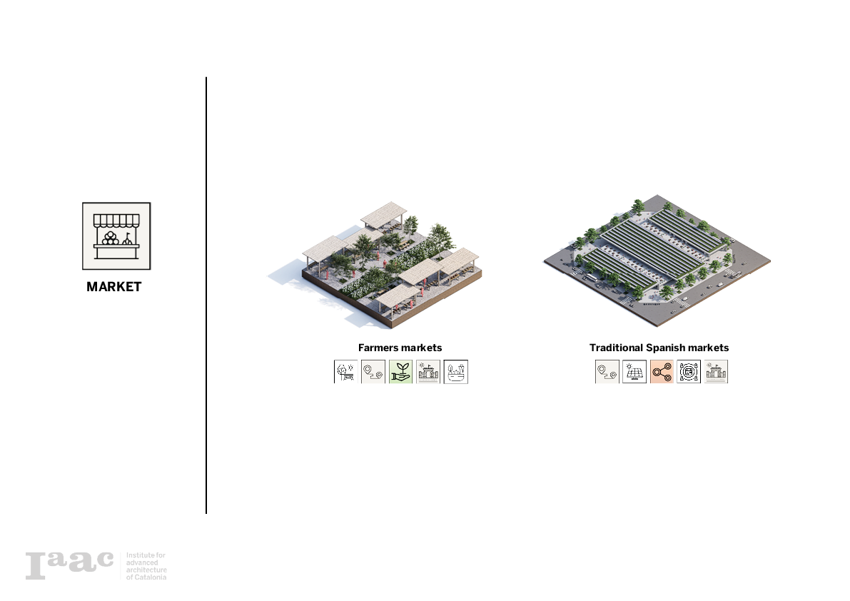
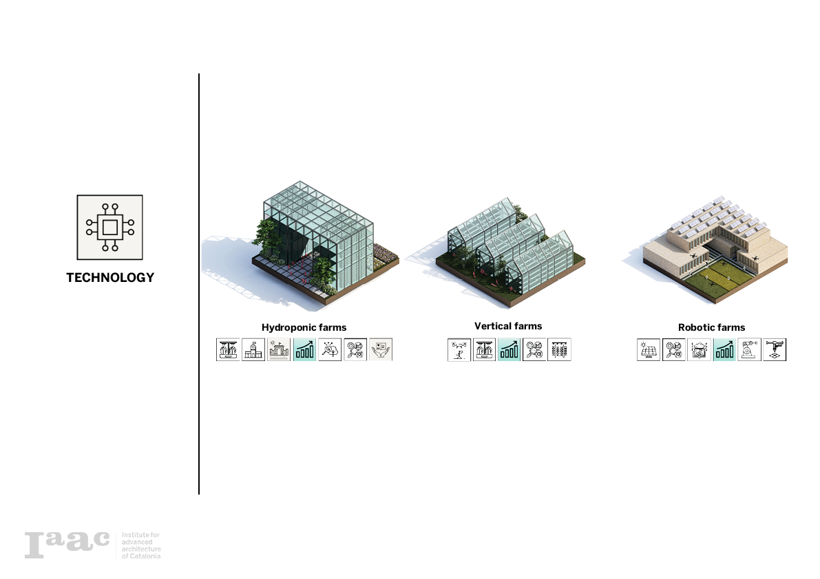
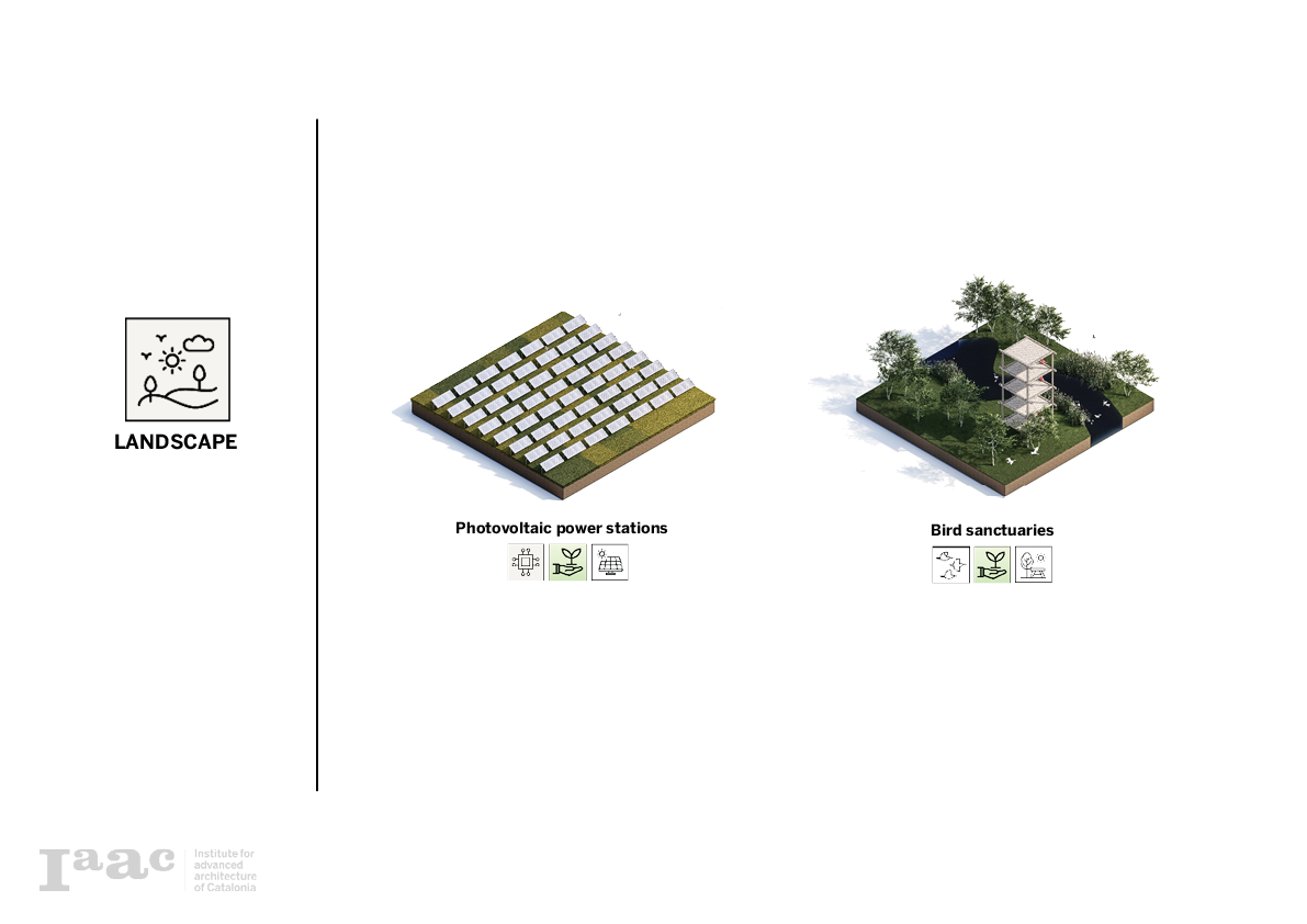
Previous land use analyses have shown a conflict in urban development. In order to mitigate every major land use with agriculture, a content table is made to design different combinations between the urban expansion land uses and agriculture. Six major categories become prominent in this study, landscape, technology, market, education, public space and housing.

Programs Catalog
Using previous categories a program catalog is made. looking for the merger in qualities, each pixel shows the implementation of agriculture in the six major typologies categories.
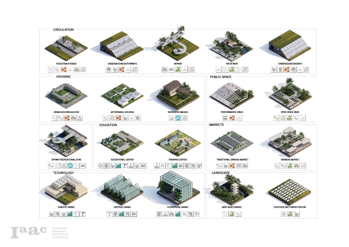
Circulation Programs
Housing Programs
Masias Programs

Public Space Programs

Education Programs
Market Programs
Technology Programs
Landscape Programs
Phase VIII: Program Allocation
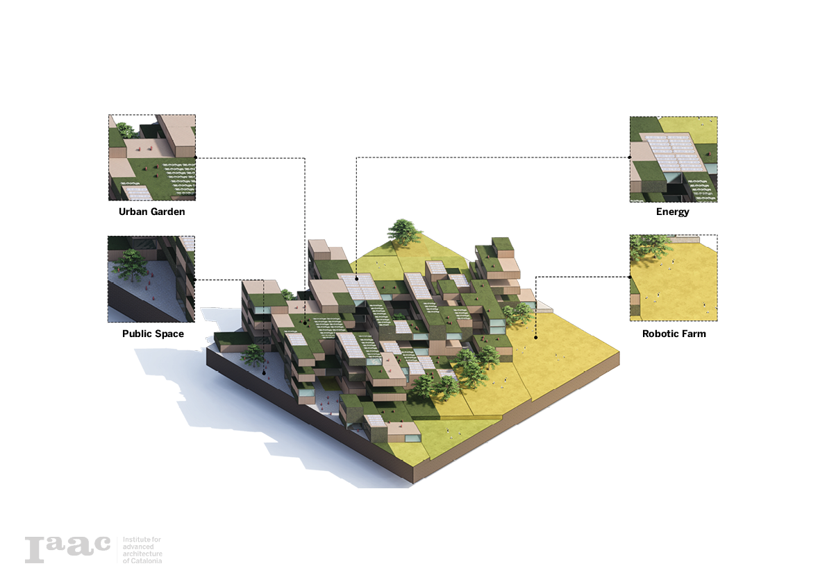
Concept Diagram
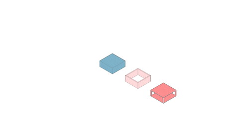
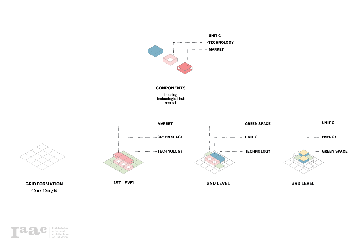
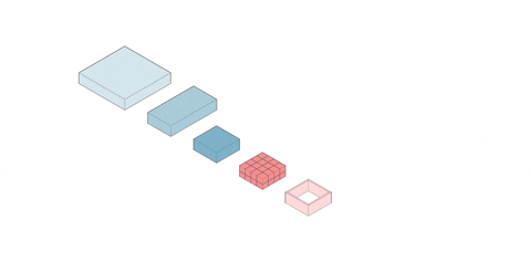
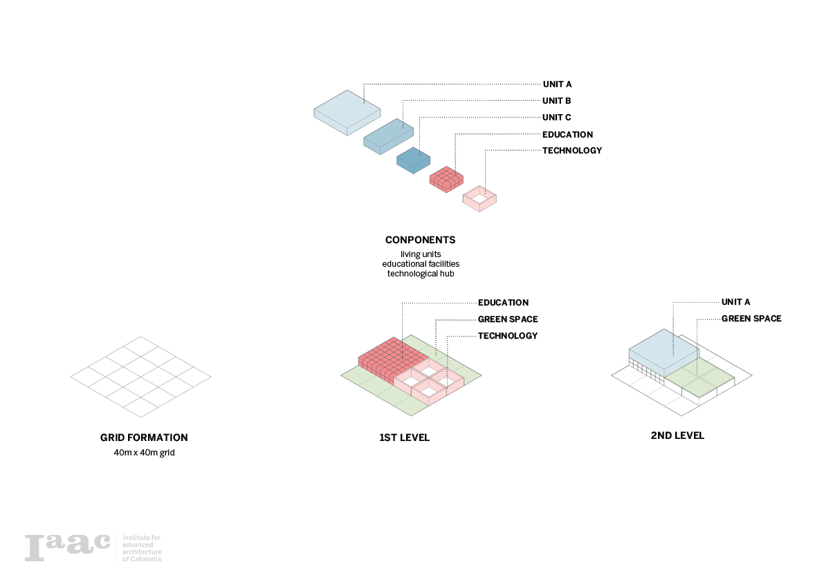
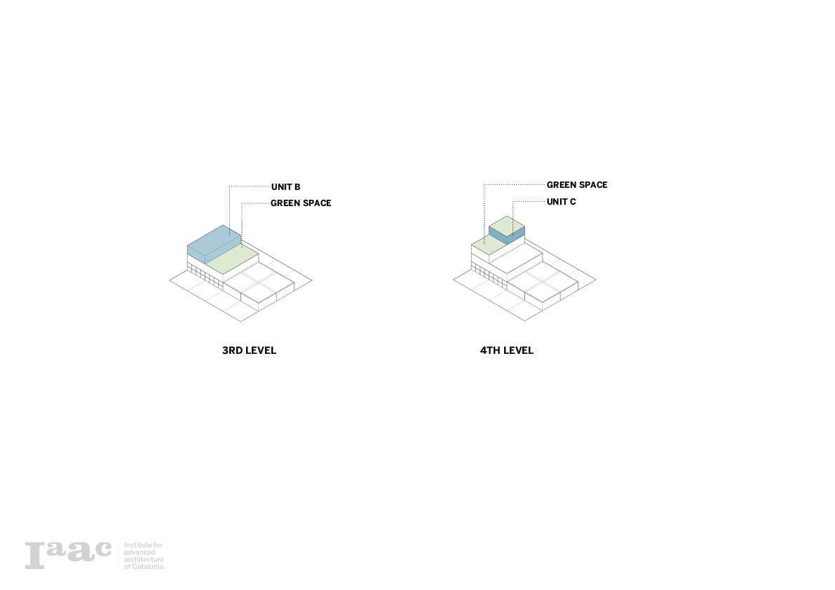
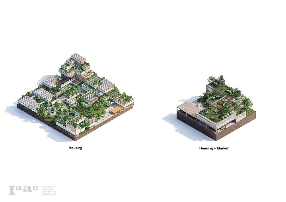
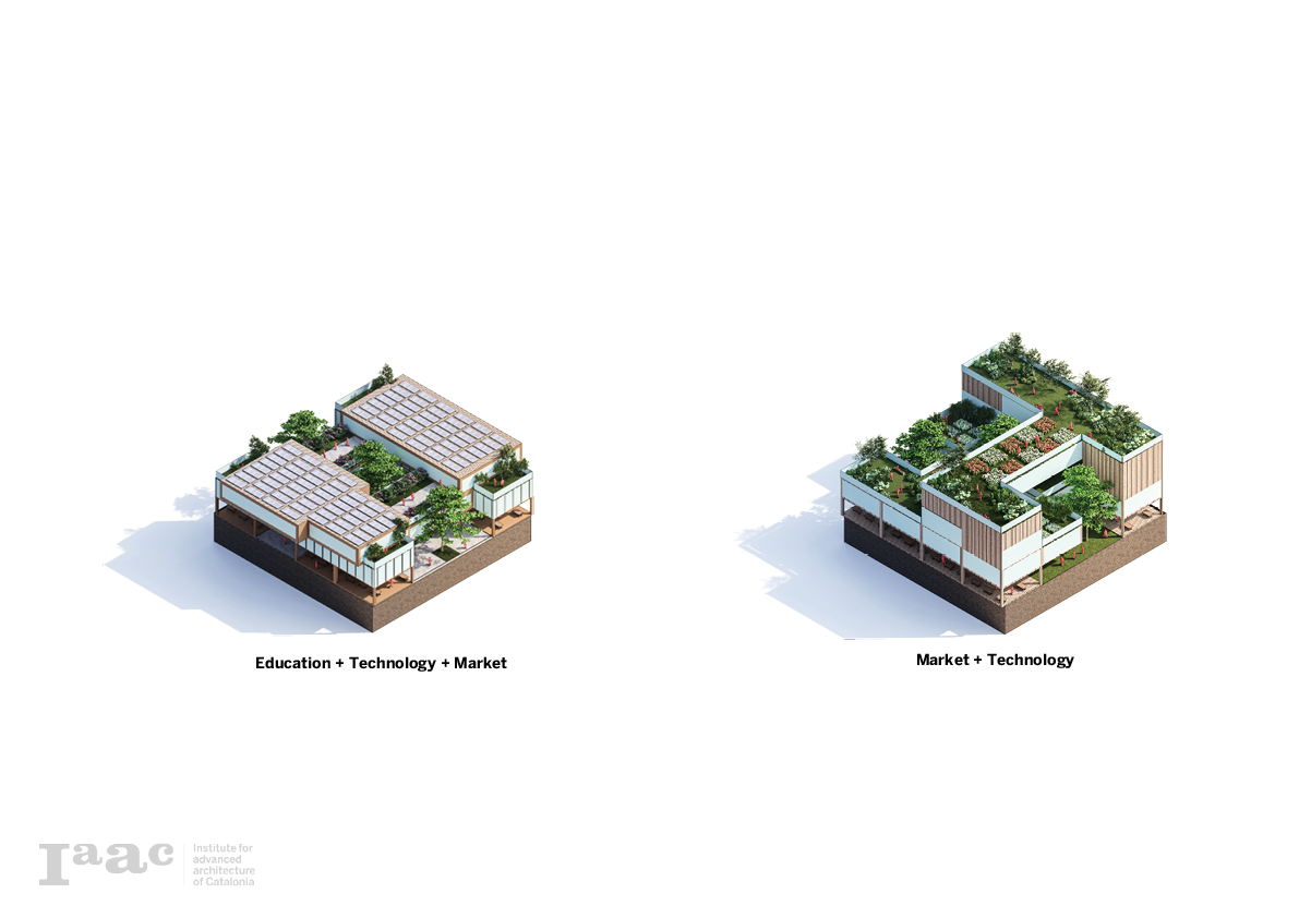
Pixel Configurations
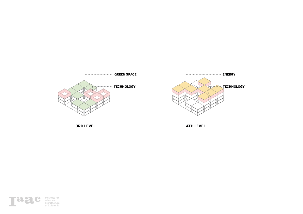
Using the concert of the pixel, each land use typology is used to create a compositor system between them. This makes it possible to use the pixel module and to make different variations with different typologies.
Housing
Education + Technology + Market

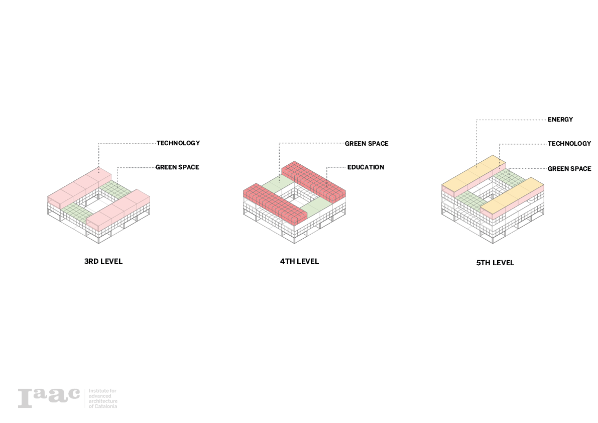
Technology + Market
Technology + Market + Housing
Education + Technology + Housing
 Scenarios
The combination between the program catalog and the pixel compositions makes a variety of scenarios possible that create a new urban context combined with agriculture. These compositions are possible implementations in the master plan and enable the transition from the urban design scale to the architectural design scale where different designers can implement their design following the volumetric program.
Phase IX: Composition Studies
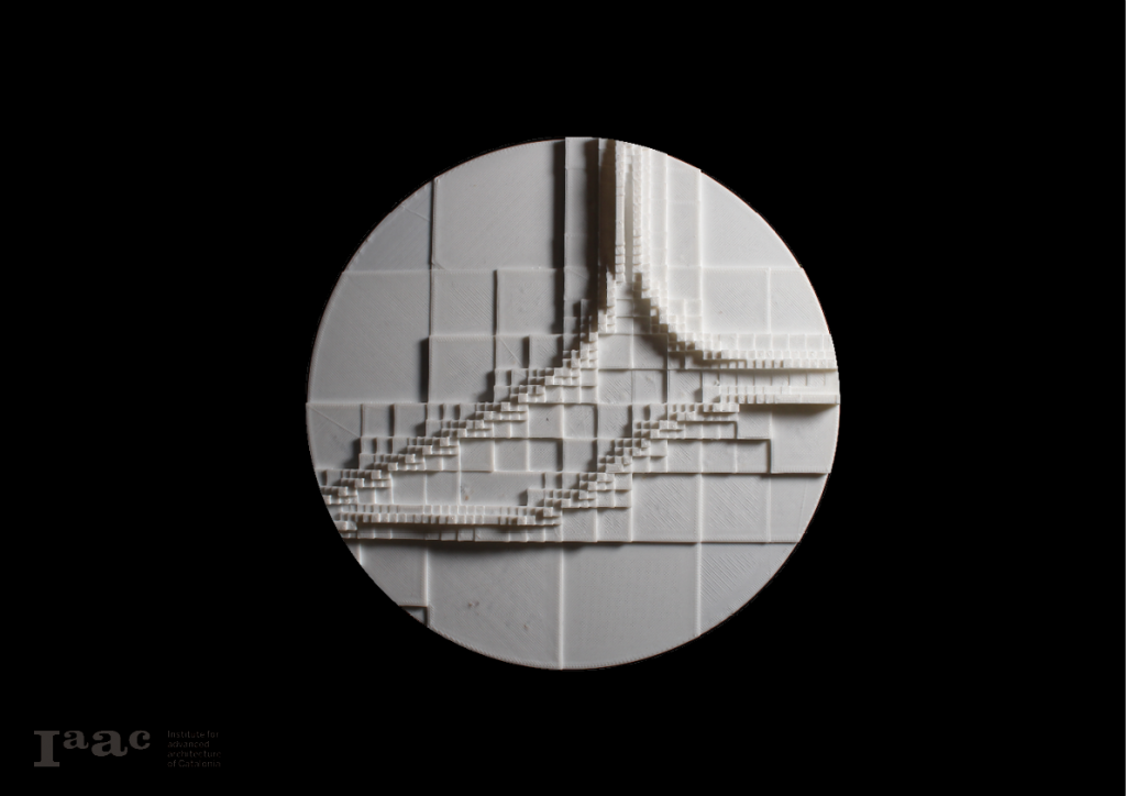
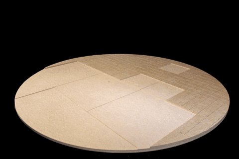
Final Prototype
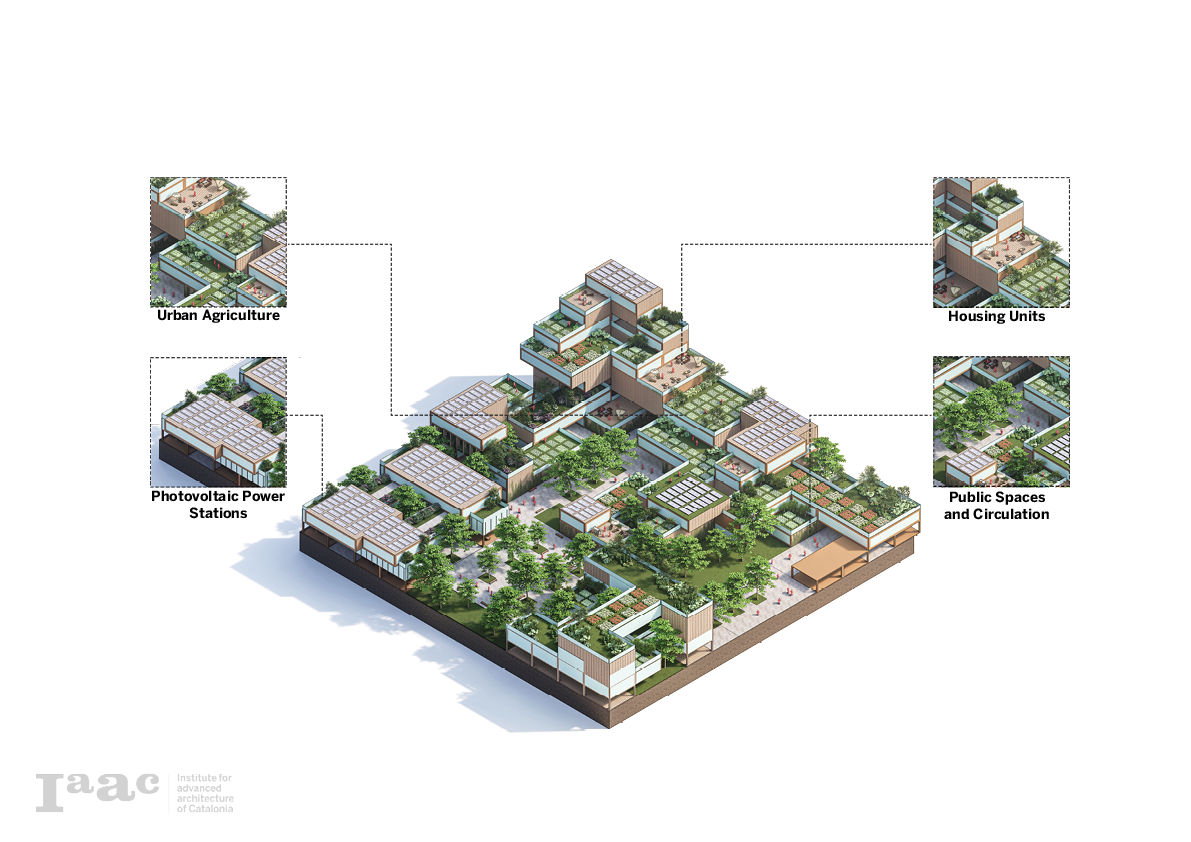
This final prototype is the implementation of the different pixel compositions based on their density. in other words, as the volumetric studies show more density the model implements the more dens compositions like housing and markets. The computational model also controls the build-up towards the city center where there is a total pixel stacking of 7-8 units high. As the city moves away from the center the number of pixels stacks lowers to one. This methodology enables a transition between agricultural land and the urban fabric.
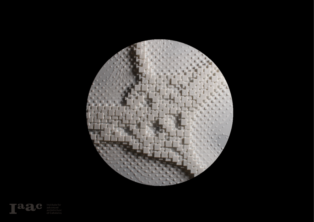
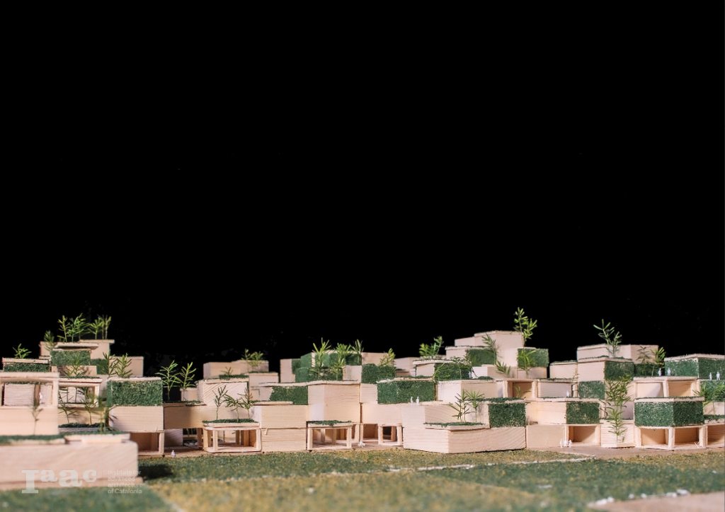
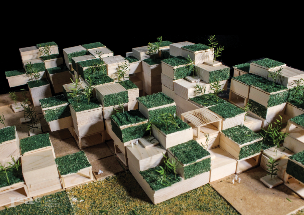
Model Buildup
</p>
Model Simulation
This model shows the systematic growth of the pixel composition. The buildup towards the center of the city and the stepping of the different agriculture typologies going over the elevated surfaces of the city. At the beginning of the simulation, different city networks are tested to create a ground level. Based on the size and use of the city this ground level will change.
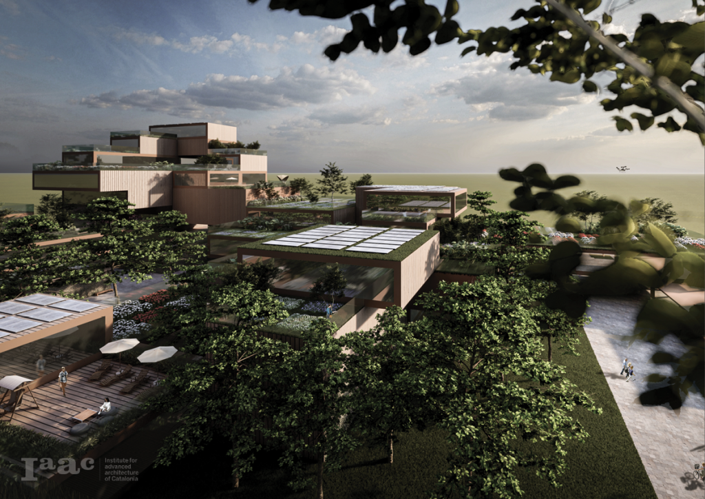
Phase X: Design
Masterplan Animation
This video is a part of the project Agro Pixelization in the X-Urban Design Studio in The Master for Advanced Architecture. Representing the analyses of the site and showing the development of the master plan for Parc Agrari del Baix Llobregat.
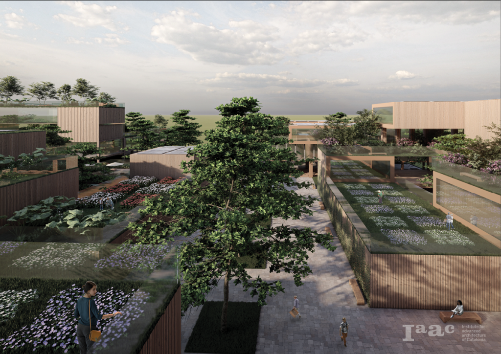
Masterplan
The implementation of the city enables the nature of the Llobregat river to expand back into the land. The previous boundaries created by the highways don’t exist longer on the surface as the land goes over the barriers. A new way of doing agriculture arises.
City Development
The city development shows the implementation of the different volumetric pixel compositions based on their respective density. Visible in the animation is the positioning of each of the different typology compositions that were made previously.
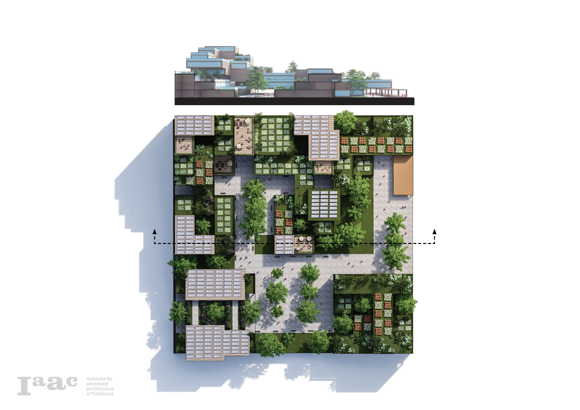
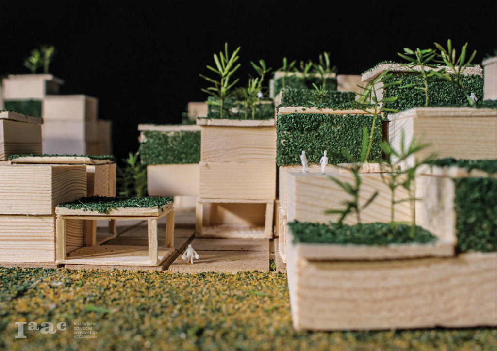
Masterplan Model
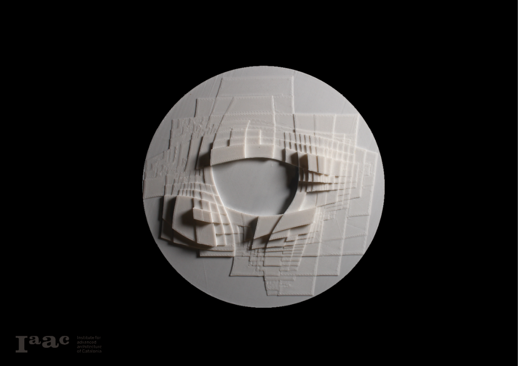
The image below shows the combination of the 3D printed models superimposed on top of the highways in the topographical model. This model shows a clear reactiontowards the highways and the linear effect this brings.
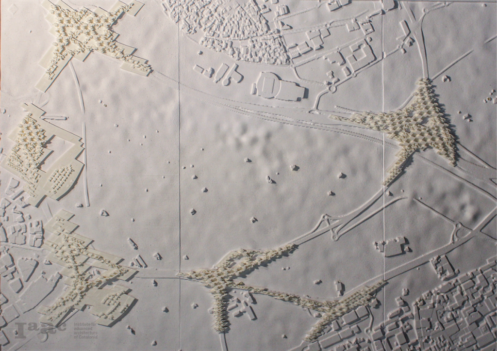
Plan View
Visualization
Animation
</p>
Agro Pixelization is a project of IAAC, the Institute for Advanced Architecture of Catalonia, developed in the Master in Advanced Architecture (MAA01) 2020/21 by students: Alexander Dommershausen, Tsvetelina Bogdanova, Rosamary Machado, Daniel Soiral; faculty: Willy Muller and Manuel Gausa; faculty assistant: Camila Álvarez.
