Concept:
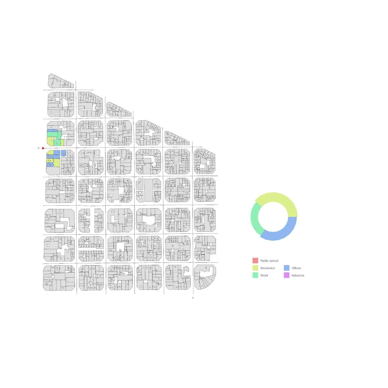
This project is focused on creating a visual narrative of land-use in a selected neighborhood in Barcelona. As a person walks from point A to point B the algorithm displays, in real time, the land-use composition of all the surrounding parcels on the journey. The tool allows us to understand the division of a neighborhood and to compare its land-use composition to different blocks in the city.
The project expresses both spatial and non spatial data, to visually represent the dataset and allow a more comprehensive understanding of each point in space.
Methodology:
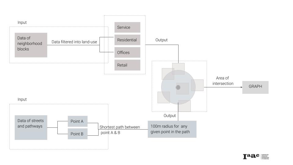
The tool follows a simple logic to carry out the objectives:
- Select a data set and area of project
- Identify the categories of land uses in the data set provided
- Identifying the shortest path between two points in the neighborhood
- Identify the different land uses that fall under this 100m radius
- Create all necessary area calculations
- Display the areas visually
Implementation:
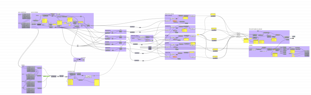
Using a combination of GIS, grasshopper and Rhino the code was created and tested on selected block in the city.
Final Result:
A Journey of Land-use, is a project of IAAC, Institute for Advanced Architecture of Catalonia developed at Master in City & Technology in 2020/21 by student: Hebah Qatanany, and faculty: Eugenio Bettucchi & Iacopo Neri.