“ …the intelligent processing capabilities of the robot are used at the “advisory” and not the ‘executive’ level. For now, the robot simply makes the job of its human remote-controller easier by pre-processing some of the information itself, or even by making and then relaying a preliminary assessment of events within its visual field. But it is precisely the distinction between advisory and executive capabilities that is being blurred in other military applications of Artificial Intelligence (AI).”
-Manuel DeLanda, War in the Age of Intelligent Machines (1991)
PHOTOGRAMMETRY IN THE FOREST
The appeal of AI and intelligent machines has always been its ability to take a process that requires an immense amount of tacit, learned knowledge and translate it into an algorithm that can be computed instantaneously. Forestry management is a great example of a field that is ripe for robotic intervention; it requires an incredible amount of contextualized knowledge and info that can only be gathered on site to properly understand a forest ecosystem, let alone produce lumber products from it. If these processes could be computerized and accelerated, could we more thoughtfully manage and care for the forests we so depend on?
During the first week of MAEB’s Raw Nature module our class was introduced to the Woodwose project, produced by MRAC students last year. This project beautifully demonstrated the multitude of applications for scanning in the forest: the ability to manage density and tree health from afar, or create a database of tree shapes and sizes allowing a more selective and efficient logging process. With these ideas in mind, our class began to experiment with scanning trees here in Valldaura to get an understanding of the constraints involved with forest photogrammetry.
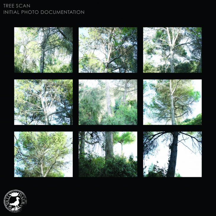
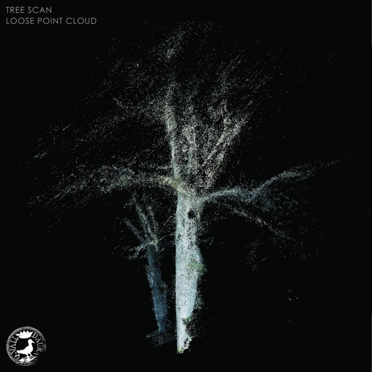
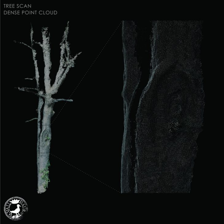
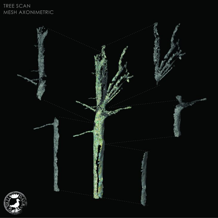
TREE SCANNING METHODOLOGY
The tree is photographed from all sides, aiming to capture the tree in high resolution with lots of overlap to allow for proper alignment. Next, the photos are scanned and aligned in Agisoft Metashape, which locates feature points that are defined by the texture in each photo. This process produces a ‘loose’ point cloud that is then simplified into a ‘dense’ cloud. After some editing, the dense cloud is transformed into a mesh surface that can be brought into Rhino and manipulated further. Because trees contain such complex geometries, most of the scans are very noisy and distorted, so post processing is very important. It is also much easier to scan a tree that stands alone in the forest than one that is nestled within a dense stand. The canopies of the trees also present a challange: most tree canopies are indistinguishable from the canopies of neighboring trees, so my scan focused exclusively on the trunk of the tree. This makes sense if we imagine that the final 3D mesh will be used to predict which lumber products we can get from the tree after cutting it.