Abstract
Luxembourg has been suffering a serious fragmentation problem and biodiversity loss during the last years due to a very low average density and a dispersed pattern of buildings and road networks.
Wetlands are the most endangered habitat from both problems so our goal is to try to increase natural connectivity between the existing ones and create new ones with beavers help too. We have identified the main ecological corridors between them on a territorial scale and now we are interested in understanding how this natural connectivity works in a smaller area.
Introduction
The area selected is the Bertrange municipality, in the east of Luxembourg city. It is an area with two main streams, the Petrusse river on the north side and the Grouf river in the south with a high density of protected wetland biotopes along both of them, and a big urban settlement as well.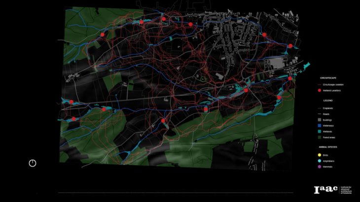
Studio
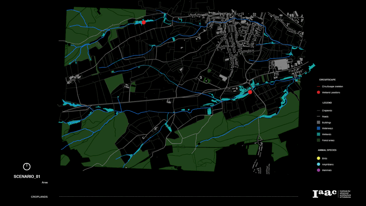
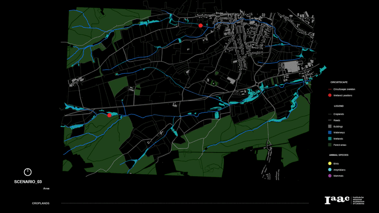
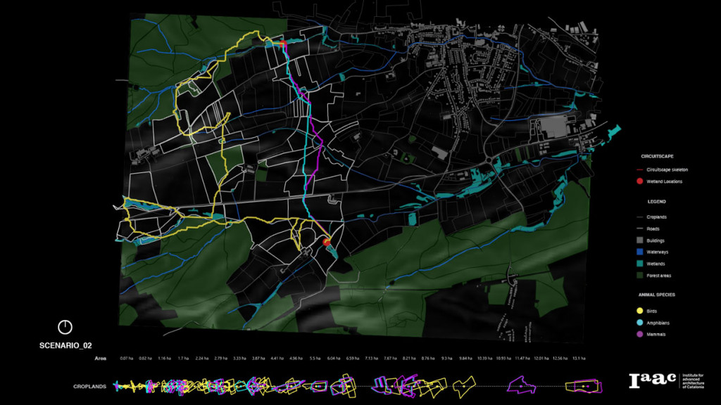
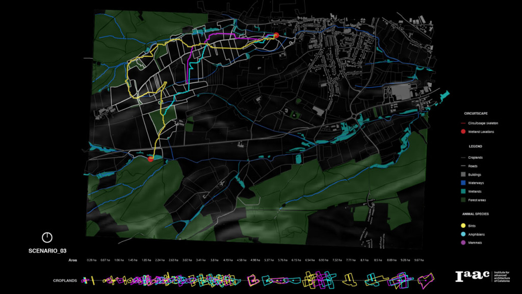
The aim of this project and grasshopper code is to try to generate a tool that allows us to visualize through different scenarios how different kinds of typical wetlands species – such as birds, amphibians, and some mammals – could move along the territory between some of these existing and new wetlands. Moreover, we used these animal path patterns to understand how they are correlated with croplands and which of them could be affected by animals’ migrations. Three different possible connectivity scenarios are shown.

Methodology
- Import shapefiles with the skeletonization lines resulted from Circuitscape final ASC Raster as the possible paths that animal would follow, and the existing and possible wetland locations that will be used as starting and ending point each time.
- Import shapefiles with forest areas and main waterways to be used later in the configuration of the shortest walk component resistance depending on each animal species, considering that mammals will follow the shortest path between locations, birds will follow the ones with the closest trees, and amphibians the ones with the most aquatic spots near the route.
- Create an animation that shows each animal path between each pair of wetlands selected to visualize at the same time their different patterns along with the territory and their relation with the elements around it.
- Create a graphical analysis that visualizes and highlights on the map all the croplands affected by the animal paths extracted before and relate each of them with the animal that is expected to use it. Map in a chart the total of croplands affected, classifying them by each animal path (color scale) and sorting them from lowest to highest by their area.

Data source: Geoportal of the Grand-Duchy of Luxembourg & Open Street Map
Wetlands connectivity-Luxembourg is a project of IAAC, Institute for Advanced Architecture of Catalonia developed at Master in City & Technology in 2020/21 by student: Alvaro Cerezo, and faculty: Eugenio Bettucchi & Iacopo Neri.