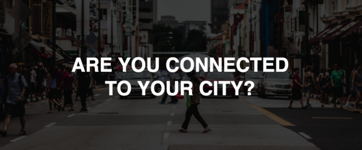
Connection with our cities is a vital part of our experience in the urban environment. How rich this experience is, depends on a number of factors ranging from ease of mobility, amount of activities on the streets, to how much one feels like a part of the city.
Analysing the city of Shanghai we recognised that it is very well connected in big scale (with other cities and within its’ neighbourhoods), though in small scale it is quite the opposite: the rapid evolution results in poor collective memory of the people in such a society. In terms of physical connection, the most basic form of human mobility is examined. For cultural reasons, walking in Shanghai is affect by various factors ranging from weather, pollution, fenced neighbourhoods, scale, to distance. Regardless of this, communities with high level of walking are known to be safer, sustainable, have more economical value, local activities, and healthier citizens.
With the hypothesis that; walkability = active neighbourhoods = programs + connection, we propose an app –URBAN RADAR- that aims to inspire walking in Shanghai communities in order to activate neighbourhoods and improve connection within.
How it works
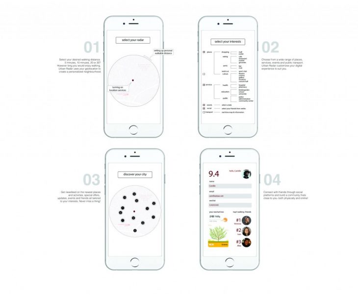
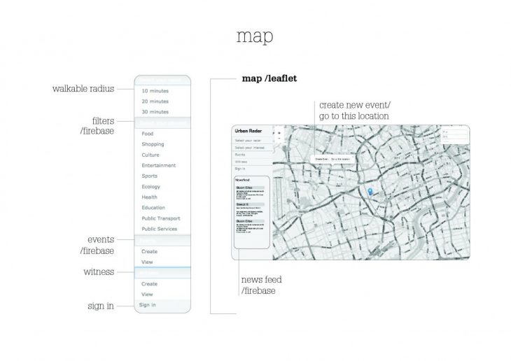
The platform consists of a map, with the user at the middle and different points, tailored to predefined interests, in a selected walking radius. Users get notified of the changes that occur around their selected personalised neighbourhood. They are also able to feed into the system by creating events, and reporting activities on streets as they walk. Routes are suggested based on selected interests, creating a different digital and physical experience for each user.
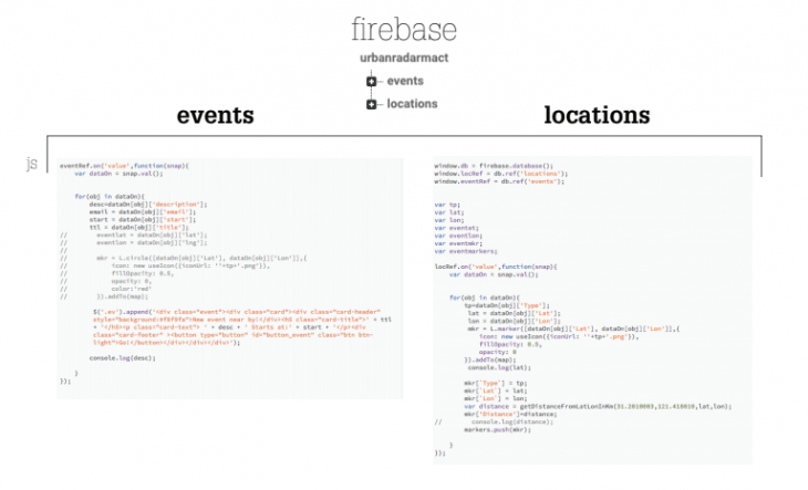
On the backend, data is read through firebase, enabling a real-time database to be created. The data is imported on the leaflet map markers as well as the newsfeed generated by the user (or business) about events, activities or other outputs. In order to transfer data from one page to another we tried to use cookies, but our process still needs to be improved to transfer location from click on map – to firebase – to the marker.
Backend Coding
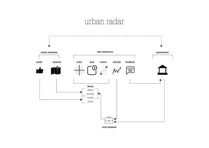
The general view of the system includes three major steps: taking advantage of existing online platforms (data in), generating user experience through radar and generating output (data out) for local administration in making decisions concerning the public space.
URBAN RADAR app is a project of IAAC, Institute for Advanced Architecture of Catalonia, developed at MaCT (Master in City & Technology),
2017-18 by:
Students: Camille Feghali , Saule Gabriele, and Venessa Williams
Faculty: Andre Resende