Abstract
The project UrbanAI | Rewilding Luxembourg is exploring machine learning algorithms, such as 2D neural Style Transfer to generate a series of complex and organic habitat patterns.
Introduction
This project was developed in relation to the Internet of Cities studio and the challenge of Rewilding Luxembourg. Our goal for the studio project is to reduce the landscape fragmentation rate in Luxembourg through connecting and rewilding Luxembourg’s wetlands.
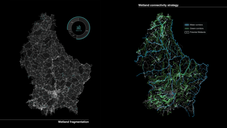
Landscape fragmentation and potential green corridors to reduce fragmentation
One of our key strategies is to cooperate with beaver, an “ecosystem engineer” species to spontaneously increase landscape connectivity and heterogeneity in Luxembourg. Beaver is a keystone species in a wetland ecosystem, since they are one of the few species that can manufacture their own environment; they create micro habitats in typical patterns.
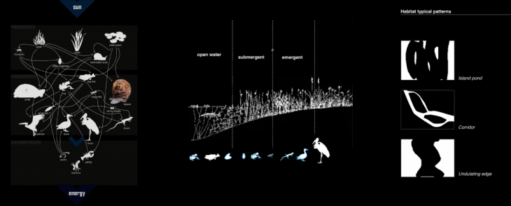
Wetland ecosystem dynamics, landscaping effect and typical patterns generated by beaver
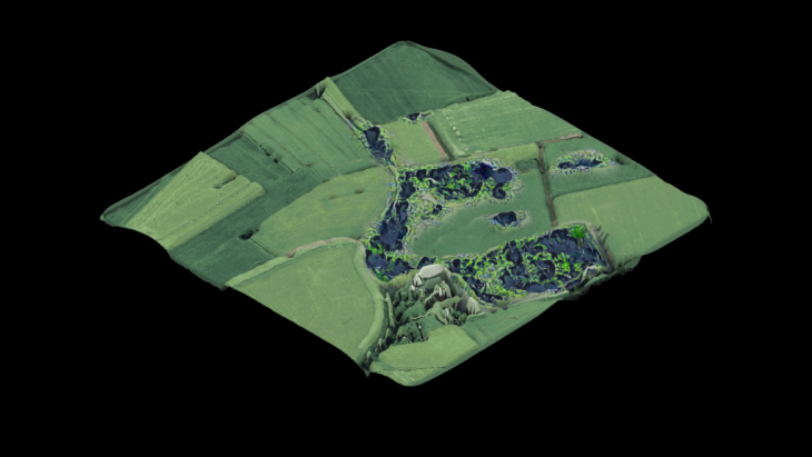
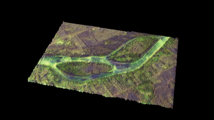
The site we are working on is located on the southern part of Luxembourg, at the area of Bertrange. The main strategy for connecting the wetlands is to create some artificial dams simulating the beaver’s habitats along the rivers and near the existing wetlands to increase the water quantity, and introduce beavers in the area so that they begin to expand these wetland areas creating micro habitats.
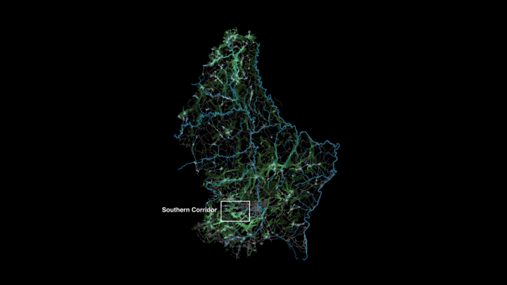
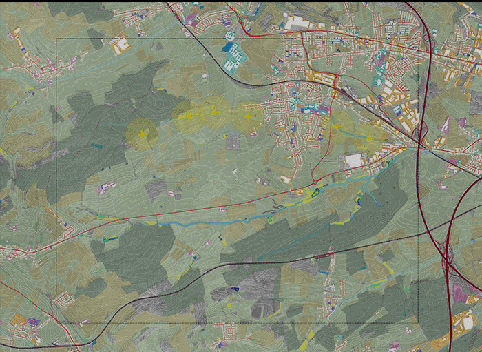
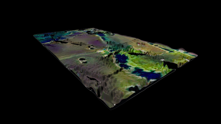
Four focused areas along potential wetland species paths (generated in studio by simulator software) near Bertrange in Luxembourg
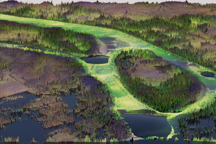
We find that with the help of artificial intelligence, the positive landscaping effect by beavers could be simulated and wider promoted. Therefore, we focused on potential wetland species paths in a typical Luxembourgish town that is located on the outskirts of Luxembourg city and started our experiments with Urban AI.
The four areas of experimentation
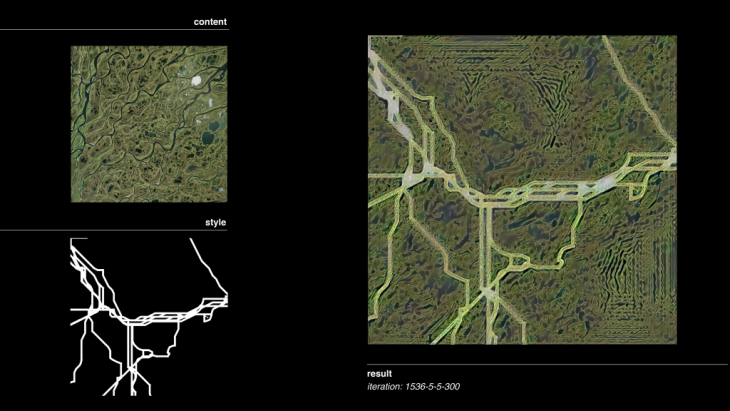
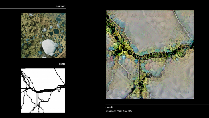
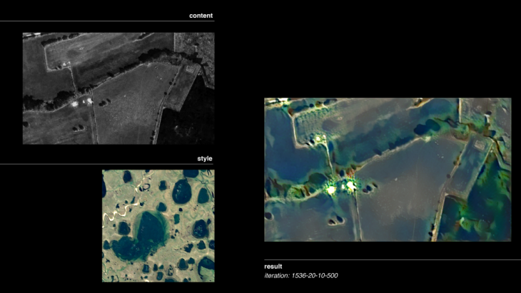
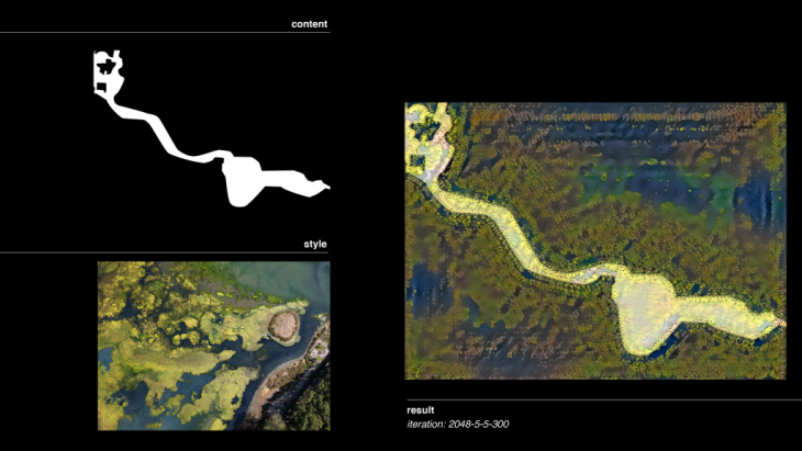
Area 1
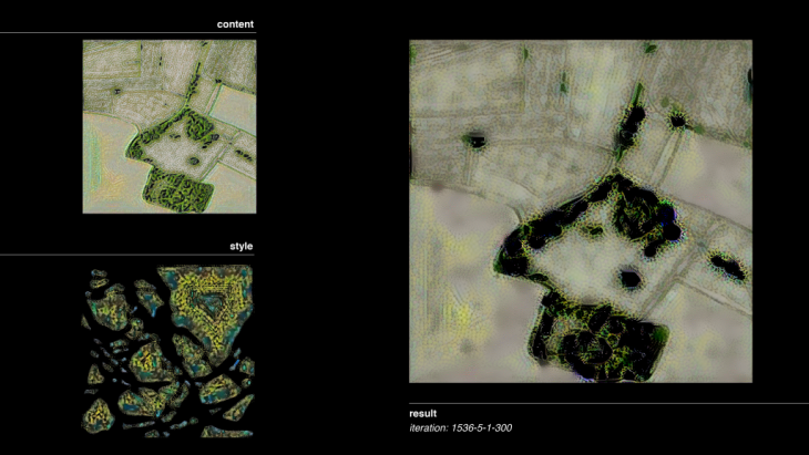
In our first area we extracted the animal paths Circuitscape generated as pattern lines and we used the 2D neural transfer tool to visualize them as wetland linear corridors. The generated result of the previous operation was used with a satellite photo of our actual area, to generate a new outcome. We deliberately used a picture with a building, a “wetland barrier” we have already identified in the area to increase the parameters of our visualisation.
Using a different wetland image, with more wet elements such as ponds, the outcomes are different, resulting in a more diverse landscape.
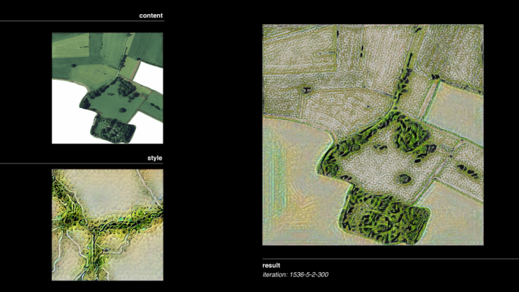
Area 2
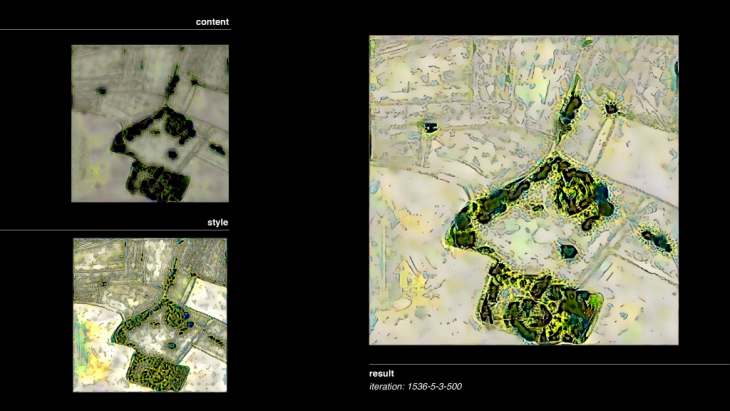
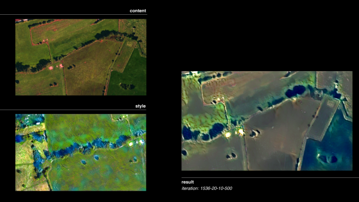
In the second area we started by using the generated result from the circuitscape lines mixed with wetland patterns to generate new more complexed landscapes. By using two types of habitats, ponds and islands combined we created a more detailed pattern that will after result in an even more complex and detailed outcome.
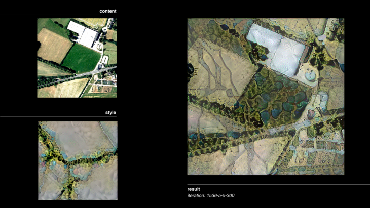
Area 3
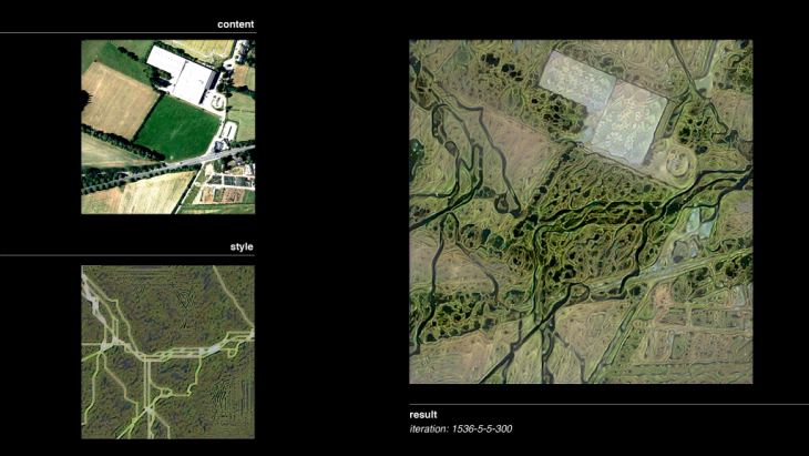
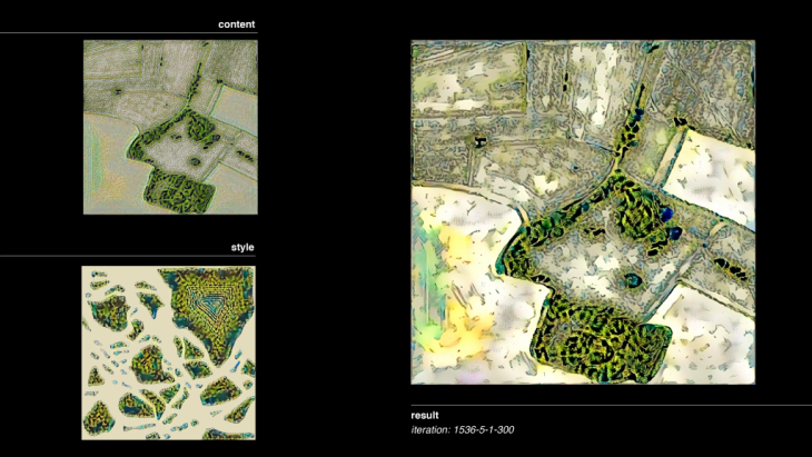
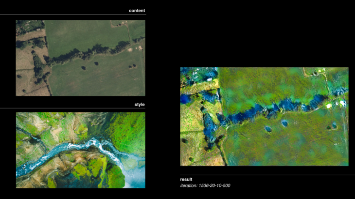
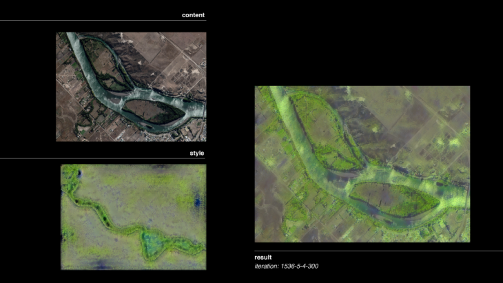
The third area we choose is one of the locations of the new dams that we are introducing in the area. Since in this area the presence of the river will be very important, the first generated result is from the combination of a satellite picture of the area mixed with a wetland picture with many ponds and distinguished water elements, so that we can visualise the area with more water surfaces.
Since we also want our outcome to become more realistic and adapted to the Luxembourg landscape, we tried again to visualise more water in our area, by combining a satellite image of Petrusse river with an aerial river picture. The generated result was again combined with our area, resulting in a more complex wetland landscape.
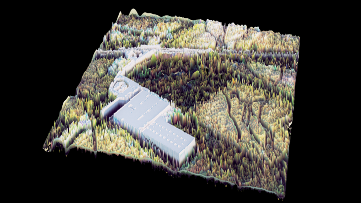
Area 4
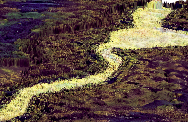
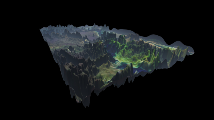
New dams are introduced also to the fourth area, however it is in a different landscape than our previous one. What we wanted to visualise was how this part of the landscape will look after the introduction of the beavers. So, firstly we used the extracted from Caesar, simulation of the flooding of Petrusse river as a pattern that we applied the style of a beaver wetland landscape.

By using our generated results from our first iteration, mixed with a satellite image of our actual area, creates a really complex and interesting wetland landscape. 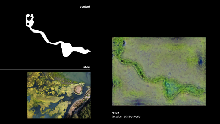
Credits
UrbanAI | Rewilding Luxembourg is a project of IAAC, Institute of Advanced Architecture of Catalonia developed at Master in City and Technology in 2020/21 by students: Alvaro Cerezo Carrizo, Arina Novikova, Dongxuan Zhu and Stefania-Maria Kousoula and faculty: Dr. Matias del Campo and Prof. Sandra Manninger.