IS.1 – Introductory Studio G.1
ACTIVE PUBLIC SPACE
Senior Faculty: Edouard Cabay
Faculty assistant: Rodrigo Aguirre
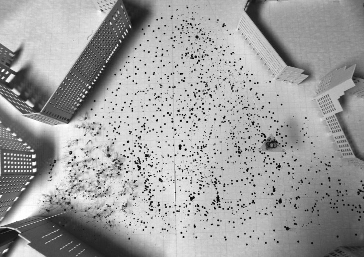
In 1859, little after Barcelona’s over-densified medieval fabric is finally authorised to spread outside of it’s walls, Ildefons Cerda’s masterplan, an homogenous and precise 133,3 by 133,3 meter orthogonal grid, built regulated by a force that does not yet exist: the automobile. The Eixample’s morphology responds to multiple intentions, both social and infrastructural, yet the dimension of movement is central in the experience of the city and the car, an individual, space consuming and polluting device, dominates. Today, mobility is still at the centre of urban evolution, yet that city struggles to transform. Within the regularity of its urban fabric, exceptions occur in the Eixample, under the form of strong centralities: nodal points act as transportation hubs and are formalised as the largest open public spaces of the city. Suddenly, the complex nature of the urban is revealed: the space is alive; it is animated by fluxes of different natures producing a kinetic interwoven ecology of events and behaviours.
DYNAMIC URBAN FOREST
Dirk van Wassenaer / Lina Salamanca/ Levit Arroyo/ JengRung Hong/ Catherine Simakova/ Sidharth Kumar
Goutham Santhanam/ Khushboo Sonigera/ Vishnu Jadia/ Naitik Shah
In the city of Barcelona, car traffic always radically mediate the public space; the studio will question the presence of the car in the public space and speculate on the consequences of its sudden removal. Space will be understood through the examination of layers of activities and the interactions that exist between them. Before acting on existing orders, we will need to thoroughly analyse the public space using means of mapping and cartography. As architects, or urbanists, we traditionally observe, represent and plan space by means of drawing; the static nature of a printed map implies that, whatever appears on the paper, it is the representation of a frozen moment in time. Equipped with measuring tools, we will spend long hours on our sites to map their dynamic patterns and behaviours over time; aiming to convert them into dynamic drawings, or kinetic maps. Our proposals, speculating on the hypothesis of the removal of the car from the public space, will take the form of large performative models. We will be using digitals fabrication tools and parametric design to simulate behaviour and animate, or automate, spatial scenarios over time, understanding the city as a real time simulated custom-scale theatre play…