In this seminar, we explored the idea of designing a digital participatory design tool – particularly Mixed Reality – for the Superilla in Poblenou. Using the Super Barrio game by MaCT 2016/17 students, we started our research phase by testing it out in the Superilla. What we came to notice was not an immediate observation from people’s responses to the game, it was however the lack of involvement of a certain age group, children.
Using Mixed Reality, we sought to explore the possibility of transforming the public space into an outdoor schools where kids can interact with its features, learn new things, and discover the hidden gems in their area. The data collected from these interactions will help decision makers to better address the needs of children in a space. 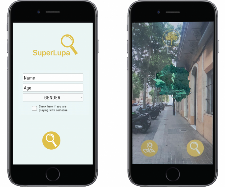
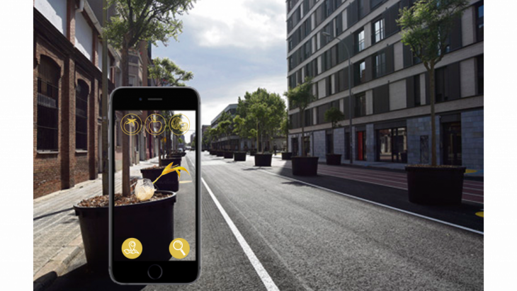
How does the game work?
SuperLupa is an educational, self-guided game and an indirect participatory design tool that encourages urban exploration of the neighborhood by having markers distributed in different locations for kids to seek and find. Using these markers children are able to unlock chapters of the game and each chapter has a different lesson about the public space and what it contains.
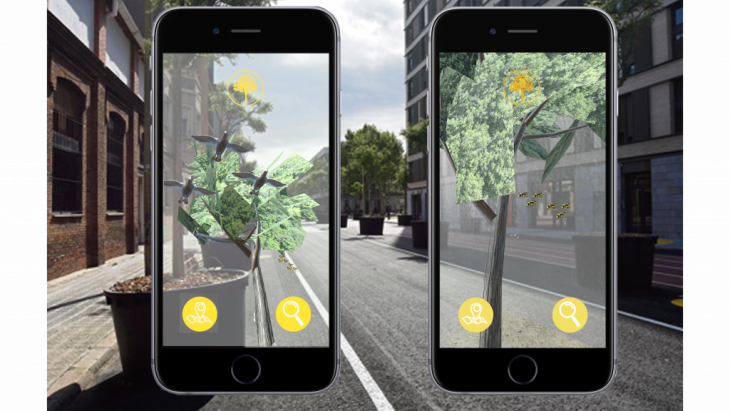
The interface works as a magnifying glass where kids can use the phone to move closer and examine the mixed reality objects to further explore and learn. The chapter we developed using Unity was the Tree Chapter which teaches children about biodiversity and how trees are home to different species such as birds, bees, and even microorganisms that cannot be seen by the naked eye.
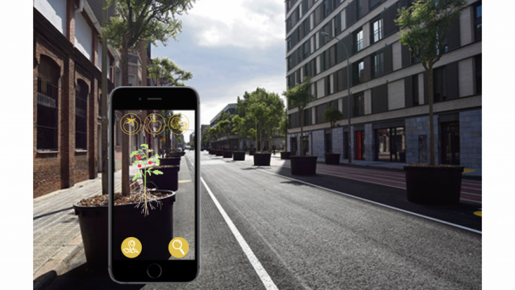
 The next chapter to be further explored would be food production where kids can learn the types of crops that can and cannot grow in Barcelona by dragging different kinds into the screen and watching its growth process.
From testing out the game in the Superilla, we managed to verify that it can be considered as a multiplayer game since kids where always playing in groups and teaching each other every new discovery they make.
How can the data extracted transform public space?
Location, age, time, interest and level assessment are the five main categories of data generated directly by the game. By cross-referencing these different categories and overlaying them over existing data such as current land-use, decisions makers can be able to:
- Identify hot-spots and deserted areas in the neighborhood
- Understand where kids of certain age gather and why
- Understand when kids use the public space and why
- Distinguish which chapters kids seek and find more interesting and how much time they spend on each chapter
- Identify kids levels and reaction to challenges
Urban interventions such as reactivating deserted areas, introducing temporary events that are more targeted towards different age groups according to their location and interests, creating outdoor learning spaces and others are examples of how SuperLupa can influence the future of the urban planning process.
SuperLupa: Building on children’s curiosity to design the neighborhood and emphasize their sense of belonging.
SuperLupa is a project of IAAC, Institute for Advanced Architecture of Catalonia, developed at MaCT (Master in City & Technology), 2017-18 by:
Student: Najla Aldah | Ren Jiale
Faculty: Areti Markopoulou | Marco Ingrassia | Starsky Lara