ABSTRACT
New Orleans, Louisiana is a port city on the Southern coast of the United States. Culturally, NOLA is most well known for its jazz, creole cuisine, and large, annual celebration of Mardi Gras. On a national level, the city is a major source of imports, including petrochemicals and coal, coffee, and steel. Climatically, the city is infamous for its frequent and devastating hurricane and high flood seasons, which are a constant challenge to infrastructure. These almost annual phenomena are a natural process that is greatly shaping the urban environment of the city from a small to large scale. This study has been conducted in an attempt to first, understand the existing nature and conditions of the city in climatic definitions, and second, provide an anthropocenic solution to threats these climatic shifts pose. This proposal uses natural water flow to restore the vital ecological systems of the surrounding area and prevent further damage, while simultaneously harvesting hydro-energy for adjacent urban and suburban developments.

URBAN SPRAWL
New Orleans, or NOLA as referred to by inhabitants, is located on the south-eastern tip of Louisiana. It is defined by its various rivers, bayous, lakes, and swamps, including the Mississippi River and Lake Pontchartrain to the North. These bodies of water have made the city the sixth largest port in the United States by volume of cargo and a major economy of the nation.
During the early settlement of the city and throughout its urban development, engineers, architects, and city planners have designed infrastructure to control and prevent water flooding, including pumping systems and levees. Draining swamps and marshlands allowed further expansion from the city center into low-lying areas. Over the 20th century, natural and human-induced subsidences continued to lower many areas of the city below sea level, creating a bowl-effect which enhanced flood-waters and contributed to the devastation of natural disasters, specifically hurricanes.
PAST DISASTERS
The nature of urban expansion and destruction of wetlands strongly lent to the catastrophic damages of the 2005 Katrina hurricane. Though NOLA as a city is a veteran of hurricanes, and hurricane Katrina was not the most damaging by far, poor infrastructure led to amplified damage.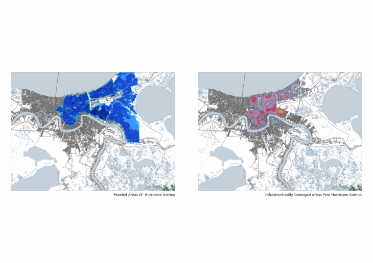
Post Katrina, over 10,300 buildings were federally funded for demolition under FEMA. There was a large population shift between 2000-2010, wherein the population decreased by 29% (37% loss of blacks, 17% loss of whites, 22%). There was a 22% increase of Hispanics, who became a major labor force within the city. Overall, 40,000 inhabitants returned to the city from 2010-2015. 40 out of 72 neighborhoods recovered from the damages as of 2015, and 90% of homes were restored. But there are still areas with very low repair.
FAILURE
Though hurricane Katrina was not the highest categorized storm NOLA has experienced, the city saw an extreme amount of damage and death tolls. In part, the magnified damage was a result of poor infrastructure upkeep and disregard of building code guidelines. Some of the most severe damage occurred in areas where levees breached. Throughout the city, over fifty levees were breached causing an increased, bowl-effect flooding. Louisiana coastline is filled with wetlands which act as natural pollutant filters. However, with oil spills, excessive water pollution, and damage from natural disasters, the wetlands are being severely damaged. Human-made interferences, such as levees, dams, and canals, also constrict the necessary water flow in and out of these areas, smothering potential wetland repair and growth. This is detrimental due to the fact that on average, 14.5 km of marsh can prevent 1 meter reduction of inland penetration of a storm surge, limiting the inland advance of hurricanes and storms.1
CITY RESPONSE
Before the 20th century, community individuals and the local government of NOLA had responsibilities of responding to floods and hazards within the area. Companies, like the Red Cross and the National Guard, with large holdings in local infrastructure also aided. After 1947 federal assistance increased, but not drastically, since the population on NOLA before the 1960s was still relatively small. Hurricane Betsy in 1965 was the major turning point, when 43% of the city was flooded and 14,000 homes were damaged. Shortly after, US congress initiated the National Flood Insurance Program and commissioned levee system constructions. However, building codes were still highly inconsistent, and the commissioned levees created a bowl effect, which caused additional damage during hurricane Katrina. 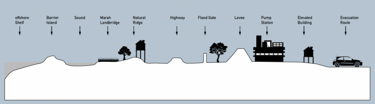
Currently, NOLA has initiated its Master Plan, which is a City Charter to construct framework for core systems that will shape the city’s physical, social, environmental, and economic future. The Plan accepts that no infrastructure is completely safe from flooding: instead, it provides adapted building codes, infrastructure strengthening protocol, and evacuation plans for future threats. The City is also creating multiple lines of defense for future threats, relying on wetland restoration, internal and external structures, and non-structural strategies.
STORMS, SEA-SURFACE TEMPERATURE RISE, SEA-LEVEL RISE AND COASTAL URBAN POPULATIONS
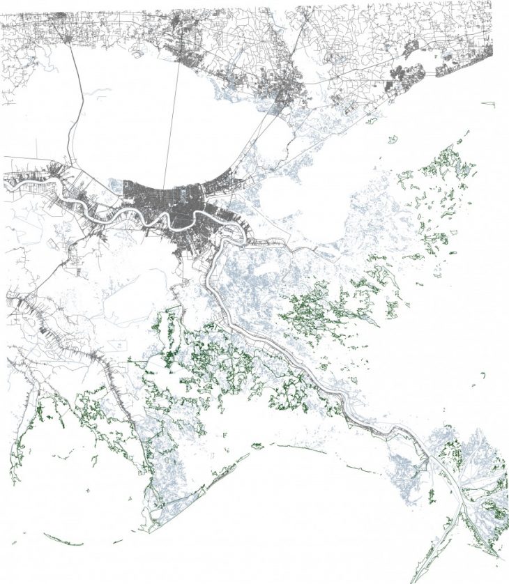
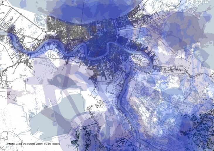
The impacts of hurricanes Katrina and Rita in 2005 and Gustav and Ike in 2008 caused 850 square kilometers of coastal land loss throughout the state of Louisiana.Their powerful winds and excessive rainfall which can result in surging floodwaters uplift the soft sediment of the wetlands, changing the topography and water flow, and subsequently, the water chemistry. In order to better analyze the progression of water and land flow, it is necessary to look outside of the city, to the surrounding coastlines. As shown by the satellite images from 2004 to 2009 (right), the water-to-land ratio has increased significantly. While the City of New Orleans is taking steps to rectify this land loss, solutions are too slowly enacted. Therefore, a new, multi-layered approach is necessary to study, asses and design a plan viable enough financially yet permanently effective.
WATER FLOW STUDIES
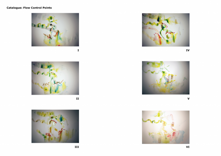
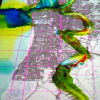
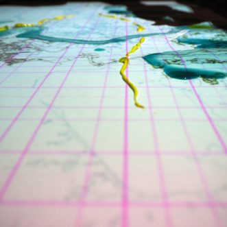
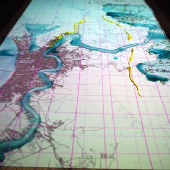
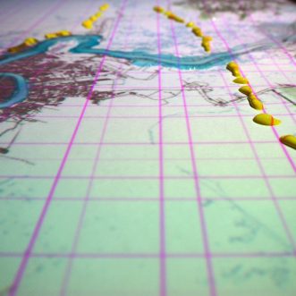
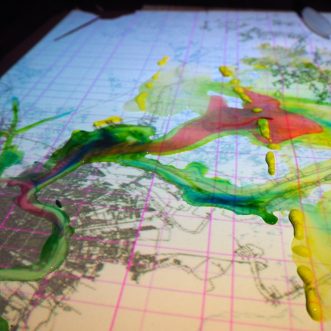
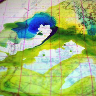
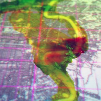
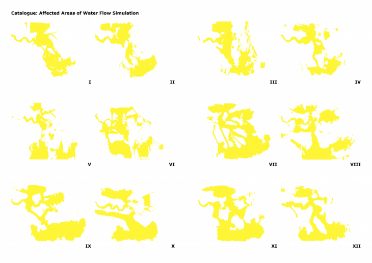
In order evaluate the impacted zones throughout the city and surrounding areas, water flow simulations were made using ink and water color pigmentations. Water is placed on a scaled map of the city, such that topography and water paths are generated through warping of the paper. Pigmentation is then systematically introduced, starting from showing intersection points between the river and main water bodies. Different pigments are then added, to show specifics such was water flow and direction of the hurricane, before an overflow is introduced to map the aftermath of the hurricane and possible scenarios with regards to redirecting the water. 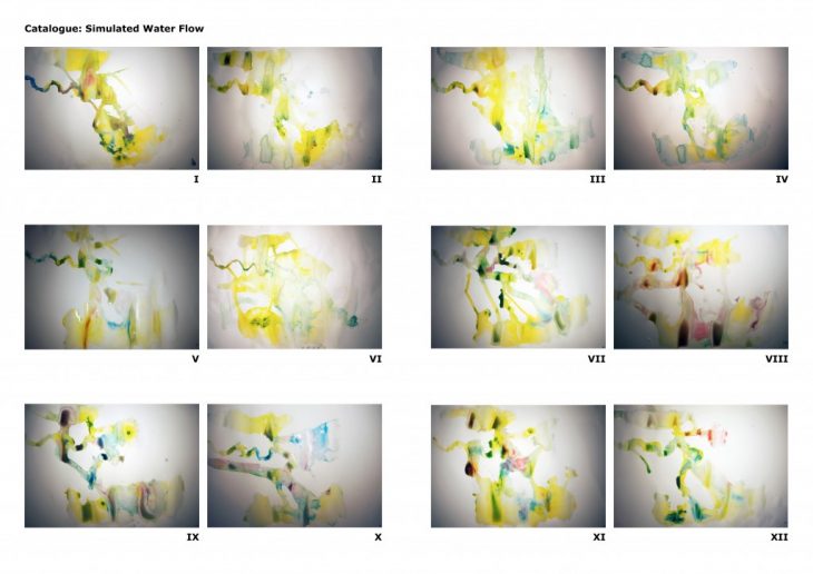
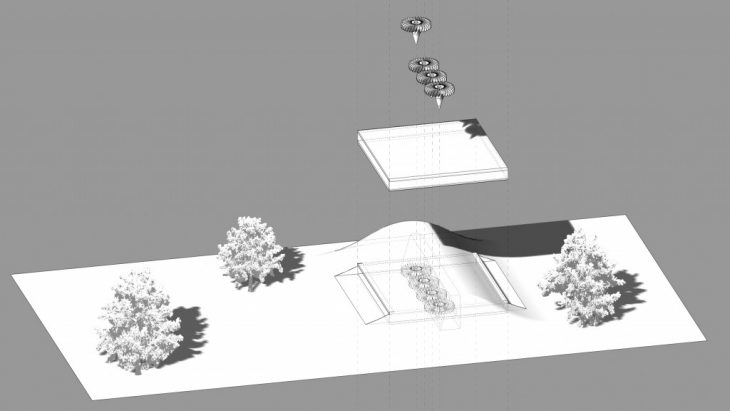
FLOW CONTROL POINTS
The control points are a multi-functional approach towards a synergistic solution between architecture, technology, and nature. The main priority of this solution is to slow large amounts of water flow from hurricanes and seasonal storms while keeping natural water flow to feed into wetland areas. The secondary function of the control point is to harvest hydro-energy to supply to NOLA and surrounding areas.