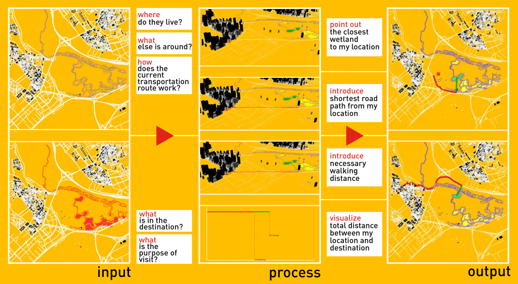
Shortest Paths to the Wetlands | River Llobregat is a study to comprehend the relationship of stakeholders -who are the possible users of the place- with the proposed urban forms, wetlands. As one of the components of this relationship, the ‘distance’ between stakeholders and the wetlands has been defined as the main variable of the study.
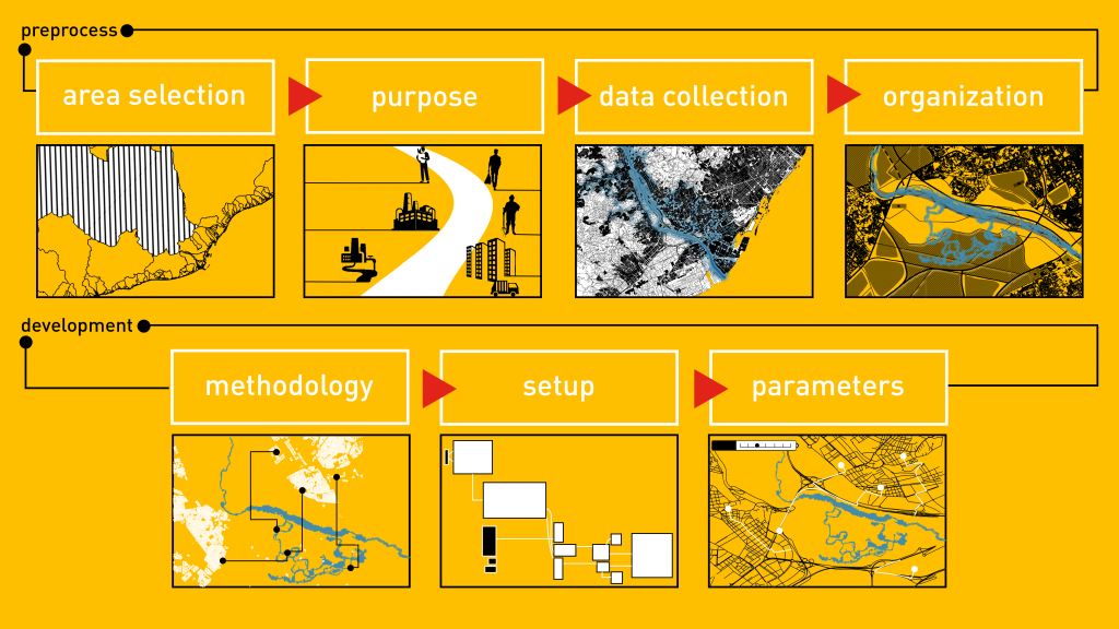
The study consists of 2 main steps: Preprocess and Development. The first step deals with the area selection, definition of the purpose, collection and organization of the necessary data, while the second step focuses on the definition of the methodology, the Grasshopper process, and the creation of visualizations with different parameters.
Structure of the study
Spatial context of the project has been determined as the Llobregat river at a larger scale, considering the main objectives, content, and development of the Internet of Cities – studio project in order to support conceptual design processes with a computational tool. Data used is confined to existing residential areas, road network and proposed urban form, considering the scale-based applicability of the study. It has been organized and trimmed to define the area of ??interest and better analyse the final output of the study.
Methodology of the study
While setting up the Grasshopper definition, the existing residential areas have been visualized in different colors and heights according to the size of the area they cover on the land. In the next step, existing road network has been analyzed together with the existing urban fabric and the proposed urban form is defined. The Grasshopper definition has been set up first to point out the closest wetland and then the shortest route from the selected residential unit to the closest wetland, that shows both the road route and walking path.
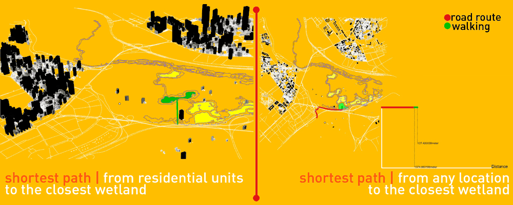
Shortest paths to the closest wetlands
Sources: Open Data BCN & Open Street Map
Shortest Paths to the Wetlands | River Llobregat is a project of IAAC, Institute for Advanced Architecture of Catalonia developed at Master in City & Technology in 2020/21 by student: Sinay Coskun, and faculty: Eugenio Bettucchi & Iacopo Neri