River Meander [Analysis of Agricultural Areas affected by the Meandering of a River]
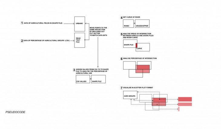
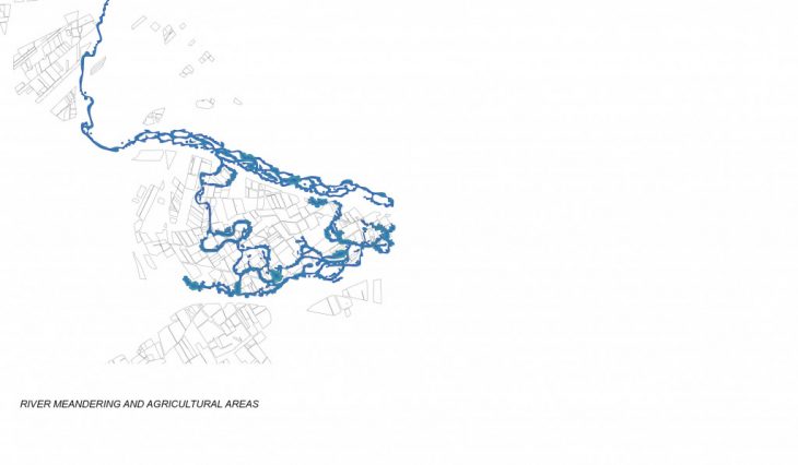
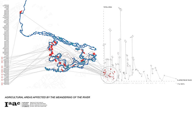
 On a site that is predominantly agricultural, the projections of where an existing river meanders into is analysed by first analysing the kind of agricultural groups exist in the fields and identifying the percentage of their use. Secondly the study aims to identify the agricultural fields that are affected by the new meandering by taking into account how much in percentage they are affected as well as the agricultural group they belong in.
The purpose of this calculation is to help guide designers and decision makers to identify where the issues are through a spatial analysis as well as a non spatial one to extract the same information in a way that helps identify the amount of areas affected and their percentage affected which can then used to guide the necessary decisions that can be taken for the affected areas to adapt to the change in landscape.

</p>
River Meander ,is a project of IAAC, Institute for Advanced Architecture of Catalonia developed at Master in City & Technology in 2020/21 by student: Aishath Nadh Ha Naseer, and faculty: Eugenio Bettucchi & Iacopo Neri