Can we expect to live in a self-sustainable world without even understanding our body and nature? This project is based on raising awareness about the human body in a natural environment.
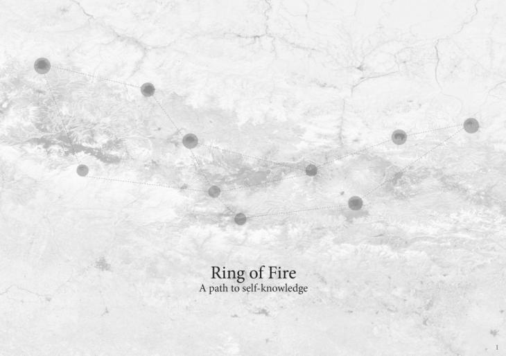
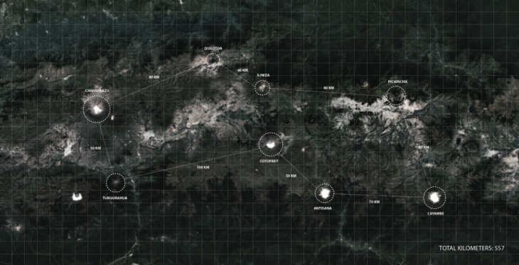
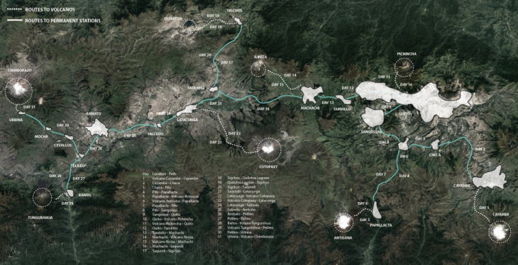
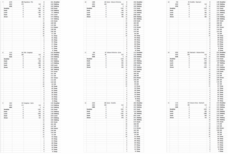
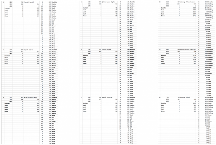
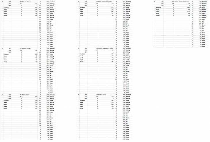
The project is located in the Ecuadorean Andes, it connects 8 important active volcanos with a path of 534 kilometers. While walking people are going to experience the connection with themselves and nature. The 31 day program was design taking in consideration 8 systems that influence the human being when performing physical activities, these are, topography, weather, energy, water, calories, oxygen, distance and time. All the information obtained was aligned to find the highest peaks experience of people through the entire path. Points in time that mark the specific spot when people are most open to learn.

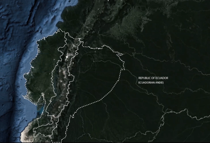
Ecuador is an small country in South America and also one of the most bio diverse in the globe. 10% of the world’s vascular plant species are in an area that barely represents 2% of the Earth’s total surface area. The landscape, in the Sierra region, is characterized by high mountains and active volcanos. Also, through its territory cross the plates of Nazca and South American, which makes it a place susceptible to natural disasters.
Despite this, efforts against climate change are close to zero. The 70 percent of the Ecuadorian economy depends on the fossil fuels and the destruction of the nature becomes more and more massive.
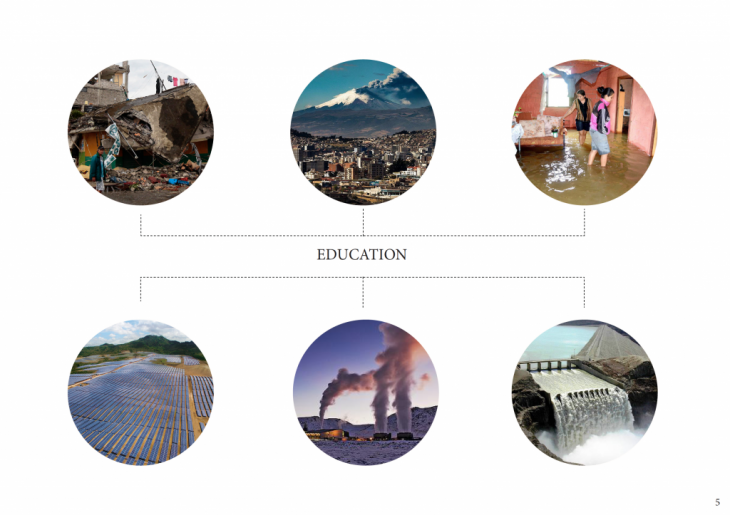
It is time to raise awareness in people about environmental change. But not through cheap discourses of half measures, education about nature is something that can only be done while in NATURE.

The choice of the site where my educational project would be located is linked to the field trip that we did before the seminar began. In this we created a mobility plan from Los Angeles to the Navajo Desert.
Ecuador is located in the mountain range of the Andes, Quito, the capital, is surrounded by 40 volcanoes, of which 27 are potentially active. This landscape gives the agenda not to choose just one site for a specific project if not an entire environment for a totally different experience.
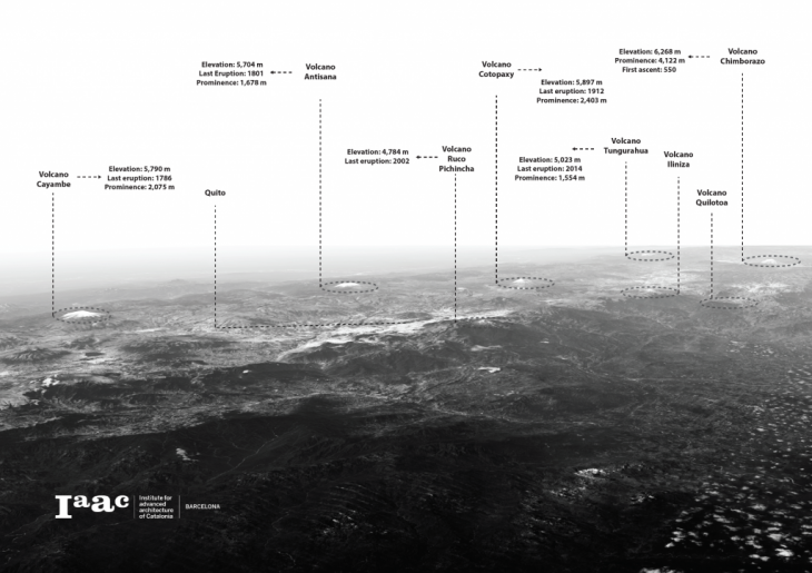

The educational plan is based on an extreme mobility through a path (ring of fire) created by the volcanoes around the Ecuadorian Sierra region. In this path people will learn about nature and self-suficiency while walking.
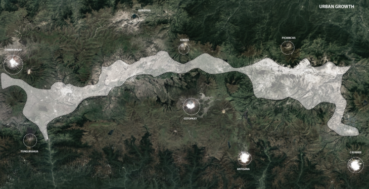
Urban growth:
Because the region is among volcanoes, urban development has been created in the valleys and has been spread longitudinally in satellite cities and major cities.
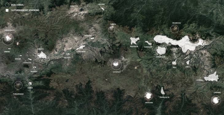
Permanent Stations:
In order to mobilize, the 18 most important cities of the region and the 8 most important volcanoes were selected as points of concentration and rest.
Edicational plan:
The program will last 31 days, people will walk daily a specified amount of kilometers. At the end of each day they will rest in a different city or at other times on bases created in the foothills of the volcanoes. There are no classes nor teachers, the idea is that it is a system of horizontal education where students learn from other students, for this reason there is no limit or restriction of age
Urban Growth:
Permanent (rest) Stations:
Educational Plan (mobilization):
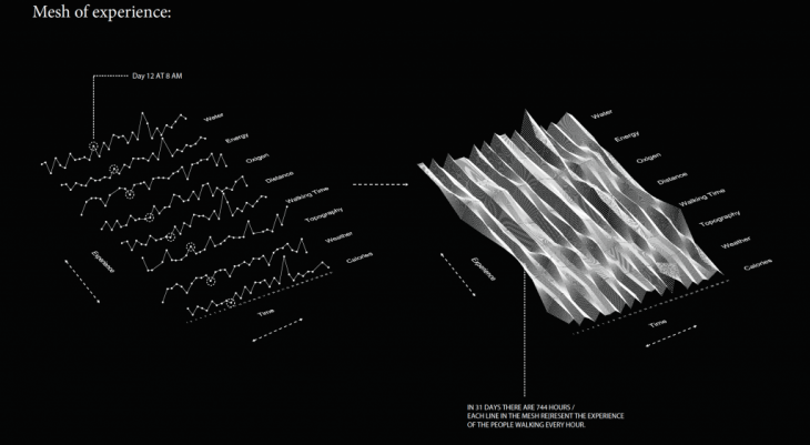
As a designer it is important to understand that we design experience, whether for a piece of furniture, a building or a city, the most important thing is to take the user along a path where the environment is experienced. The fundamental role in this Educational System is to understand what people go through when walking almost 600 kilometers. In this way the focus was to research 8 types of systems that make up the total experience.
Weather, Water, Topography, Oxigen, Energy, Calories, Walking time, and Distance
In this way, for each system, thirty-one data are obtained, which are collected depending on the location in time of the program.
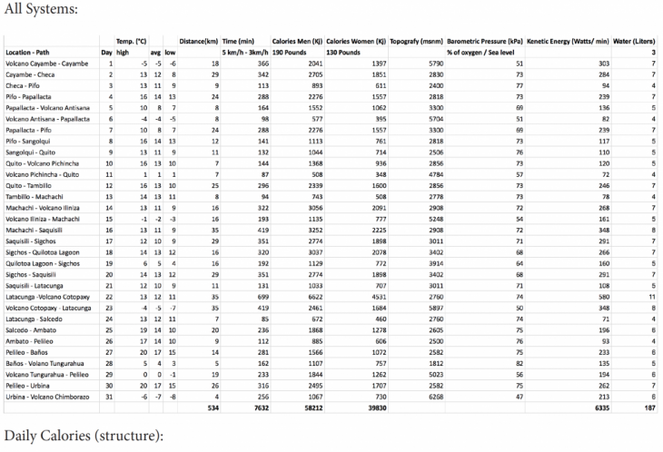
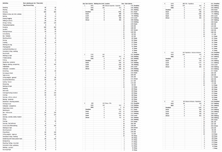
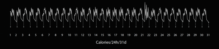
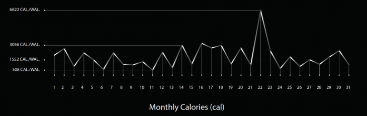

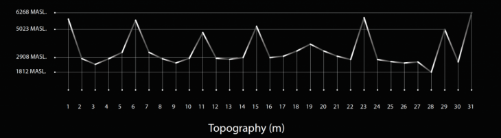
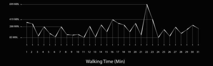
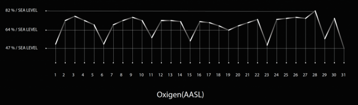
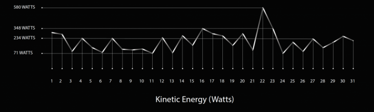
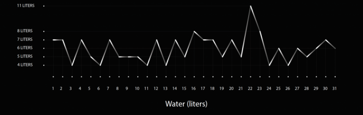

The next project approach was to determine the highest peaks of experience in the 31-day program. It is important to understand that the creation of the systems explained above did not consist solely in the collection of data of the place and people, but was a meticulous design. The design consisted in adapting human physical capacities to their environment and to their task. In this way, it is of fundamental importance to know how much a person can walk a day, or how many calories to ingest depending on their physical activity, in the same way, how much water and oxygen is needed to function properly.
All this generates peaks of experience that are designed to match depending on where the person is in sapce.
With the creation of a mesh of experience (calories, water, energy, etc.) in 31 days 24 hours (744 points of experience) and the use of an evolutionary solver that measures each point in its Z position, the highest peaks where found. In this points in space the disigner acts like and agent that releases particles that trigger experience to the maximum.
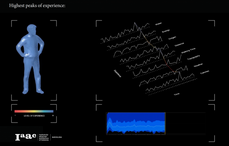

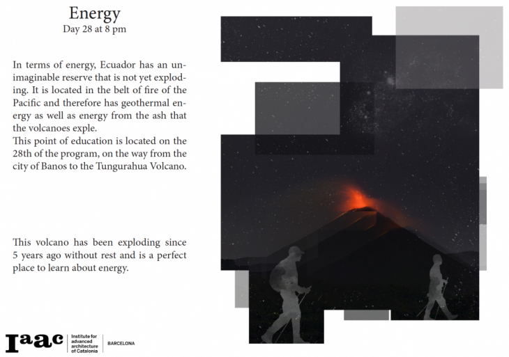
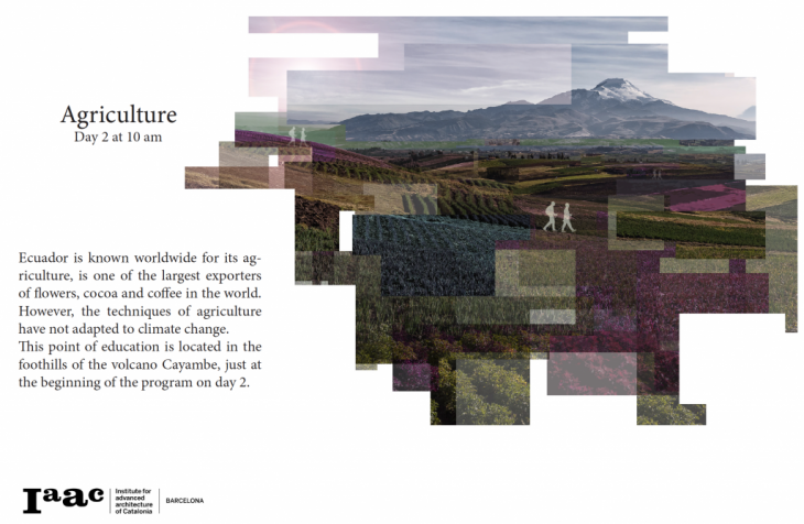
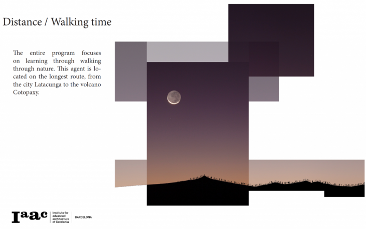
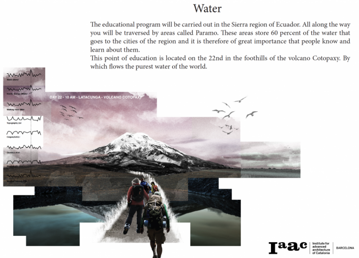
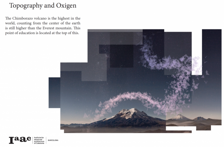
After the phase of recognizing the highest peaks of experience comes the phase of catalyzing these moments so that people live them to the fullest. Although the level of experience of one person varies from the other, there are always points in common. In this way the educational part is maximized in 5 aspects, energy, agriculture, water, topography / oxygen and distance.