
1. Manhattan | Urban Form and Characteristics
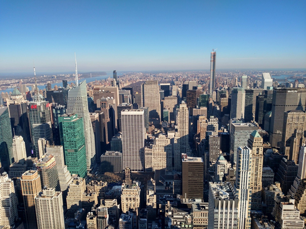
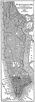 The grid street layout of Manhattan is one of the defining elements of its urban characteristics. And this formation has a history dating back to the early 1800s when the Commissioners’ plan was officially outlined that was mainly aimed at extending the city north from 14th street. It is an indisputable fact that this plan was mostly insensitive to the rough landscape of the city; such that 155 east-west streets sliced up Manhattan across 12 north-south avenues. (1)
The grid plan was not a new attempt even at that time. It was an urban model that was frequently used because either it was logical, repetitive, uncomplicated, and made the land division much easier or it was favored due to its providing real estate convenience just like many other American cities. This extremely strict grid form did not allow for any other use except for small open spaces and during approximately fifty years after the plan was implemented, Manhattan had inevitably become part of “The Greatest Grid.” Manhattan of that time was sculpted with a new look with its flattened hills, displaced forests, filled ponds and resized farmlands. (2)
The grid layout, which can be seen as a basis for the reconstruction or design of the city, has become the design itself. However, in terms of urban performance -besides providing profit, ease, and efficiency- the grid plan brought along some challenges.
To be explained in the following chapters, variations of the primitive urban tissue have been developed by considering the above-mentioned conditions and basic urban features.
2. Manhattan | Urban Challenges
2.1 Supertall Development – Struggle for light
Mapping the shadows of NYC | New York Times
As described by the New York Times as “struggle for light and air” the grid’s dense uniformity creates canyons of skyscrapers which accordingly causes poor access to natural light for the residents. (3) While bringing natural light into the living spaces of the citizens has always been one of the main issues in architecture, “regulating” sunlight and talking about “rights” was not an issue being considered until the emergence of overpopulation in Manhattan.
Despite many restrictions and height arrangements introduced in the past, with a zoning incentive in 1961, “air rights” came back to the fore and supertalls continued to rise and cast shadows over the city and the living spaces of the residents. In short, natural light has always been in short supply for the citizens of Manhattan. (4)
2.2 Proportion of Green Spaces and Barriers to Access
As it is approved by several reports and studies citizens of New York City have a smaller green space per person compared to the other major US cities. It is also often mentioned that despite its 3.5 km2 service area, Central Park does not make a significant difference considering the accessibility and amount of green space per person. (5)
As mentioned before, the 1811 grid gave way to nothing except a tiny collection of small parks inside the city. As it is reported by fleet management company, Geotab, the city has more than twice as many people as Los Angeles, the second-most populous metropolis. But the City of Angels still has nearly three times as much green space per person at 423 square feet. (6)
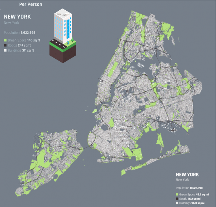
The Allocation of Space in U.S Cities | Geotab
2.3 Population Growth and Need for Housing
Affordable Housing, Real Estate Trends | 6sqft
According to a report published by Commercial Observer in 2016, it is estimated that New York City should produce at least 20,000 new homes each year just to keep up with current demand and population growth without any other externalities. (7) According to the 2015 census, a record number of 8.6 million -the highest peak after 1920 census- is expected in the city that means approximately 375k more people will be looking for affordable and livable places in the city. Among the existing skyscrapers and considering the fact that land is an extremely scarce source, it seems very difficult for the city dwellers to attain the living spaces they desire in a city like New York.
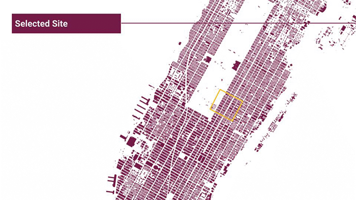
3. Selected Site
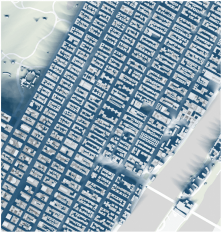
We chose one part of the Manhattan grid to start implementing our ideas. The site combines all the main characteristics of the urban tissue of Manhattan: Orthogonal grid , dense blocks and high buildings.
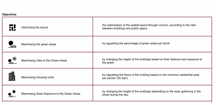
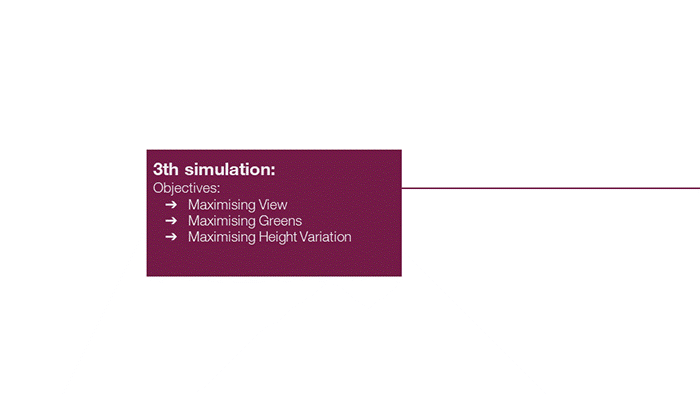
4. Objectives and Fitness Criteria
We set 5 objectives for our site:
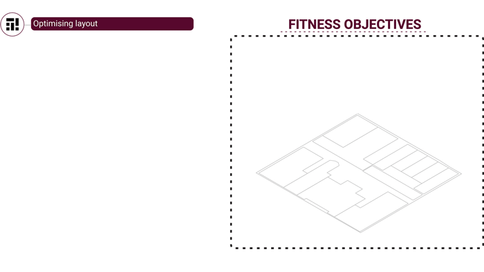
4. The evolutionary matrix
The evolutionary matrix shows the relations between our fitness objectives and our variables.
5. Methodology
Whilst starting from the existing grid of blocks, we wanted to generate new plots in our site. We decided to use voronoi diagrams to create a non-orthogonal grid of buildings, and we scaled the newly generated lots to create plots.
Our second target was to divide the plots to buildings and green areas. All the plots smaller than 120sqm were green areas, while the others were the buildings. At the same time we wanted to regulate the generated green area percentage to maximum 40% of each block.
Based on our research, demand for housing in Manhattan will increase due to population growth. Based on that, we increased the heights accordingly to the sqm/person they have. Afterwards, in order to maximize the view of the buildings to the green areas of the blocks we regulated he height of the buildings according to the distance between the buildings and the green areas of each block.
Finally, we used the occlusion component to calculate the solar exposure of the green areas and maximize the amount of sunlight that reaches the ground floor.
6. Simulation& Analysis
We first started running the evolutionary algorithm for 3 objectives to check out the relationships between them, and we continued working with 4 objectives and finally working with all our 5 objectives.
Through the whole process of simulations we had different outcomes, that sometimes were giving us conflicting results. Troubleshooting our code, we changed the sequence of our objectives appearing on the code, as well as the mathematical formulas we were using each time.
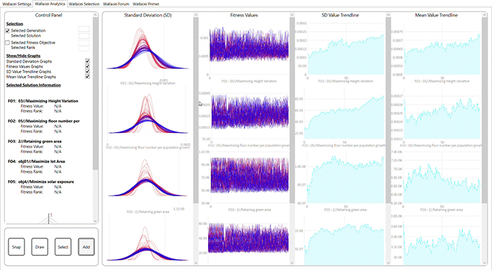
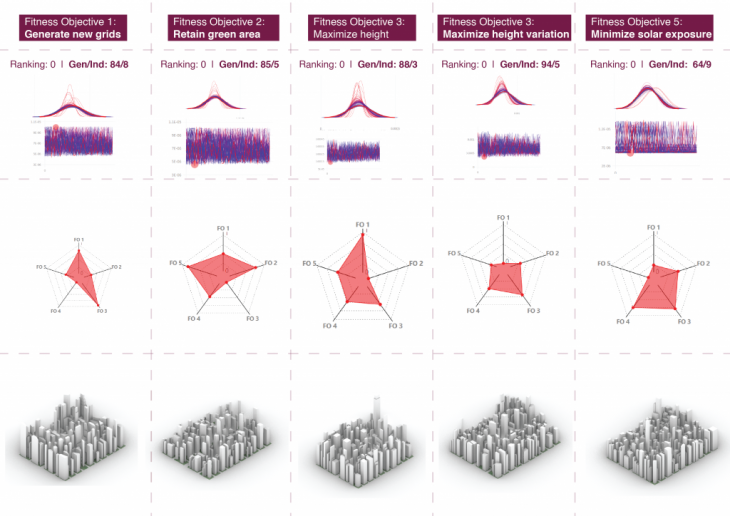
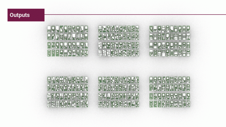
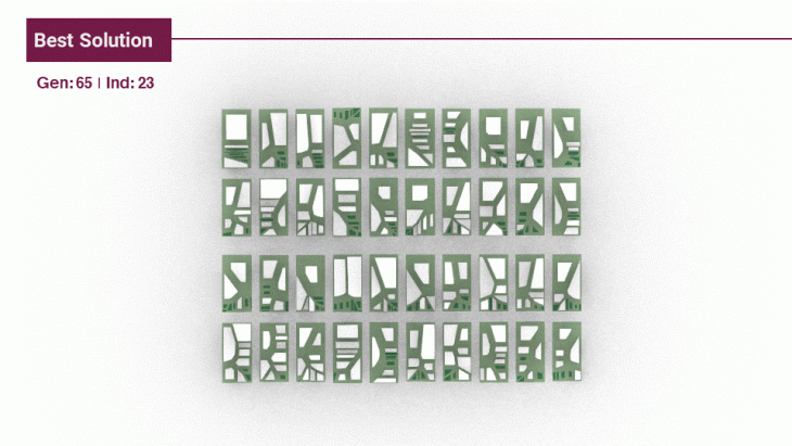
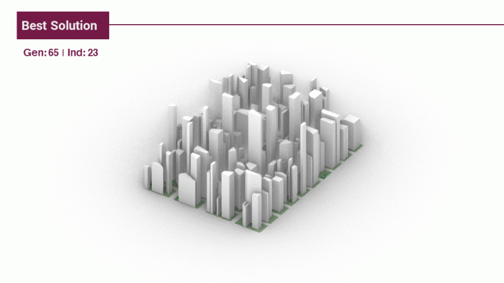
After several valuation processes, we got our optimization results. From this optimization we also extracted the individuals that ranked best in our fitness objectives, as well as the best optimal solution of our code.

7. Final Video
Manhattan | Development of Urban Tissue is a project of IAAC, Institute of Advanced Architecture of Catalonia developed at Master in City and Technology in 2020/21 by students: Kshama Patil, Simone Grasso, Sinay Coskun, Stephania-Maria Kousoula and faculty: Milad Showkatbakhsh
References
https://www.gothamcenter.org/blog/a-little-pre-history-of-the-manhattan-grid
https://bigmedium.com/ideas/nyc-grid-design.html
https://www.nytimes.com/interactive/2016/12/21/upshot/Mapping-the-Shadows-of-New-YorkCity.html?_r=0&mtrref=undefined&assetType=PAYWALL&mtrref=www.nytimes.com&gwh=2C00C3EBA733E34106627B96B1F16BA4&gwt=pay&assetType=PAYWALL
https://www.bloomberg.com/news/articles/2016-12-18/new-york-city-zoning-and-the-fight-
for-sunlight
https://www.geotab.com/press-release/greenest-cities-in-america/
https://patch.com/new-york/new-york-city/nyc-leaves-residents-tiny-amount-green-space-report-shows