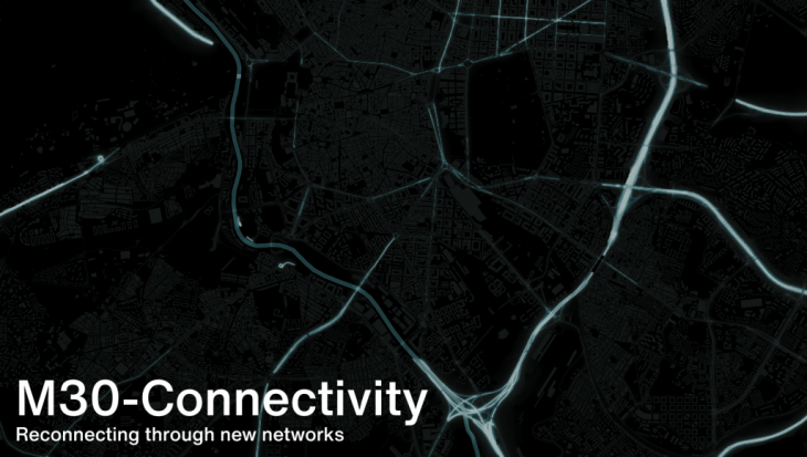
M-30, the highway that runs within the city boundaries has been one of the prominent hindrances for the coherence of Madrid. In order to understand the integration of the city, this study investigates different layers of social science polarities.
Urbanism is changing, and we understand the evolution of a city by identifying the elements which have worked and those that have not. As cities become more complex, new relationships, synergies, and contexts emerge that urbanism as a discipline has to integrate into their process and outcomes.
The project focuses our case on the east region of M-30, within the city council, where over time it’s evident that it has been one of the city’s great problems. The study is to analyze how it has affected and discover what possible solutions can be put forward to solve the problems.
ANALYSIS
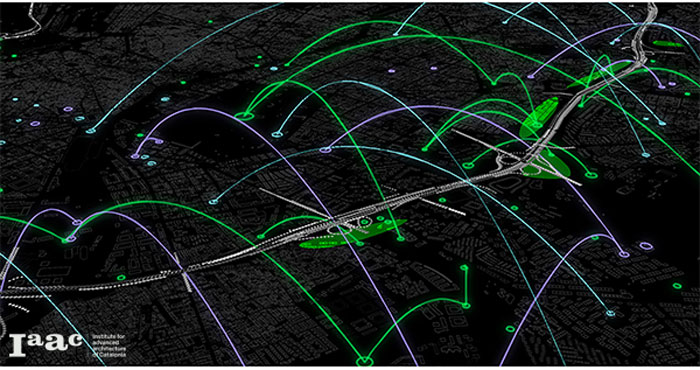
The first layer of our mapping study is to identify how mobility across the city is structured and the role of different attractors in that location. The attractors could be cultural, such as theaters, cinemas, or museums represented in blue; educational, such as schools or universities, in purple, and the main open spaces and green areas across the city.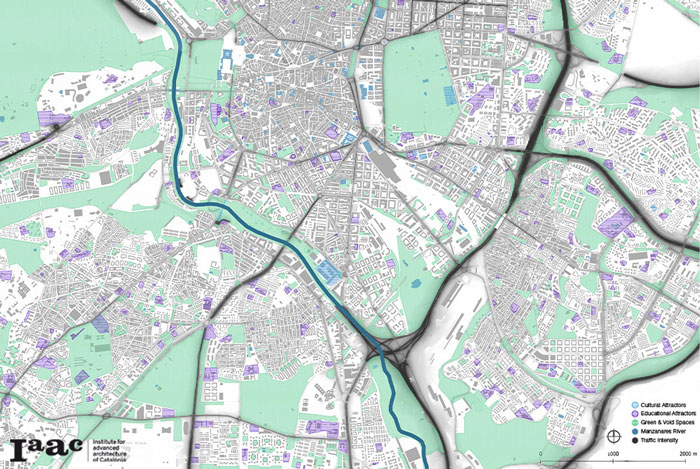 It’s inferential that the role of M-30 is a fundamental element in Madrid spatial organization. This furthered our investigation on how it affects the city’s social & economical cohesion. In order to do that, three variables were chosen to measure this cohesion by neighborhoods, average income per capita, the unemployment rate, and vulnerability index, which comprises other indicators like property value or dependency ratio. The darker the red, the more vulnerable the area is.
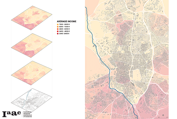
The comparison shows us how M-30 is a real barrier within Madrid which isolates and disconnects the city center from its sub-urban. This similar situation was improvised by the Madrid Rio Plan, on the southwest region, and yet to be realized and adapted for the east.
SOCIAL IMPACT
The city structure is segregated by M-30, acting as a barrier between two elements reflecting on disjoint blocks within urban areas. The physical connection between these elements is not bringing enough exchange of social and economical activities across. This process is causing a dominant polarity in the social structure with that region.
METHODOLOGY: NEW NETWORKS
In order to address the challenge, the scheme is to build a connection in an integrative way, not focusing on isolated elements. This can be mitigated through generating new connections or exchanges or adjacencies between the two areas. The strategies are to superimpose some new networks that can help and push this reconnection integrating social science. These new hubs can start re-purposing the existing attractors and also create new spaces.
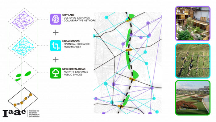 New Green Areas
Create green and public spaces around the south-east side of the M-30 taking advantage of spaces that exist but do not have a concrete function. With this first layer, new relationships are generated between both sides of the M-30, with spaces occupied by families and people doing different activities. It is possible to overturn activity on the axis and create new points of social exchange.
New Urban Crops
Taking advantage of the new open spaces, a new network of urban gardens is established with different objectives. The first would be to activate the economy around the axis, giving rise to a new market and new jobs. These urban gardens generate a financial exchange between the different areas, people who produce healthy food, and people who buy it. Different digital platforms could be launched to boost this new market and these new relationships and exchanges, not only in the physical environment.
City-Labs
Reusing some existing points of attraction identified around the city and integrating some new uses or elements will allow us to establish a new network of social centers. This network will promote a new way of connecting people based on collaborative proposals and intellectual exchange, leaving aside economic differences.
CONCLUSION
Understanding the complex of cities through the new technologies and information available raises urbanism to another level. This study helps to understand how connecting two realities of the city through different tangible and intangible elements that are not obvious at first sight, but that have a real impact on the dynamics generated through these types of interventions. That is why it is so important to be aware of them and to integrate them into the design process.
M-30 Connectivity is a project of IAAC, Institute for Advanced Architecture of Catalonia developed at Master in City & Technology in 2020/21 by students: Alvaro Cerezo, Iñigo Esteban & Sridhar Subramani, and Faculty: Manuel Gausa, Nicola Canessa & Giorgia Tucci.