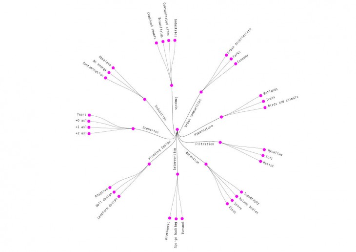
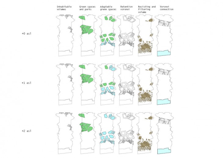
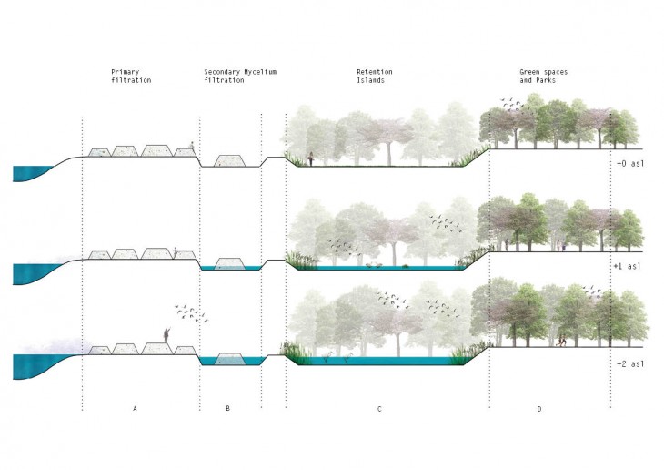
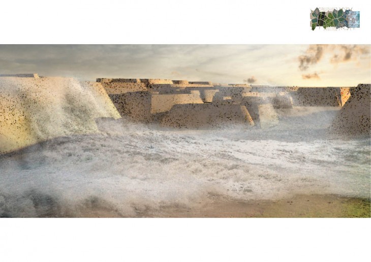
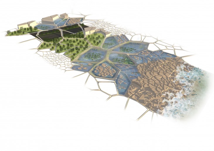
According to the National Oceanic and Atmospheric Administration, the global sea level is expected to rise within 0.8-2 meters by 2100, enough to swamp many cities along the U.S East coast. The project seeks to engage the forces of the flooding and make use of it instead of fighting it. The approach of the performative landscape is based on voronoi tessellation, through a series of different iterations the proposed algorithm determines the control parameters of different stages for the arrival of water to the site. First by primary filtration through the porous rock like structure and dissipating the energy of the flood, second by mycelium filtration colonizing the porous rock like structures, and finally after the water is filtrated it lands in the retention islands that are located according to flooding data and mapping. The “Urbanmega sponge” acts as a sponge in theory, filtering and retaining water. A series of activates take places in the landscape such as the formation of hyper-nature system, parks, responsive architecture and new hypernature communities.
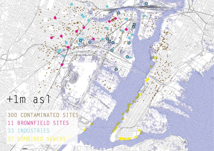
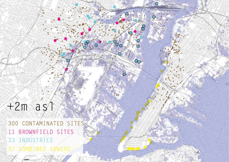
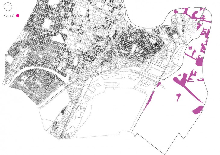
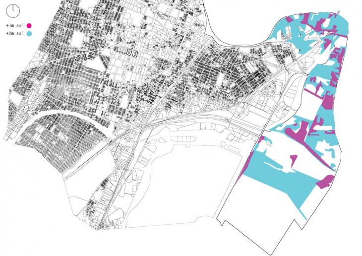
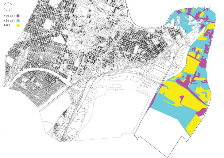
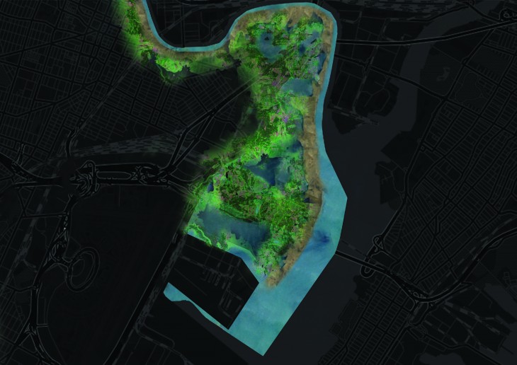
Flooding Maps of Newark within 100 years from +0m asl to +2m asl.
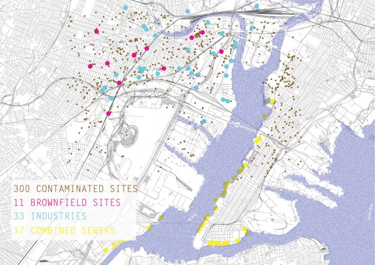
Flooding mapping of the coastal area in Newark according to the National Oceanic and Atmospheric administration (NOAA)
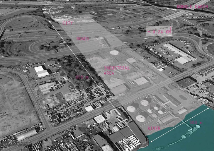
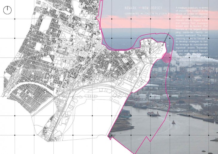
Site chosen for the intervention
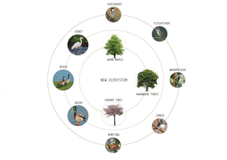
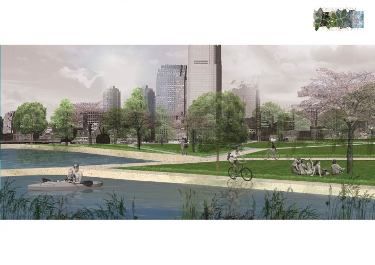
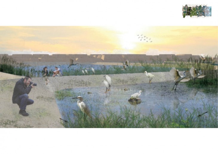
New ecosystem emerge in the urban intervention including hardwood trees, birds, and waterfowl species.
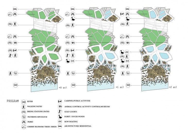
Program of the intervention at different flooding scenarios

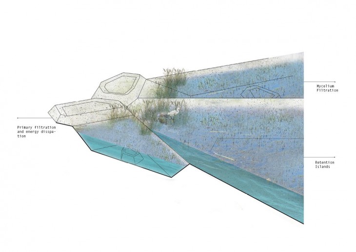
Program section
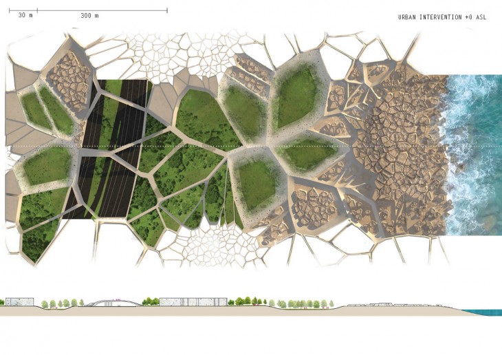
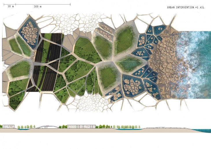
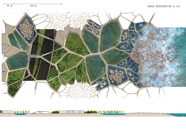

Urban intervention on site
Visionary urban view of the intervention applied on Newark’s coast in the next 100 years
Urbanmega sponge is a project of IaaC, Institue of Advanced Architecture of Catalonia developed at Master of Advanced Architecture in 2016 by:
Student : Maryanne George Ewais
Faculty: Willy Muller, Jordi Vivaldi Piera, Starsk Lara, Maite Bravo