The studio’s goal was to contribute towards the building of a global street database. The outcome of the grand scheme would be a platform containing data and visual representation on over a million streets in the world, open to comparison and analysis. The challenge was to find a common visual and sensible language which would establish the way for the next wave of entries to the system.
To complete the drawings, google earth, images and google street view was used.
The street view option is not available for Lebanon.
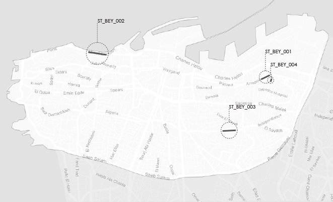
Four streets were chosen according to their different dimensions, uses but also serving as representatives of streets of similar characteristics found on the other side of the city.
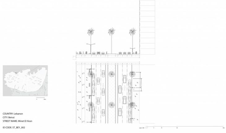
A section and plan serve to illustrate the street of analysis. A List of two hundred parameters were established for each street section. Because streets are not totally continuous in their form or use, a designated part of the street would be picked, drawn and quantified, criteria like sidewalk to facade ratio, activity types, and sound levels were harder to find.

Each street part would be given an ID code containing the city three letter code and the number of database entry.
Minel el Hosn and Younes Gebayli are too streets representative of Beirut’s build environment and culture. High rise buildings and the sea make up the borders of Beirut’s most popular jogging ground. While closely knit buildings hug pedestrians in the tight streets of Beirut’s Getaoui neighbourhood.
The fact that a team of 8 different nationalities can create agreed upon criteria for others is a testament to the power of human cooperation.