Abstract
Tehran is a megacity in the almost central north of Iran with the main issue of traffic, air pollution, and centroid density; which in this project authors considered analysis throughout the history and define strategic move as of roads, construction, public spaces to conform with the ideal (defined as less dense, less traffic and less pollution) decentralization.
Analysis and Literature Review
The followings are set of the depiction of how old days planned and graph the city
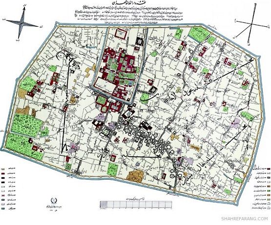
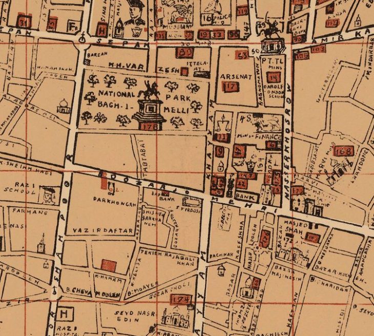
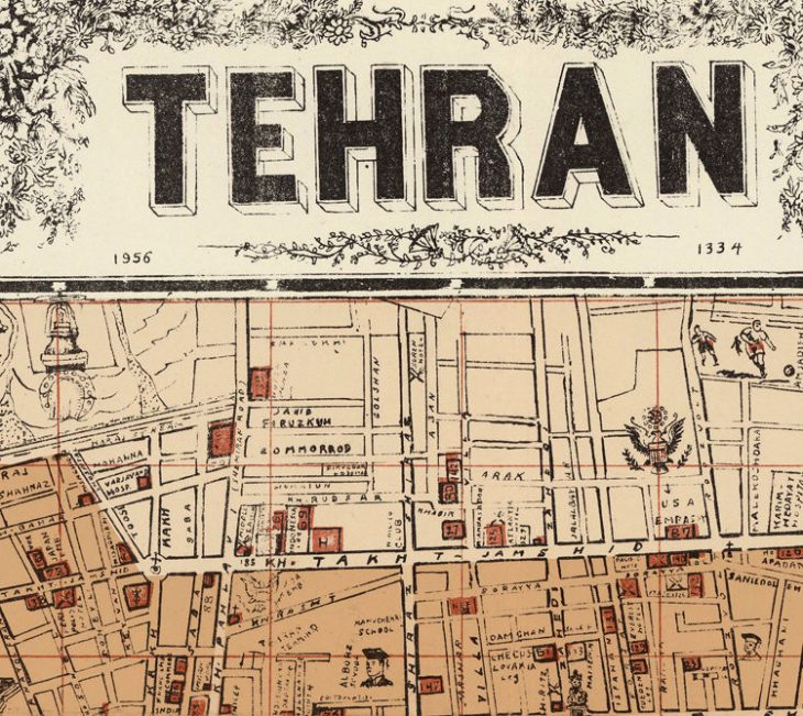
With a low population, low density, and different rural system the streets were are below:
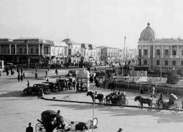
Hasan Abad Square
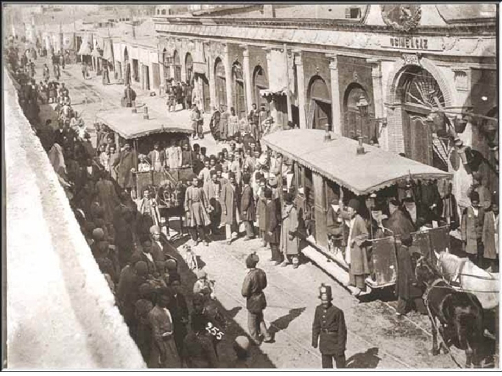
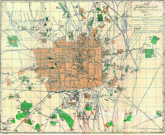
Old Tehran
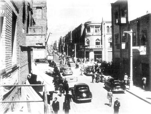
Old Tehran
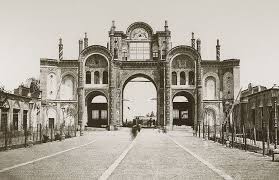
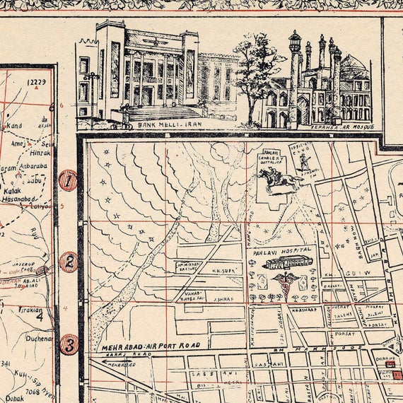
Tehran; one of the entrance gates
In the current situation, city has been first divided in a zoning strategy then intertwined with Economistic Events and more public spaces with ten million population in the morning, most of the concentration of Iran is located in Tehran; Beaurcracy, Political, Economical, Residentials, and etc, Thus the concentration made much traffic less green spaces and ecological environments and more pollution.
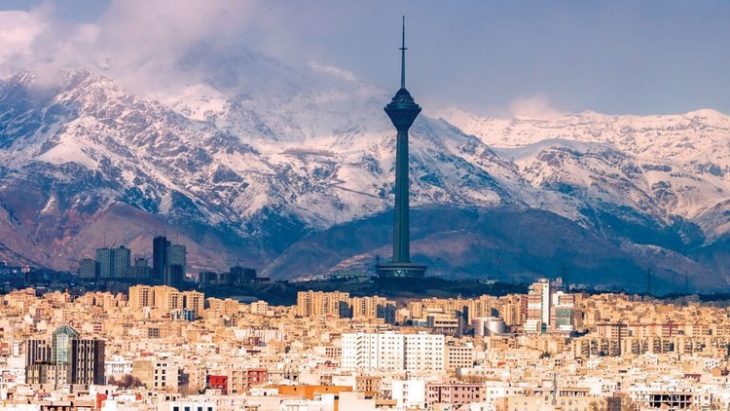
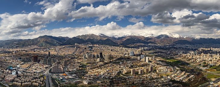
Tehran developments and current situation throughout the years:
Method and Strategy; Conceptual Maps:
The Main intention for civilians to construct on the north side of the city thus they moving from the central axis to the north part of the city and untouched area due to cleaner air, closer to the mountain and less pollution and density
![]()
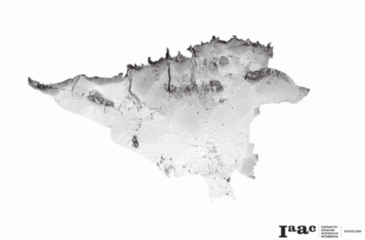
Diamond of concentration would be fined in the middle of the city:
The Main concentration is in the center of the city bordered like a Diamond as we analyzed
This is the connection of the green spaces inside the diamond conceptually connected
![]()
The Diamond within
Diamond Ideogram; Strategical ecological connection
Shining Strategy; is like the beams of diamond find the way to decntralization
Tehran Strategical Logogram and Ideogram intertwined
Strategy;The trangulated porposed strategy for decntralization with Map of Messages (Logogram)
Map of Strategy Ideogram
The Waterways are pretty inmortant as it is low next to density depicted in Map of Forces (Diagram below)
Tomography/ Structural system
Nested Tomography within the concentrated area (the Diamond area)
Nested Tomography and Iconography within the City waterways
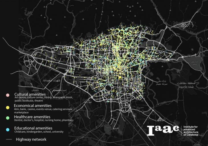
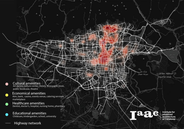
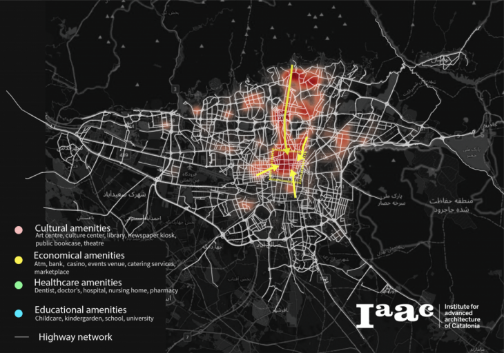
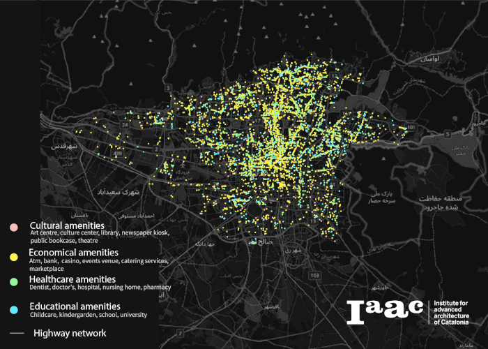
Public service is clustered along the old city center and old axis, creating centralization of supply
Description: The key public services in Tehran are concentrated along high-speed highways, and cluster in the old city center and old vertical axis. The uneven distribution of public services might play a big role in traffic congestion and unequal life quality.

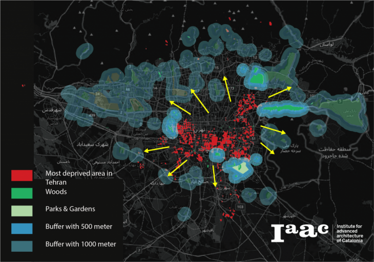
Current leisure experience of residents living in a deprived area
Under the Mediterranean precipitation pattern, public space with sufficient tree cover has become an important source of escape from citizens in Tehran. However, the accessibility to this valuable resource is extremely unequal by location in Tehran. People living in deprived areas need to seek cooling spaces usually over 1km away.
Diamond bordered Density Conceptually Tehran is a project of IAAC, Institute for Advanced Architecture of Catalonia developed at
MaCT 01 in 2020/21 by students: Sasan Bahrami, Dongxuan Zhu, Alireza Jamshidi Mojaver, and faculty: Manuel Gausa, Nicola Canessa & Giorgia Tucci