Route Tracker Lite for Windows Phone
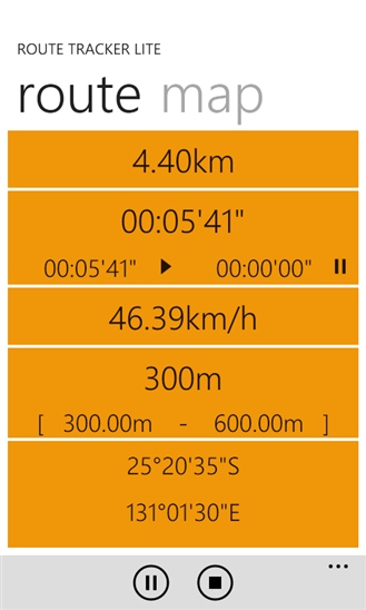
Screenshot of Route Tracker Lite display

Geo location data in txt. format and in xml. format. The latter is used to clean and organize data from the first.
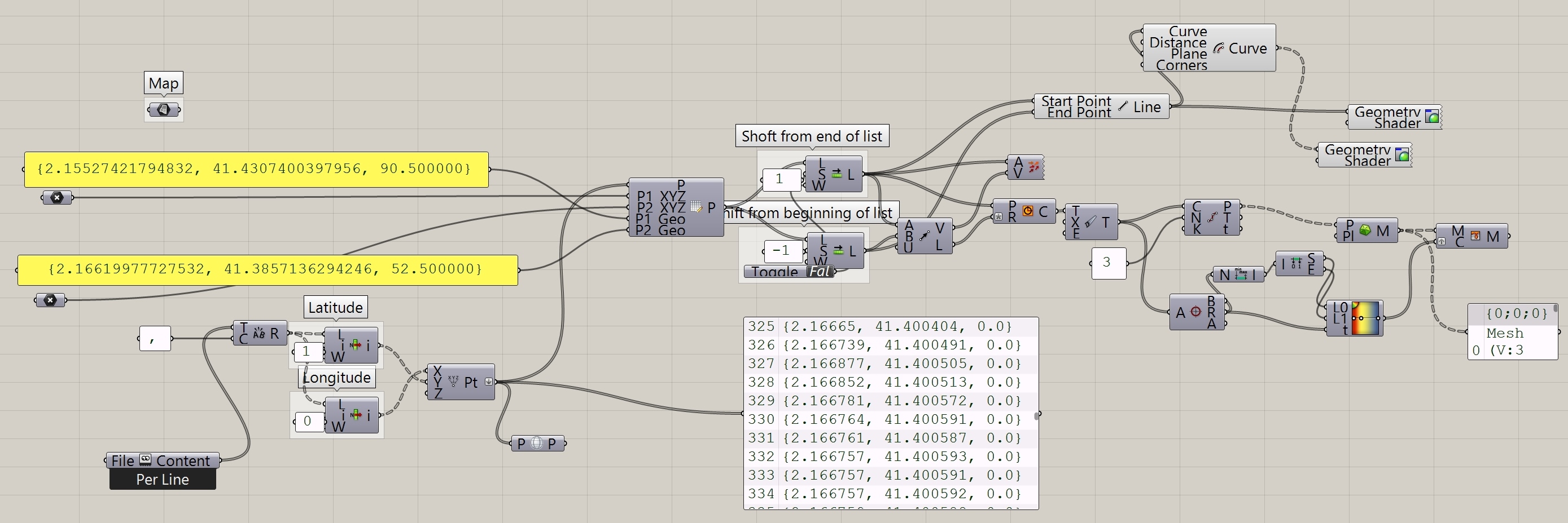
Through Grasshopper, coordinates are grouped in two shifted lists to connect every point with the following one in order to create the path.
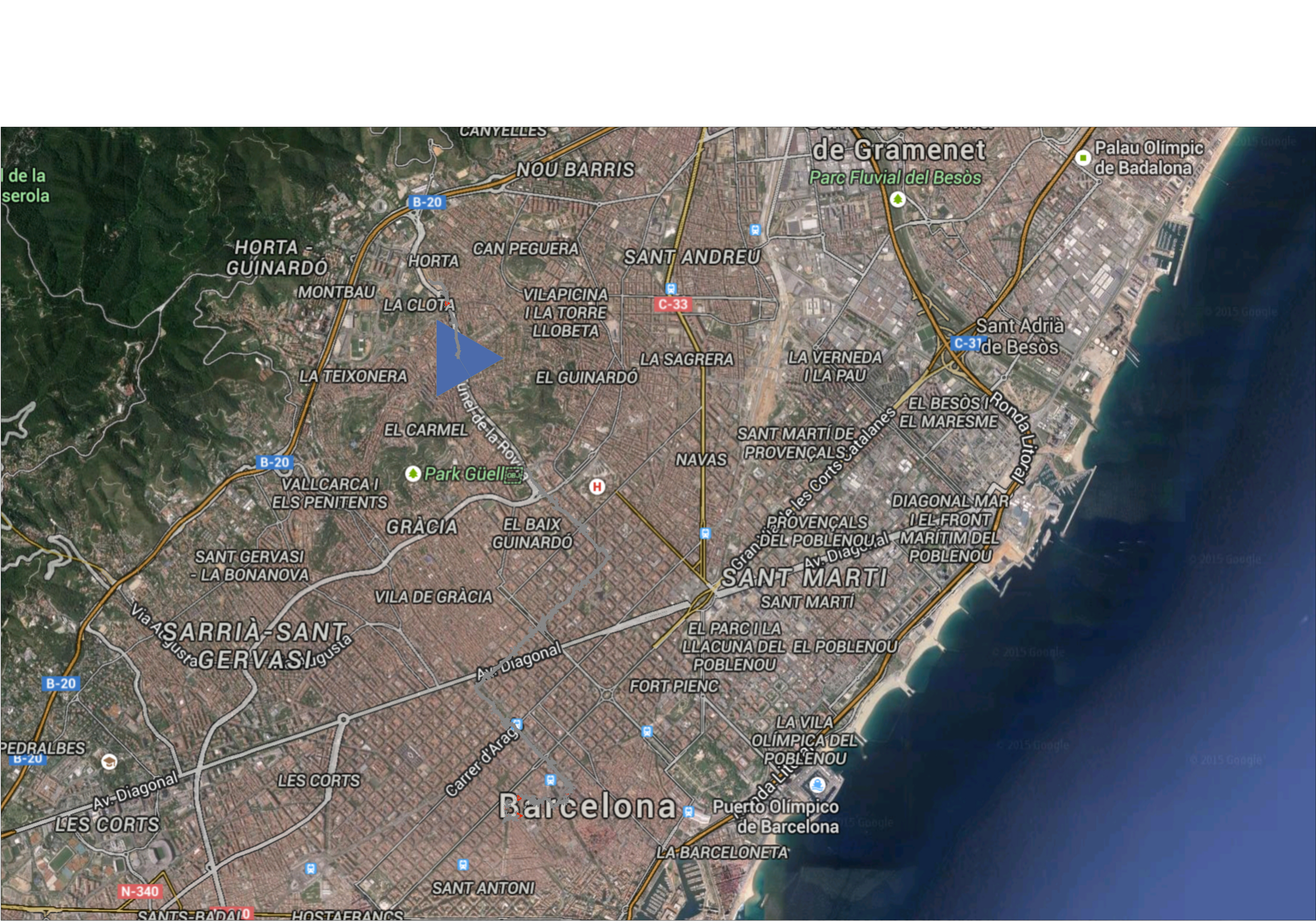
The map shows the grey path to reach the final point. At the end of every segment there is a triangle whose dimension is related to the length of the vector. In the image the most of these shapes are not visible due to the scale. The blue triangle shows how the tracking software had problems to measure the point because of a tunnel.
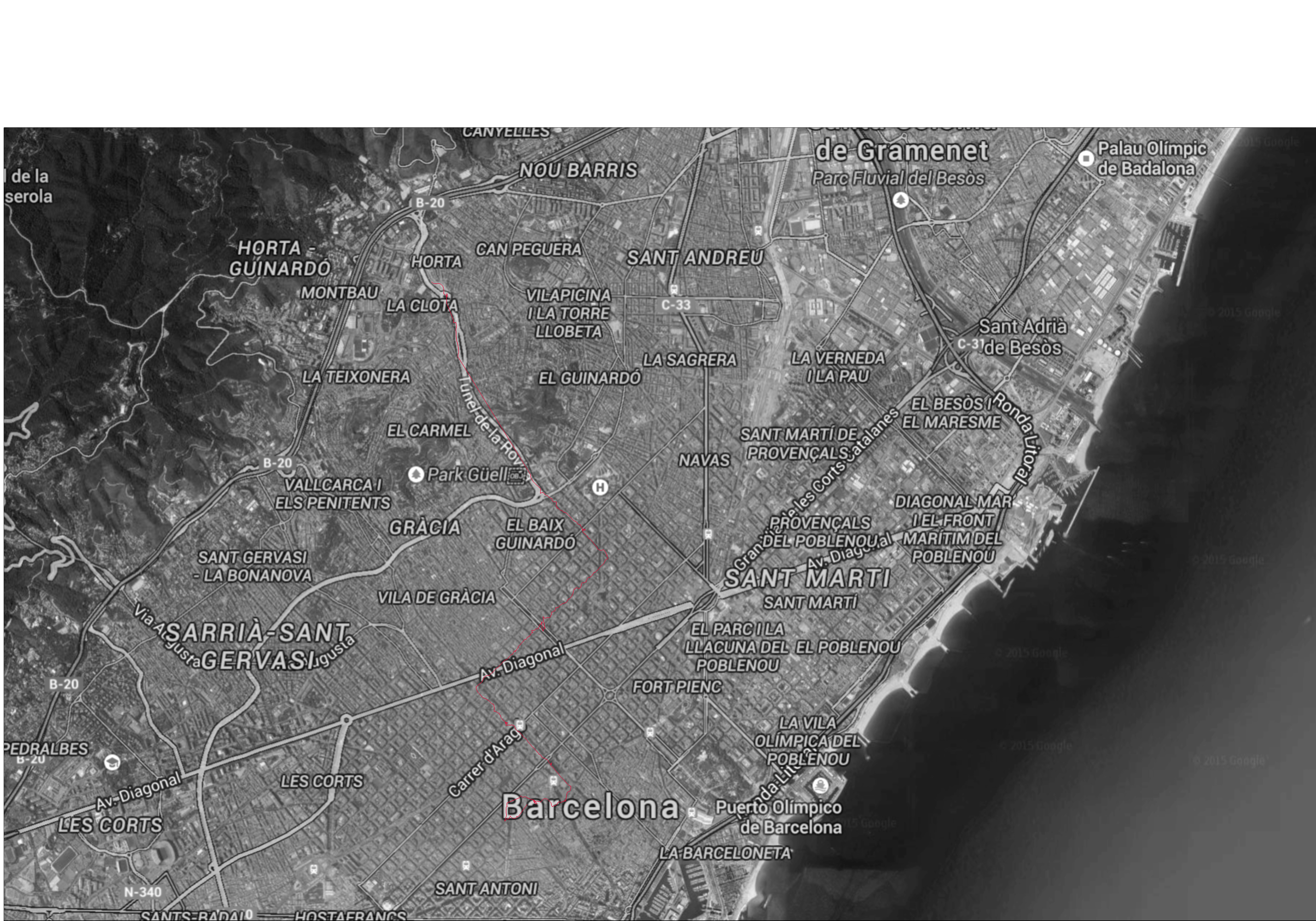
In this case the path is undermarked by a red line and the track is shown without any discontinuity point.