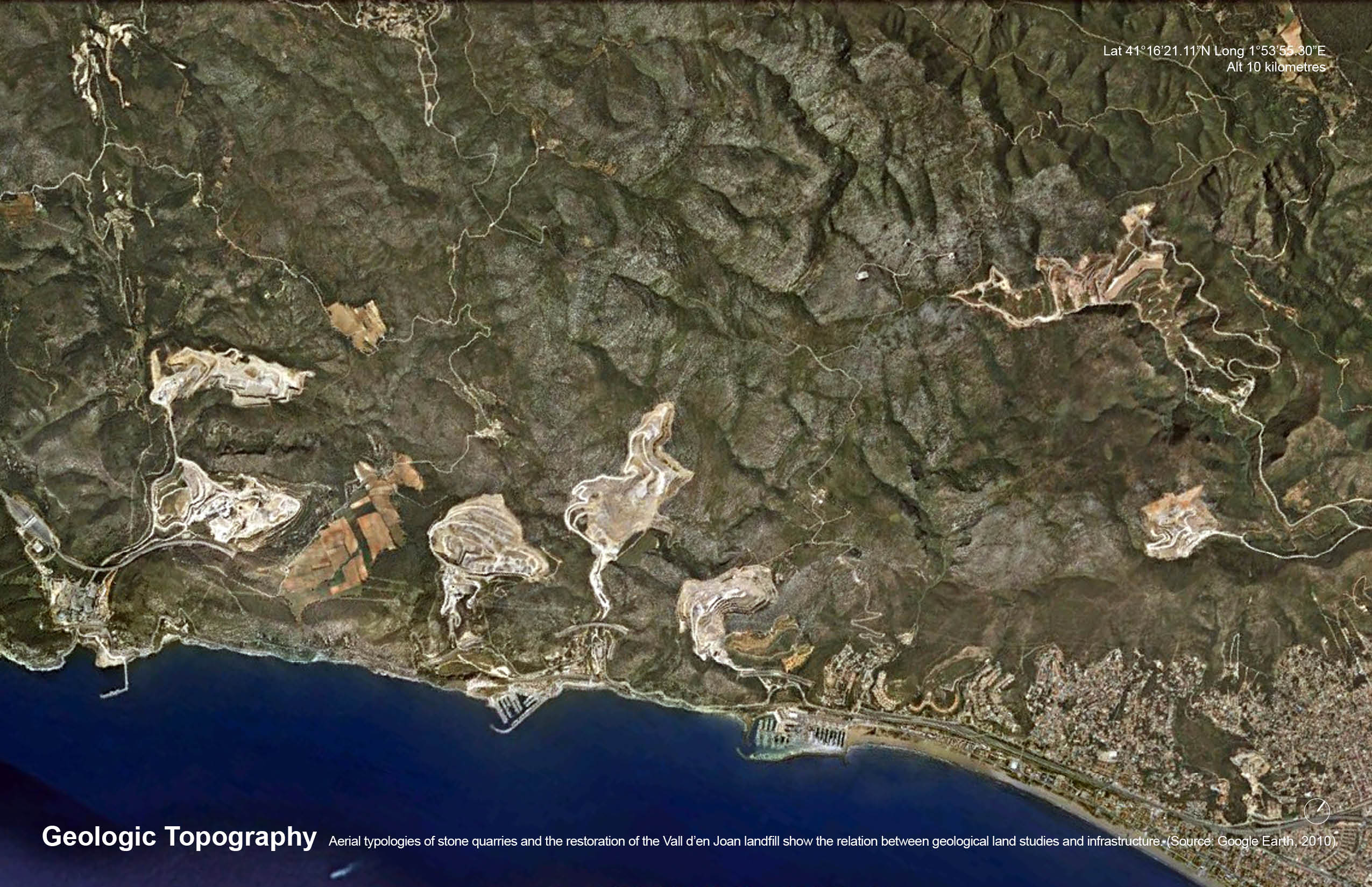
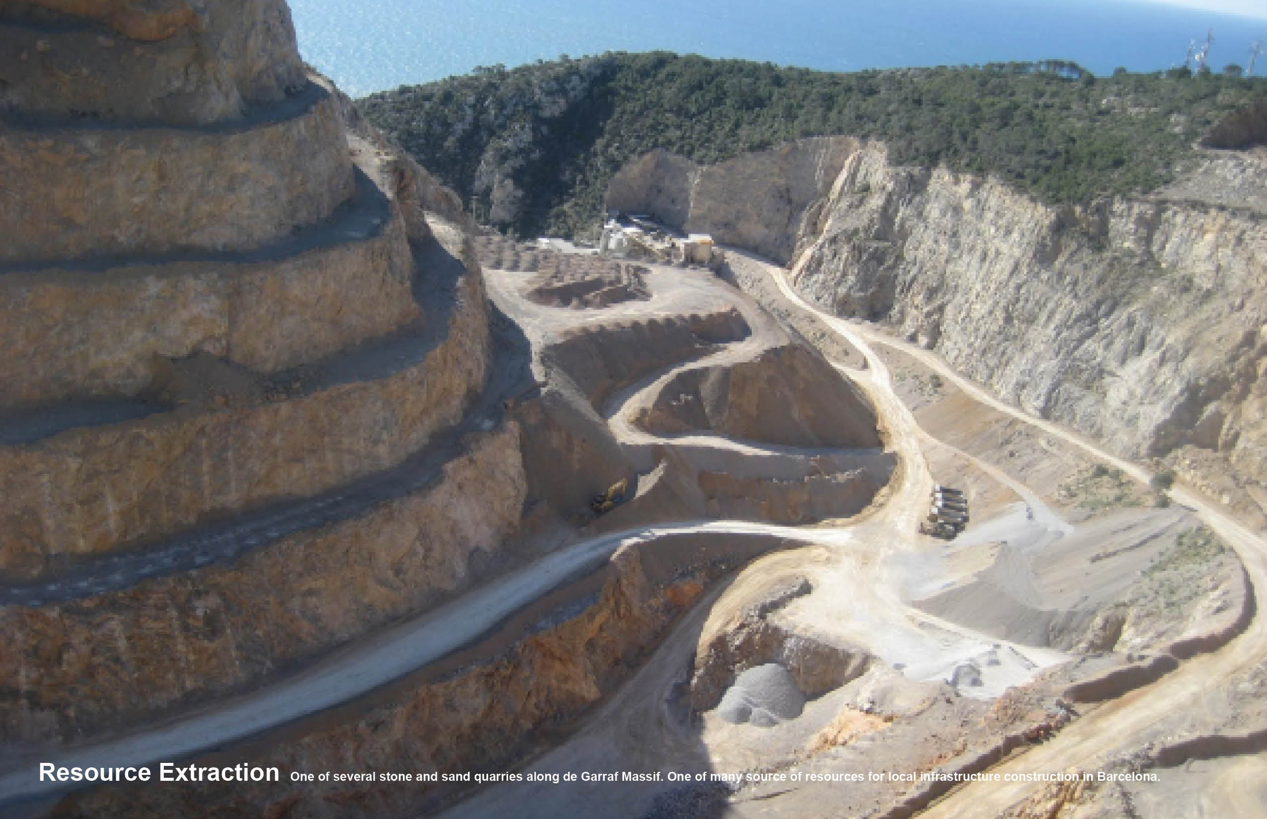
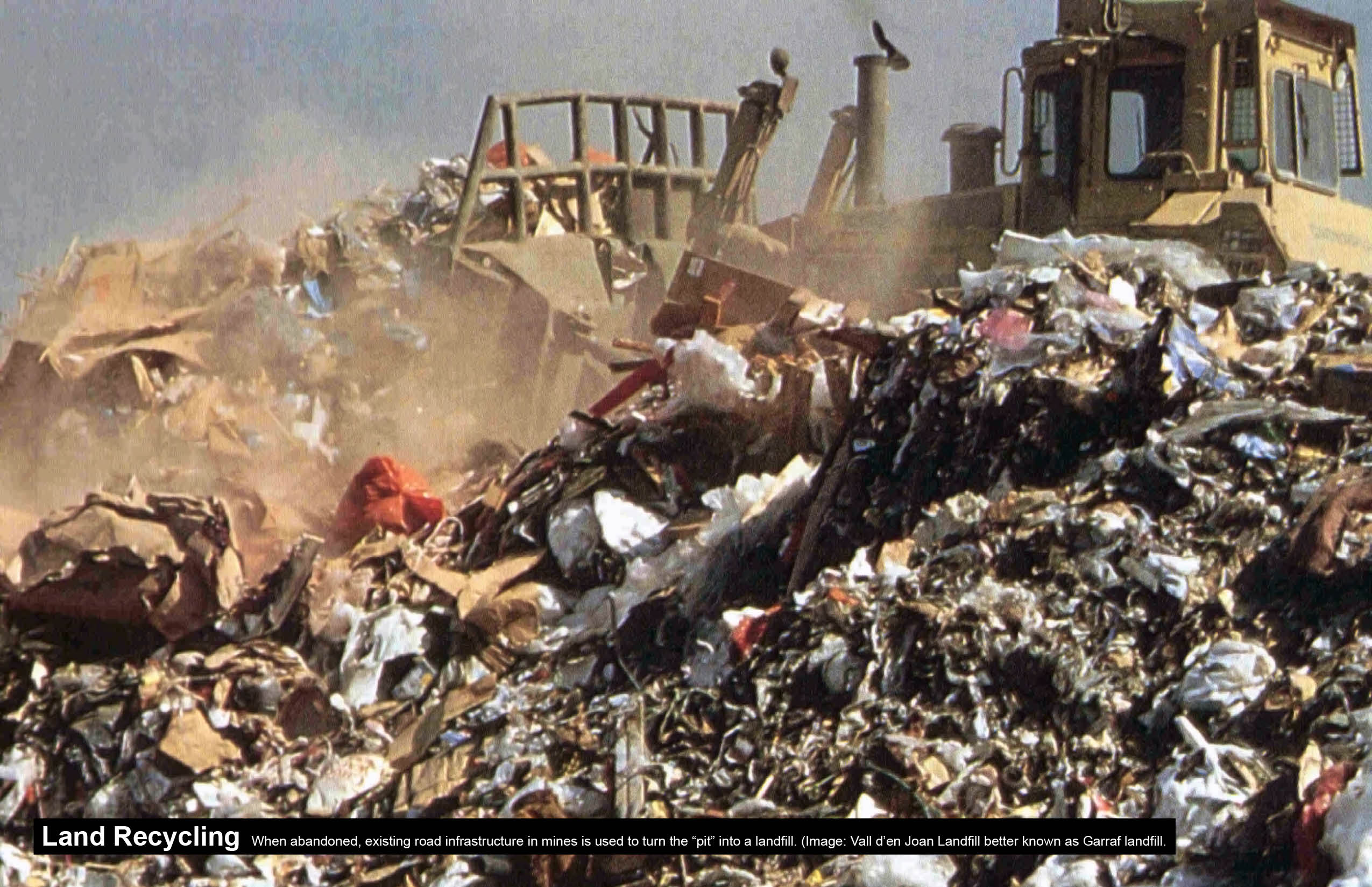
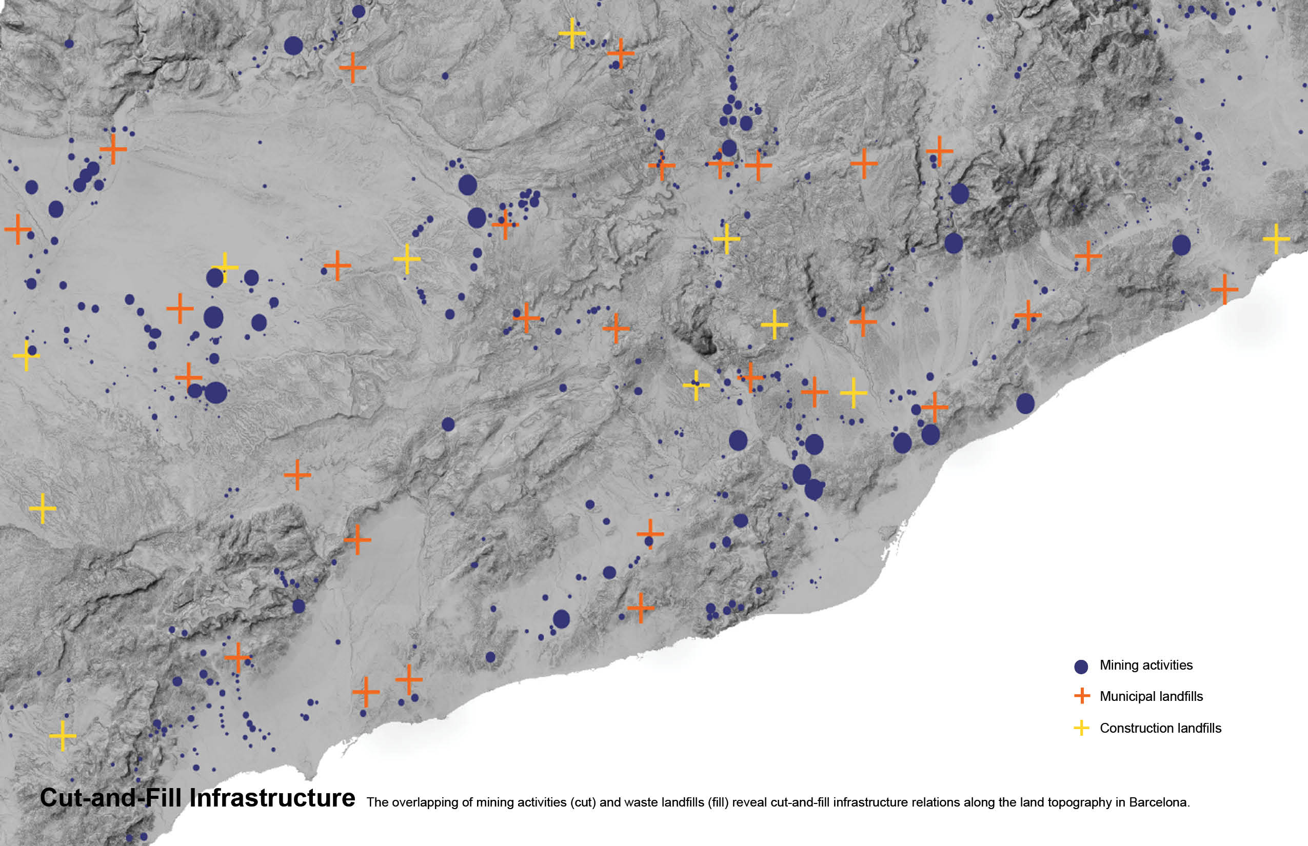
 The mapping project looks closer into the process of waste management in the city of Barcelona specifically into cut-and-fill processes where resources are extracted (cut) and the “pit” and transportation infrastructure is recycled as landfills (fill). The map overlaps recent and old mining activities with municipal and construction landfills sites. The results reveal the reuse of what otherwise could be considered totally unrelated processes. Satellite images of the Vall d’en Joan landfill restoration in relation with the stone and sand quarries of the Garraf Massif also show a closer typological relationship with geological processes and land topography. Projects such as the restoration of Vall d’en Joan by Battle i Roig Architectes could be refer to as a “pit urbanism” of sorts, to restore topographically transformed areas after the cut-and-fill infrastructures lifespan has ended.