The project emphasizes the role of urban planning as an instrument of change by understanding the fabric of the city.
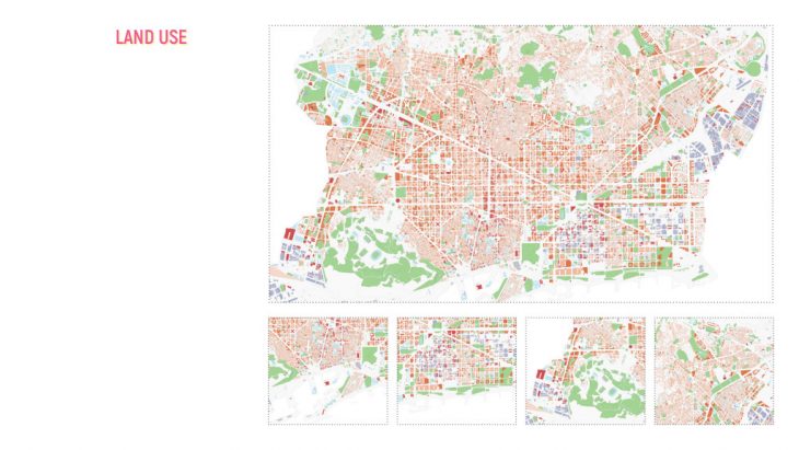
Land use analysis is meant to support the coexistence of citizens necessities while preserving the economic structure, yet it is singular in perspective and it doesn’t take into account the multi-dimensional complexity of cities.
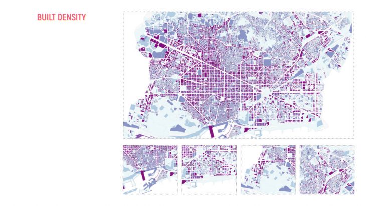
Density indices by themselves do not have any connection with the living conditions of the area but they do establish a distinct relationship between the people and the amount of land they need to attain a certain standard of living.
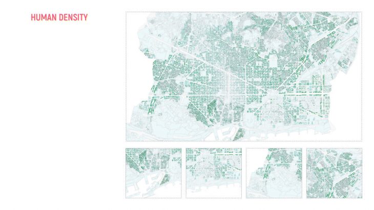
Human density is an important aspect of how cities function. When cities are allowed to expand from the centre without the benefit of smart growth planning, they can become relatively unsustainable.
The comprehension of these three layers of the city (land use, built density and human density) requires a composite index that can only be obtained through rigorous statistical methodologies.
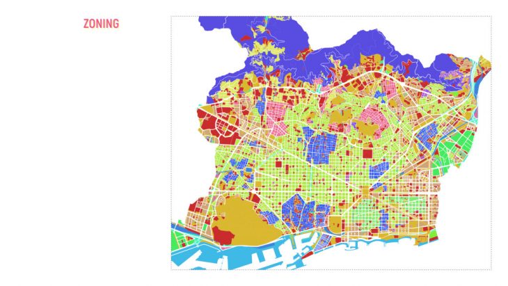
Zoning is not primarily, nor is it fundamentally, an urban planning process. It is a legislative process. It has the force of law, and it is ultimately enacted by legislators, not urban planners. It fails to reflect the reality of the current condition of cities.
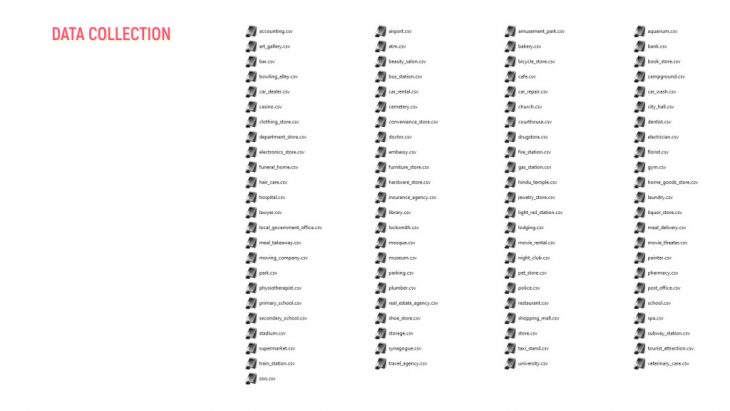
To bridge this gap between existing methods of zoning and the actual reality of cities, data was extracted from the Google Places Search API.
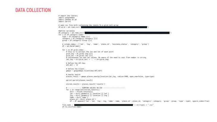
This dataset includes all the services and facilities in Barcelona.
This data was then aggregated to each block in Barcelona.
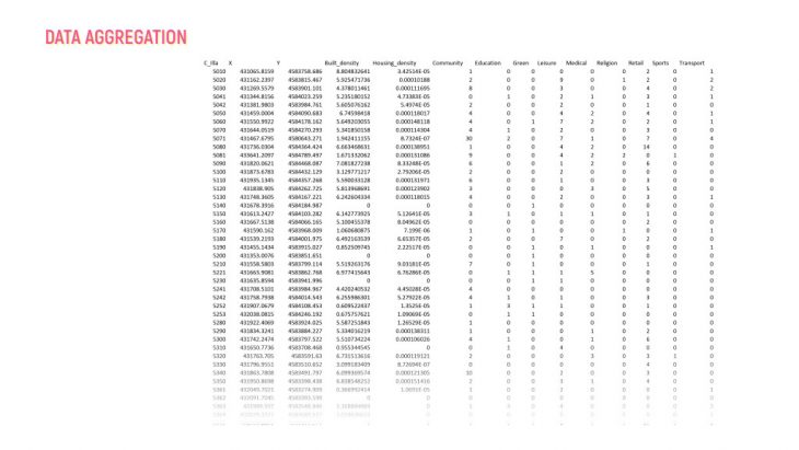
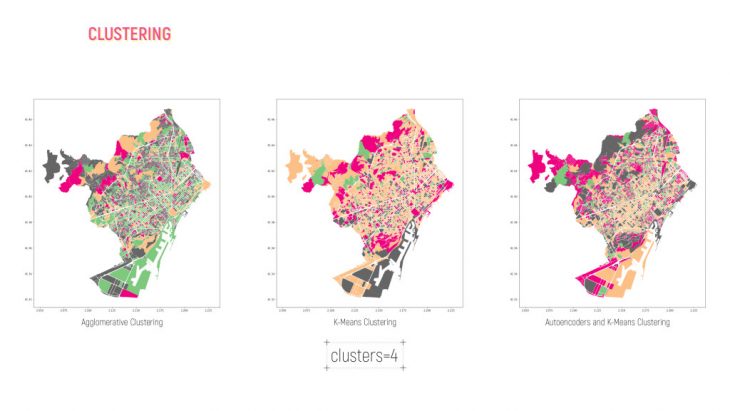
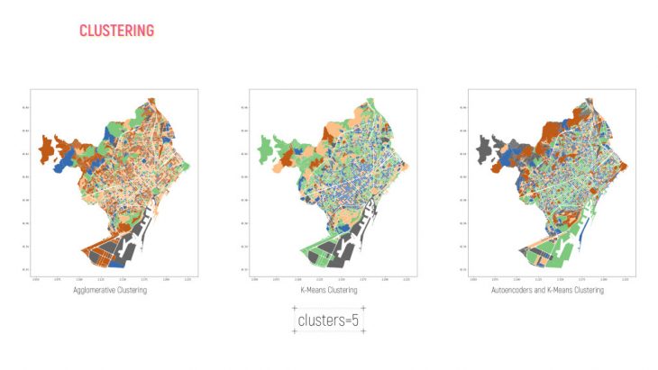
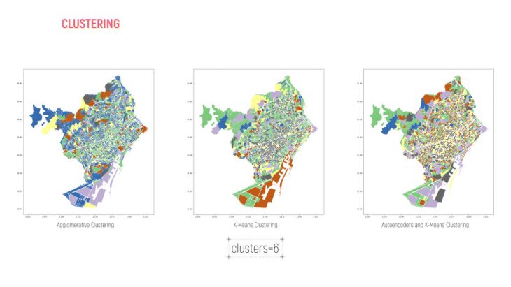
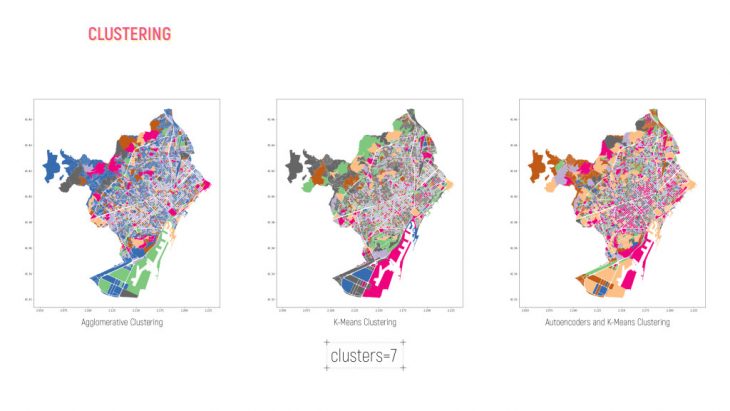
A clustering algorithm was then run to understand the relationships between these services and facilities with the existing building and human density conditions of Barcelona.
Clustering Barcelona Blocks is a project of IaaC, Institute for Advanced Architecture of Catalonia
developed at Master in City & Technology in (2019/2021) by:
Students: Kushal Saraiya
Faculties: Angelos Chronis, Serjoscha Duering, Nariddh Khean.