Our studio project aims to suggest an algorithmic model for affordable housing. Leveraging the temporality of parasitic housing as a way to attach housing to existing structures, cut down construction, and maintenance cost. And create a flexible housing system to be specifically morphed to the physical construct of certain neighborhoods within various cities. To produce the necessary analysis, we used two types of tools, that is the cadastral data set and satellite imaging.
Cadastral Data: A comprehensive land recording of the real estate or real property metes-and-bounds of a country. In most countries, legal systems have developed around the original administrative systems and use the catastre to define the dimensions and location of land parcels described in legal documentation. A land parcel or cadastral parcel is defined as “a continuous area, or more appropriately volume, that is identified by a unique set of homogeneous property rights”.
Catastre management has been used by the software industry since at least 2005. It mainly refers to the use of technology for management of catastre and land information in Geographic Information Systems (GIS), Spatial data in rather that to general management issues of cadastral and other land information agencies
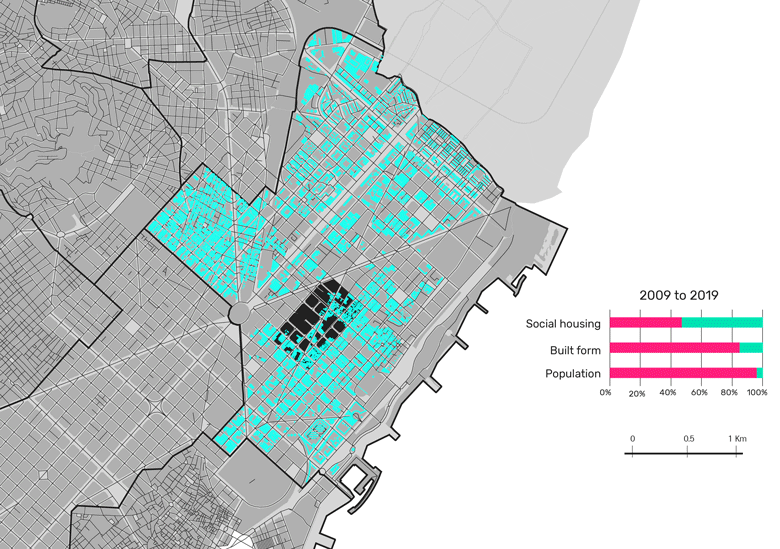
For example, for the Housing project in the studio, the team wanted to show the constructions that were developed year over year for the last ten years. In order to do this, we leveraged the query builder in QGIS to filter on the year of the construction. We created a layer for each year and filtered the query builder for that year of construction. Once we had all of the layers, we were able to export the map for each year, allowing us to show the progression of these constructions in the Sant Marti area. The principal outcome created for a project of AFFORDABLE HOUSING, the cadastral data used for creating a timeline of how housing buildings are growing in the last 20 years. This data has the benefit to provide a proposal and understand the past and current condition of the buildings.
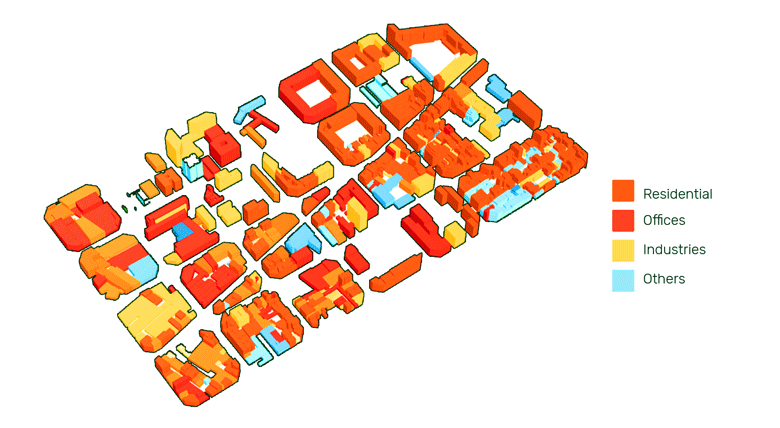
The main problem was trying to clean and understand the cadastral data of Barcelona, especially when we try to represent land value. Cadastral data has its representation of the different indicators (land use, number of floors, year of construction, etc.) Therefore, to understand the symbols we use different sources and planes form the city.
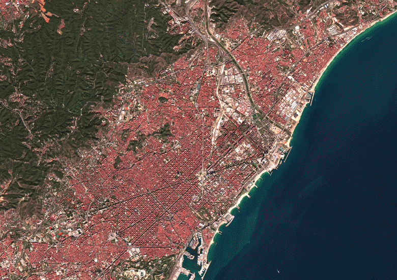
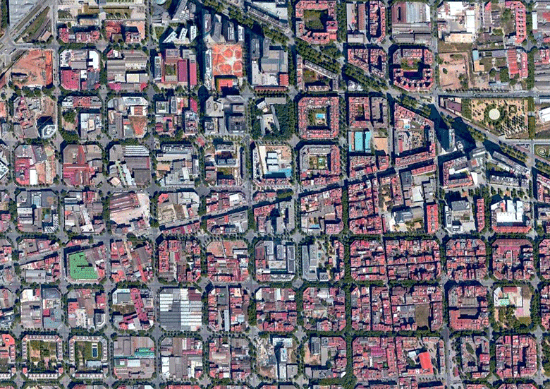
Satellite Imagery: The presence of satellite imagery becomes very useful in city planning as it is open sourced and relatively easy to obtain. Remote sensing has long been widely used in resource inventory, land use change monitoring and many other applications. In urban planning, first of all, remote sensing is regarded as an important data source for monitoring urban expansion and land use change analysis. While the cadastral dataset allows us as urban planners to identify temporal trends on a construction scale, as well as identify buildings and areas within a city that may be prime candidates for a project when looking at building specific parameters.
With the use of both tools, various kinds of analysis can be done for a decision making process in urban planning. In regards to our studio project, input parameters required to create the interface were gathered from the city’s cadastral dataset. Parameters such as building use, floor area, built year, and height is the kind of dataset needed to consider when adding new structures to existing buildings. Additional analysis that was useful to our project was the detection of available roofs through satellite images. In general, these images have the power to give us a perspective from the top on different scales. It can also be used as a determining factor for us to decide where to deploy our project in a congested city.
https://scihub.copernicus.eu/
CADASTRAL & SATELLITE DATA. Housing Affordability Index is a project of IaaC, Institute for Advanced Architecture of Catalonia
developed at Master in City & Technology in (2019/2020) by:
Students: Byron Cadena, Aryo Dhaneswara, Andrew Saltzman
Faculty: Diego Pajarito