Introduction
We, in this class, have used this time to reflect on how public spaces, especially streets are used. In the past, Architects and urban designers would draw by hand the movement of people. Now we can use technology like computer vision to do the same automatically and more precisely.
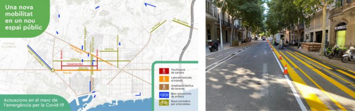 Via Laietana was chosen because of the yellow painted streets. Carrer de Seneca was chosen because of the better vantage point for camera location.
Methodology
Buildings, street network, and morphology defines the base map. The computer vision detection focuses on tracking the more dynamic elements of the city, particularly: persons, cars, bicycles and motorbikes – and their association with the base map.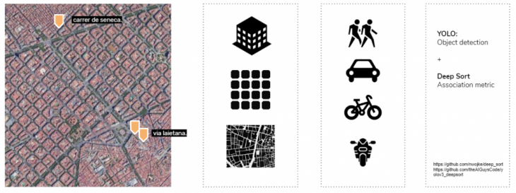 Yolo was used for object detection. Deep sort as the association metric to tag / attach ids to each detected element as they move through time.Detections are classified into different classes – cars, persons, bicycles, and motorbikes. The count is the number of id’s that the algorithm detected. The algorithm sometimes fail to associate the id to the tracked element. In this case the algorithm creates a separate id to an element that already has one. The count therefore does not exactly reflect the actual number of the tracked elements. The count however provides an approximation of the possible distribution of the different elements in space. The street was segmented across its cross-section (building, sidewalk, parking, street, bus lane)
Urban analysis
Via Laietana (1)
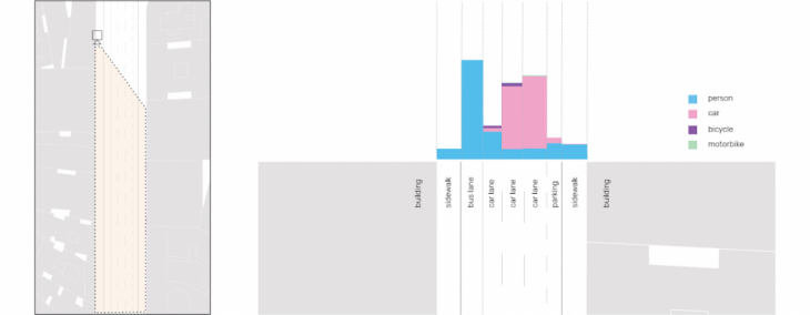 Combining the count and the cross-section we can identify the utility of the different segments of the space in a particular scope of time.
 2 maps methods of computer vision detection were used to map the points which was done to cross-reference the validity of the data. The algorithm uses bounding boxes to mark detections. To map these computer vision detections on a map, the center points of the bottom edge of each bounding box (where the feet meets the ground) were extracted. The two methods are produced similar results, meaning that certain issues could be associated with camera placement.
The trajectory of each point is defined by the presence of a point across time. This was done by associating an id to each element. The deep sort algorithm detects the presence of the object id through different frames. By associating the location of points and the id, we can identify the trajectory of each element.
Via Laietana (2)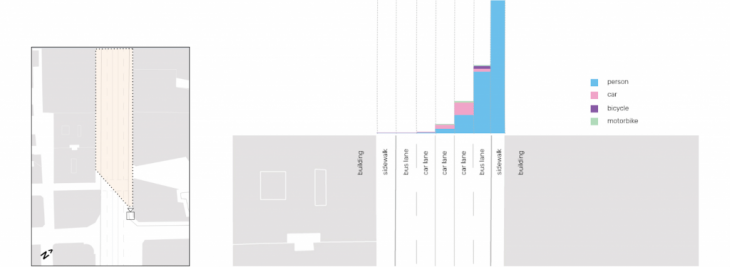
The distorted cone-shaped dispersion of points can be correlated to camera placement. A fact that remains true however, is the disproportionate amount of people cramped in the sidewalks compared to the previous analysis. It may be good to disperse this amount of people across the other segments of space to allow for appropriate distancing and movement.

Carrer de Seneca
 The better vantage point of the footage provides a more accurate mapping of the points
Design Proposal
Concept
A recent study on the spreading of COVID-19 by joggers and runners shows that these groups have a potential to project droplets as far as 7m, making the 1.5m distance unsafe for those in the path of their slipstream. Joggers lined behind each other are likely to be contaminated by the droplets of the person in front of them, whereas joggers side-by-side are safe.
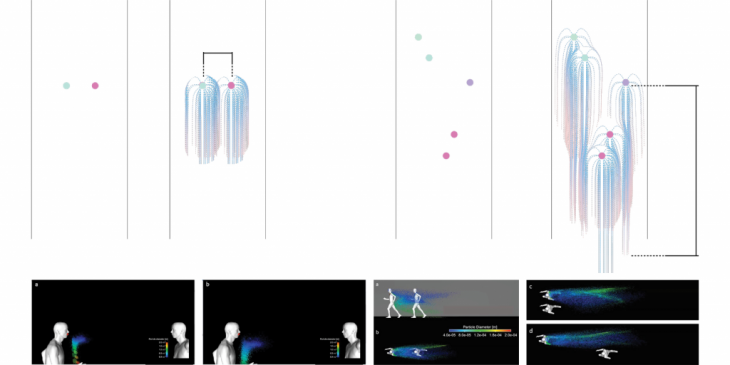
In order to decrease the possibility of contaminations, these joggers would need to be dispersed. To do this, the path was split into several sections and obstructions were placed in these sections. The jogging path was simulated with various arrangements of obstructions where joggers have to make a left-right decision upon the obstruction. These examples showed the potential of dispersion in various scenarios.
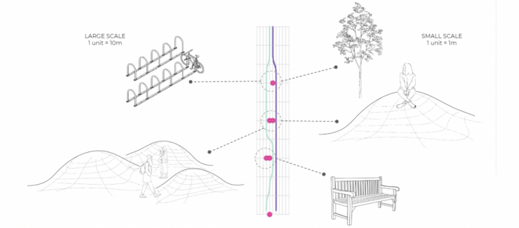
Multi-scale urban design elements
Each block in the section can be scared to represent 1m or 10m spans. At the large scale, obstructions can be entire areas for seating or even bicycle racks. At the smaller scale, the obstructions can be mounds, trees, or even benches.
Design implementation
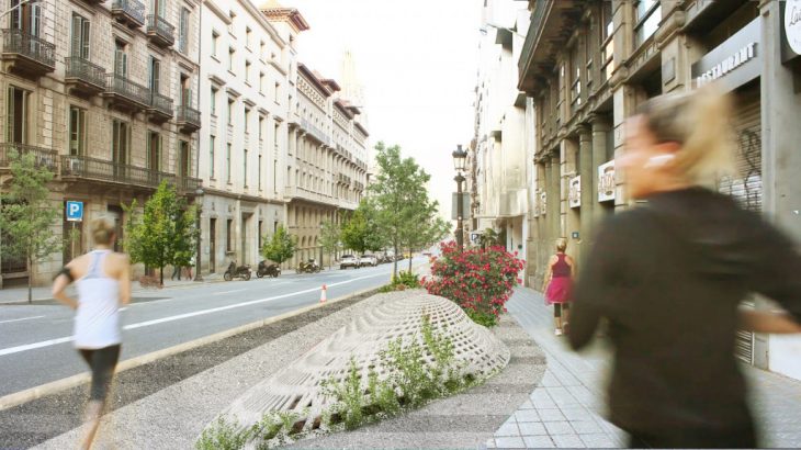
To further disperse the joggers, the path can be branched into neighbouring streets. This would create lease crowding on major streets and allow visiting joggers who are prone to use these streets to further integrate and explore the area.


Faculty: Aldo Sollazzo, Iacopo Neri, Soroush Garivani
Students: Elijah Munn, Eve Nnaji, Rashid Gilfanov, Rovianne Santiago
References:
https://github.com/nwojke/deep_sort
https://github.com/theAIGuysCode/yolov3_deepsort
