The course
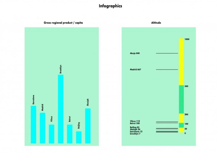
Habitat OS – Sharing cities’ project – has started developing Urbanization.org, a common platform to share knowledge on cities and public space. With this purpose, this term 40 streets from 8 different cities have been analysed in terms of spatial qualities and element quantities.
Steps followed
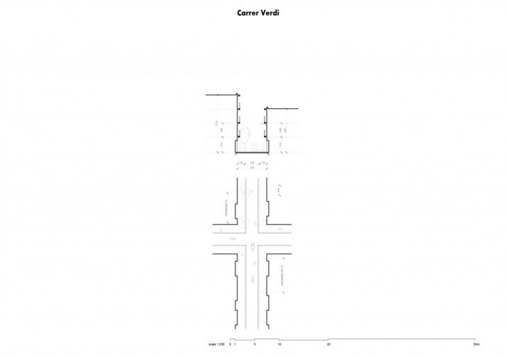
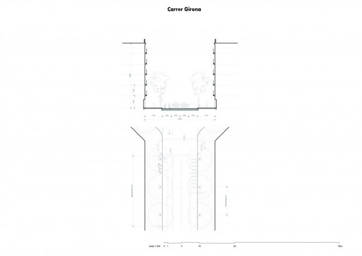
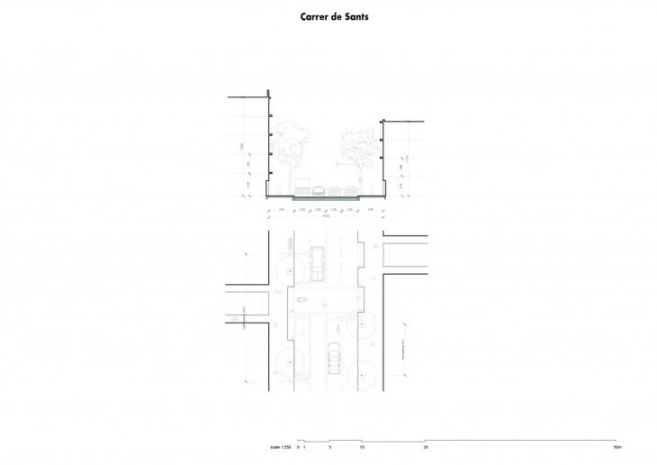
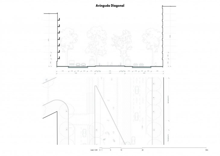
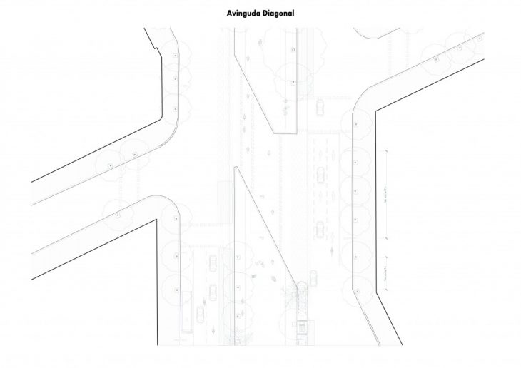
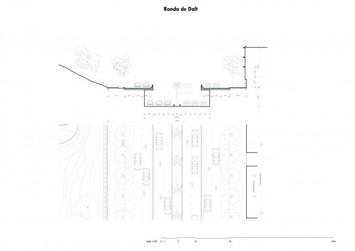
The approach to analyse cities starts recognising their main urban corridor structure. This enables to detect different typologies that cover and articulate the urban system of each city. After this, one street for each typology is selected and analyzed fully: from its position and total lenght to its basic geometry to finally be able to describe its main elements.
Outputs
The analysis has been developed in two directions: a qualitative and a quantitative approach. The outcome of it is a set of drawings (sections and plants) and a database of about 200 parameters that will help comparing different aspects of all cities.
Barcelona
As for Barcelona, the streets analyzed have been:
– Carrer Verdi (neighbourhood distributor)
– Carrer Girona (district distributor)
– Carrer de Sants (district main axis)
– Avinguda Diagonal (crossroad)
– La Ronda de Dalt (ringroad)

BARCELONA: SHARING CITIES is a project of IAAC, Institute for Advanced Architecture of Catalonia, developed at MaCT (Master in City & Technology),
2017-18 by:
Students: Alba Alsina Maqueda
Faculty: Vicente Guallart, Marta Milà
