MAP 1 – Collections + Distributions of Leaves
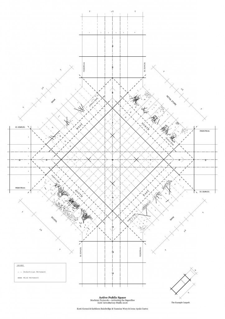
For this strategy, the movement of leaves across the site has been mapped over the space of a day. The map shows the clusters of leaves attracting to various areas, as well as the spastic dispersion around the site.
This mapping is to be repeated again different climactic conditions (windy v still days) to generate a broader and more accuracy range of results.
From this mapping exercise, the clusters can be see to cling to impediments on the footpath, protected from the breeze. We would like to see the effect of greater wind levels on the area, as well as consider further the fact of pedestrians + cyclist on the air movement.
MAP 2 – Dilapidation of the street
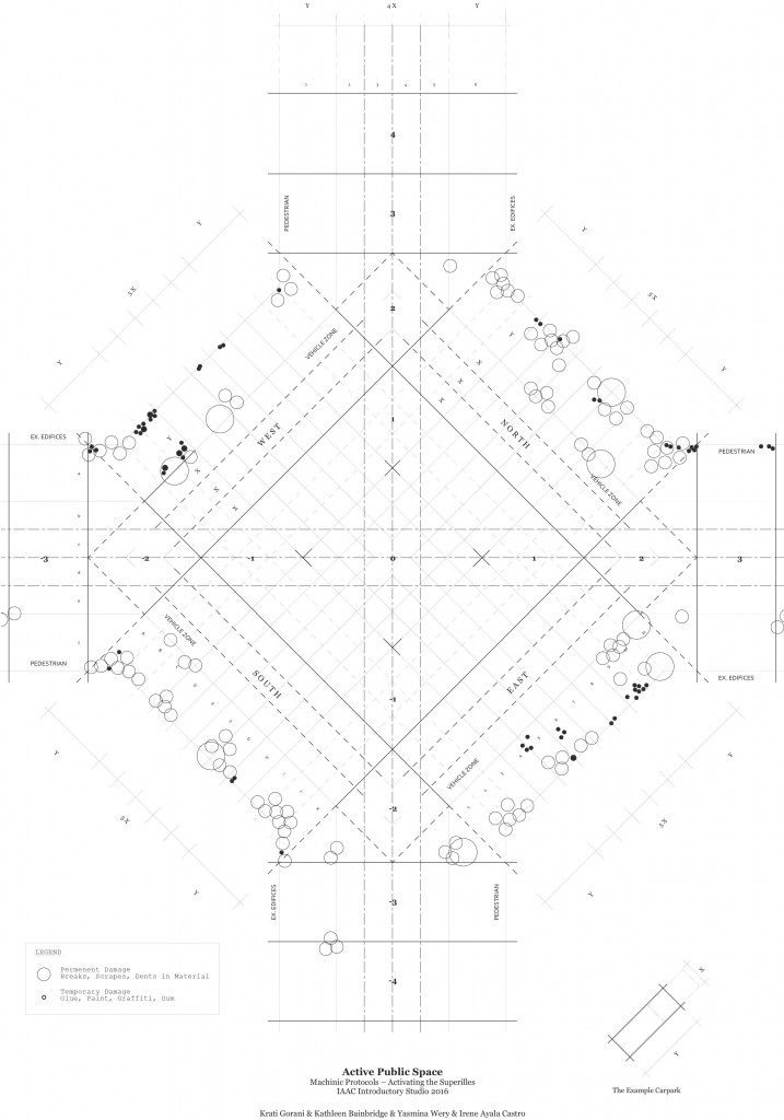
Wear and tear to the pedestrian zone occurs incrementally overtime, building upon itself, slowly, so as to avoid notice from passers by. We aimed to map this dilapidation of public surfaces, by deciding the damage into ‘permanent’ and ‘temporary’ afflictions.
Permanent are those that create a physical change, such as chips and cracks, while temporary damage relates to chewing gum, graffiti and scuff marks.
The map above breaks down the damage into these two categories – noting a propensity for damage to occur near road crossings and openings to store fronts. In these areas, speed is slowed down and contact with the physical environment increased.
To add further detail to the map, we intend to look more closely at the various scales of damage, and be more methodical with the mapping process.
Cartography is a project of IaaC, Institute for Advanced Architecture of Catalonia, developed at Master in Advanced Architecture in 2016/2017 by:
Students: Yasmina Wery, Irene Ayala Castro, Krati Gorani + Kathleen Bainbridge
Faculty: Edouard Cabay + Rodrigo Aguirre