// Pedestrian Centric City
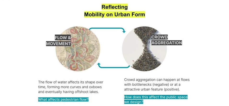
Everyone benefits from having a more walkable city. We gain improvements to our health, happiness and even improves the economy of a city. Urban planners and architects are aware of this importance and are constantly working towards reaching this standard. The tools that help us in this industry however are still quite limited, time consuming or expensive. There is opportunity for machine learning to help us build on current pedestrian simulation tools which is currently a process that is under developed, and yet is key to planning a healthy city.

How does this affect the public spaces we design? From the geometry such as plazas and sidewalks, to the programs such as the type and number of amenities in a given space.
// Urban Path Maker Tool
We aimed to create an interactive simulation tool for designers to iterate through multiple interventions with speed and ease so that a holistic evaluation can be made on the impact of our urban design decisions. Currently there are many existing pedestrian movement simulations already available, which we plan to implement and mix with machine learning technologies to generate a stronger simulation tool.
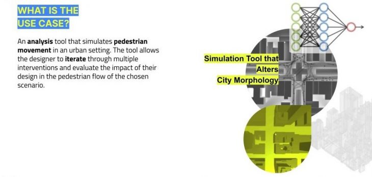
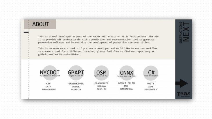
This Pedestrian movement prediction tool is intended to be used readily by urban designers and planners. On the front end is the Urban Path Maker tool that is created using Unity and has a Game-like interface that provides ease of usage and this will help planners get quick simulations of their design. The back end is a 2 level process that involves extraction of data from open source dataset and a Grasshopper script that exports the 3D model of the part of the city that we want to simulate.
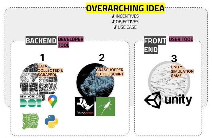
Front end of the UPM tool allows for easy access to pedestrian simulation in a user friendly way. Back end of the UPM tool allows for flexibility and openness so that others can adopt the tool to their particular case and build on it.
// Case Study – New York City
New York offers a publicly accessible NYCDOT pedestrian dataset as an alternative to OSM/Google Places data. This particular dataset is publicly available, and the methodology of its collection is completely transparent. For over 10 years, the city of New York has included pedestrian traffic as part of the mission of the Department of Transit, and as such it has collected data for it in as thorough a method as it has for other methods of transport. New York City relies on the MTA metro system to collect data on daily riders, however it deploys city workers twice a year to count the number of people crossing a particular street during the morning and afternoon rush hours in 100 locations throughout all five boroughs. This method of data collection means that local pedestrian traffic, not only commuters, are taken into account.
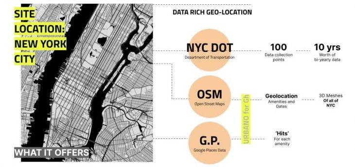
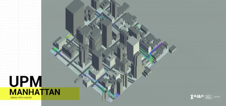
New York City, which is a data rich geo-location was chosen for the first implementation of the Urban Path Maker tool.
The availability of this dataset is a crucial part of choosing New York City as our case study. To create a pedestrian simulation tool based on machine learning models, it is important to have reliable data to train these models on to get the best and most unbiased results. We also would like to highlight the importance of the work that the Department of Transit in New York has done in collecting these data as this dataset has allowed us to study and create this tool. The Urban Path Maker tool can be replicated in any other city that has a similar pedestrian dataset.
// Data Gathering
Even with these datasets in hand, we had become highly aware of the faultiness of relying solely on second hand-sourced web data, and understood the importance of generating our own dataset through alternative methods, which prompted us to explore data-generation using an ANN Regression Training. Using the existing dataset, which we found was plenty in certain popular areas and sparse in others, we were able to generate predictions of number of pedestrians in any part of New York City. This trained model would be the building block of our tool in the Unity game interface.
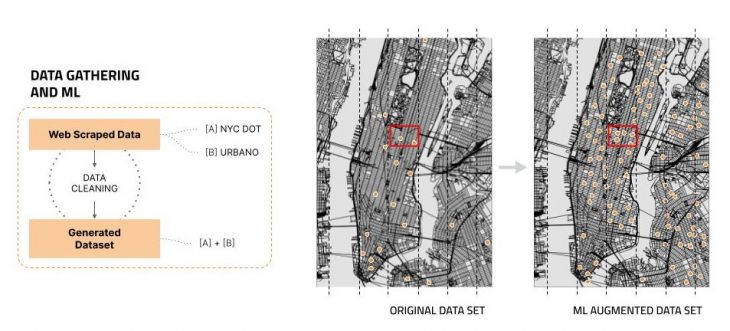
Generating our own data set using Machine Learning
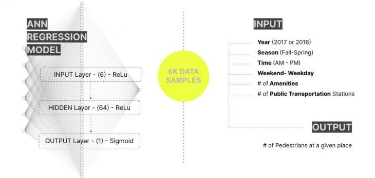
The architecture of our trained model using 6000 samples of the web-sourced dataset
// Creating UNITY Front End
After some evaluation of available software programs, we decided on using Unity for the development of the Interactive Game UI. Unity offers a behavior and flock based agent creation that is suitable for simulating pedestrians. It can also support the trained machine learning model that we have derived from the data collection via Barracuda in Unity. The software has an easy UI component that can be an attractive and friendly interface for the planners and designers to use.
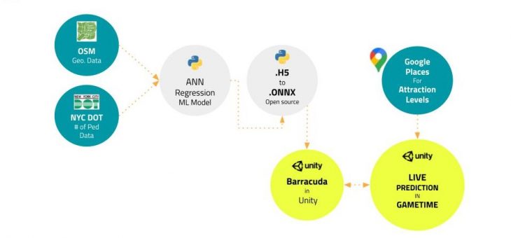
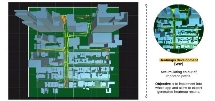
Flowchart of the processing of gathered & generated data into a trained machine learning model to live pedestrian predicted program in Unity.
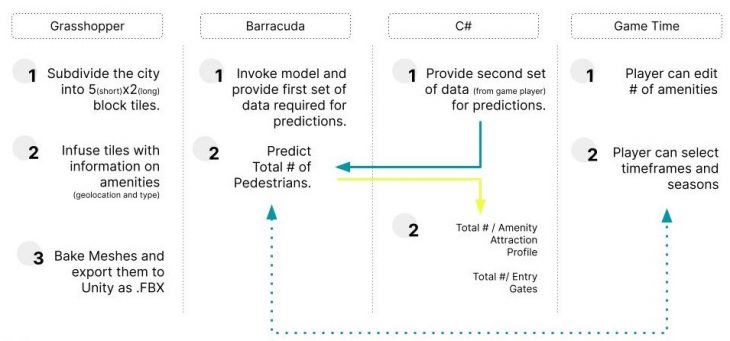
Diagram of our workflow that includes Grasshopper, Barracuda, C# & Unity.
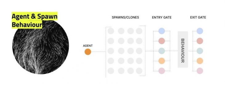
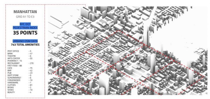
The behaviour is based on the agent’s attraction to different types of amenities. The number of agents per behaviour are based on the weight analysis from google places API extracted using urbano hits.
// Urban Path Mapper Interface
Step 1: Urban Path Maker
Step 2: About the Urban Path Maker Tool
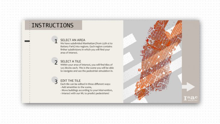
Step 3: Urban Path Maker Instructions
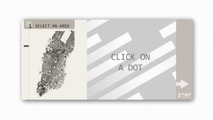
Step 4: Select an area in New York
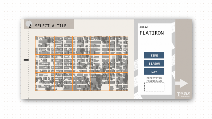
Step 5: Select a tile in the area
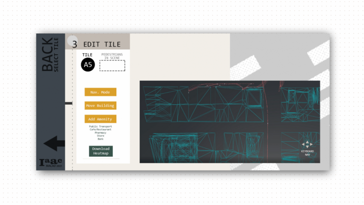
Step 5: Enter interactive pedestrian simulation & prediction to make changes and test design in 15 minute runtime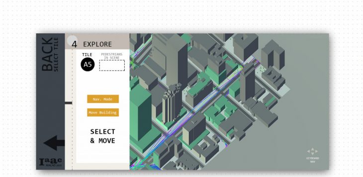
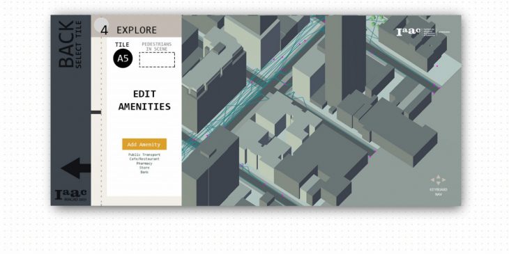
Step 6: You can explore and observe the pedestrian movements by making changes in the type and number of amenities and moving the building blocks around
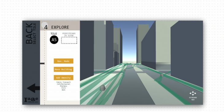
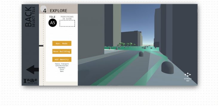
Step 7: Use the Navigation to explore views of the pedestrian movements from different angles
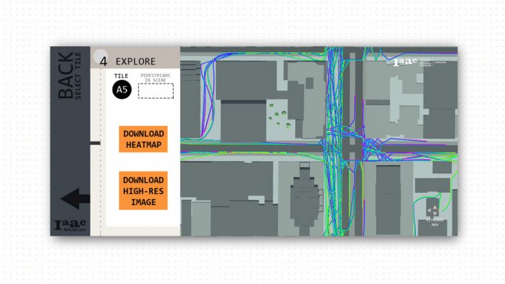
Step 8: Download a high resolution image of you final configuration and a heatmap WIP) for further studies
// REFLECTIONS
// Link to Theoretical Discussion
Link Here >>> Urban Path Maker : Theoretical Discussion
// Link to Project Repository
For developer use, please follow the link below to our GitHub repository.
All the relevant developer information is available in the readme section.
Link Here >>> Urban Path Maker GitHub
‘Urban Path Maker’ is a project of IAAC, Institute for Advanced Architecture of Catalonia developed in the Masters of Advanced Computation for Architecture & Design 2020/21 by Students: Marissa Ridzuan, Cami Quinteros, Andrei Okolokoulak, Krishnanunni Vijayakumar and Faculty: Angelos Chronis & Oana Taut