Alzette River Analysis and Risk Assessment
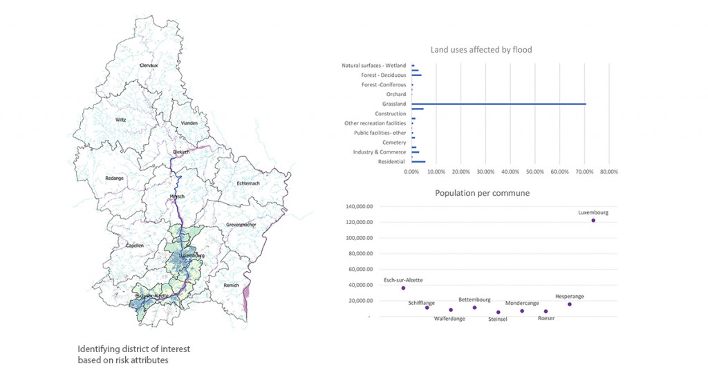
Identifying areas of interest and high risk
As part of a wider renaturing study of the Alzette River in Luxembourg, the Alzette River analysis is aimed at identifying current environmental and physical issues in the river. These high risk areas are identified in order to apply appropriate interventions.
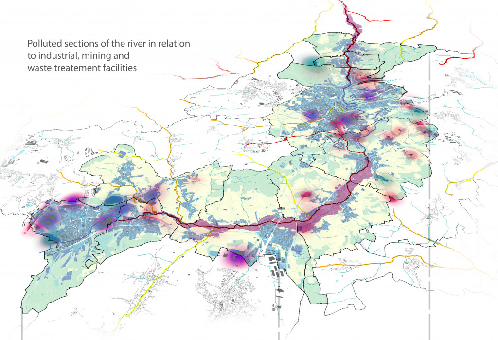
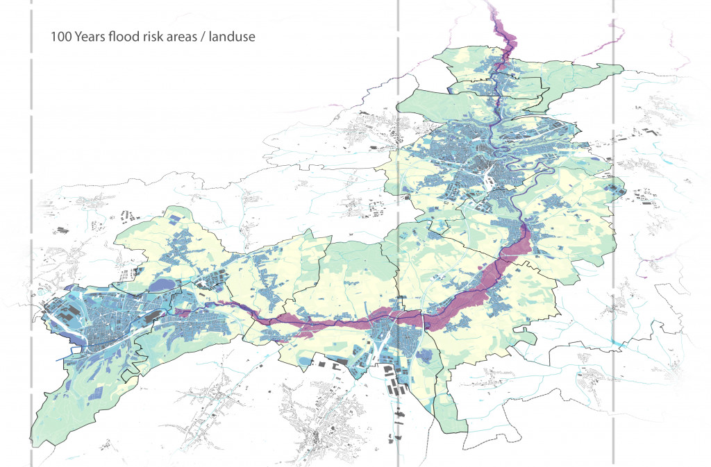
Following extensive research and data collection mainly from the Luxembourg official geo portal, a number of issues in the Alzette river were identified. These mainly concern flooding, pollution and the ecological status of the river. An analysis on population in the communes surrounding the rivers was carried out to identify areas with the highest population. These areas would be the focus of the first stage interventions due to the importance of citizen participation in the renaturing project.
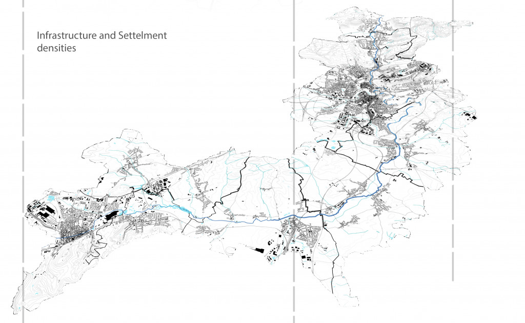
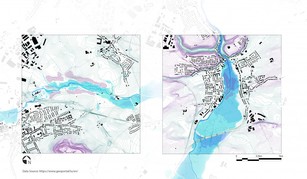
The maps shown in this study show areas affected by flooding, sections of the river with bad ecological status and pollution. Land use and infrastructure was overlaid to identify possible connections and sources of pollution which were assessed in the identification of pilot study areas. In addition to land use, pollution and flooding analysis through maps and observation.
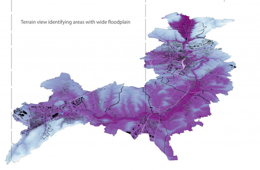
The above analysis resulted in the selection of two areas for further study and intervention. Location A is the upstream of the river as it enters the wide floodplain, and location B is downstream just before the river enters the city of Luxembourg and departs the wide floodplain.
The two identified zones of interest will be studied further as part of the Internet of Cities Studio.
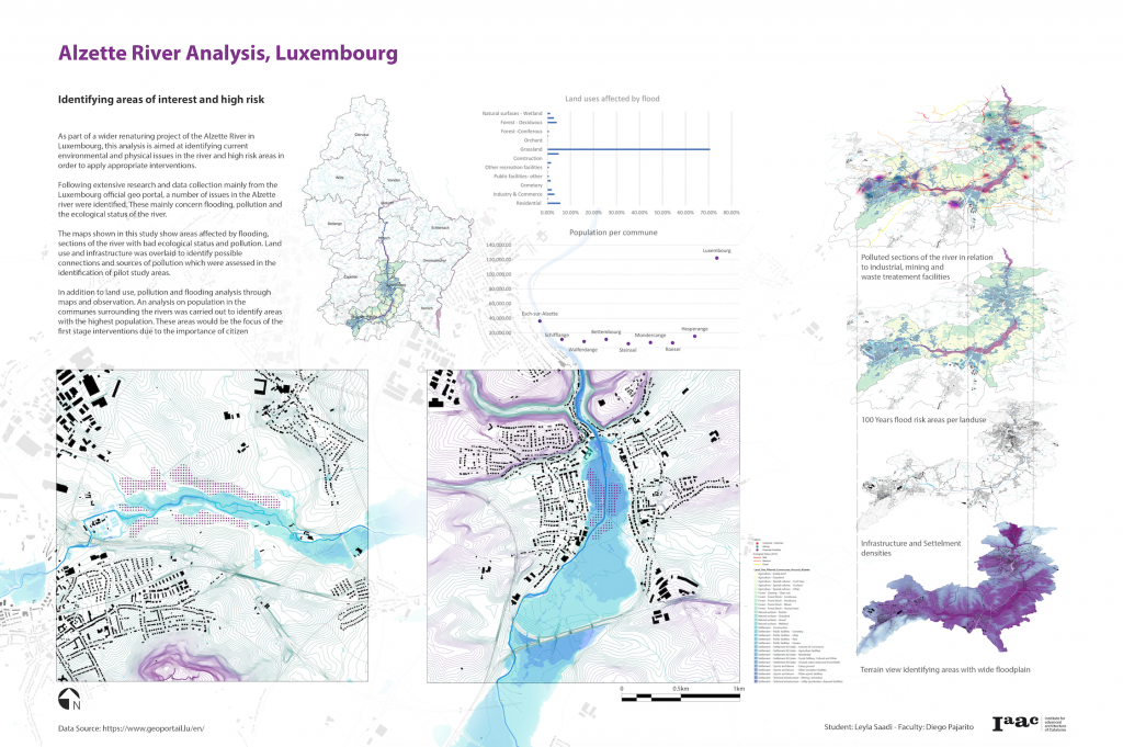
Alzette River: Analysis & risk assessment is a project of IAAC, Institute for Advanced Architecture of Catalonia developed at Master in City & Technology in 2020/21 by student: Leyla Saadi, and faculty: Diego Pajarito.