Technically we can consider the soil as the “skin” of the planet, covers it entirely with a layer that varies from 70 to 200 cm; in this thickness range, occur some of the most important and complex phenomena of regulation and biological transformation of the whole planet.
The phenomenon of land consumption generates in fact high and evident damage environmental, such as the loss of important ecosystem services, like carbon sequestration or the interruption of the natural corridors used by animal species to move on the territory.
This study is preliminary to broader research, linked to the identification of ecological networks, as a conceptual tool of extreme importance for the conservation of nature and a sustainable land use order.
INTRODUCTION
The objective of the present poster is the analysis of land uses trends as one of the most important indicators of changes in the ecosystem, with particular reference to the spatial evolution of the cropland as a key element in the territory’s rewilding strategy.
The study area is located in the plana del Vallès unit, up of Barcellona, and it’s the result of a preliminary analysis that showed the high potential of this area in terms of ecological connectivity, using abandoned crops as an opportunity to mend.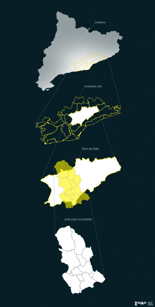
THE ANALYSIS
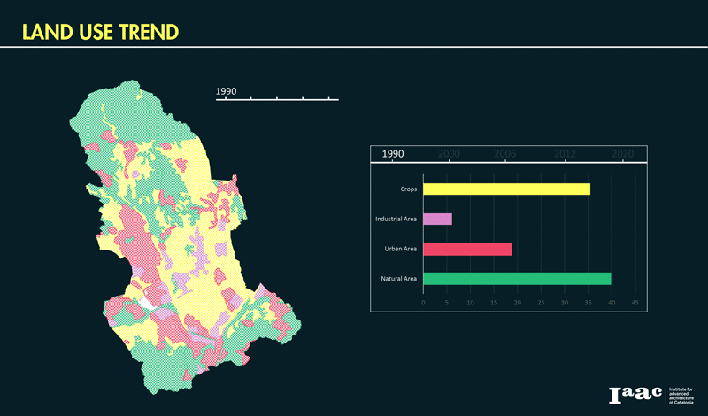
The reference dataset is the Corine land cover (CLC) maps, between 1990 and 2018 (v.2020), modeled by 4 macro-categories:
-Crops
-Urban Areas
– Industrial Areas
– Natural Areas
In the first phase, I analyzed the percentage variation of areas occupied by each category within the macro area.
The continuous increase of the urban area, which includes the growth of infrastructural networks and service areas for residences, and industrial areas, such as logistics and commercial service areas for industry, leading to a continuous reduction alternating agricultural and natural areas.
Gif shows how the cropland is particularly influenced by changes and tends to decrease over time.
The second step is been the statistical analysis of the four categories for each municipality involved within the green corridors identified in the preliminary analysis.
It is interesting to note how all the municipalities show a continuous loss of cropland, whose percentage difference, not converted into urban or industrial uses, is defined as abandoned cropland but considered, in this analysis, as part of the new natural areas.
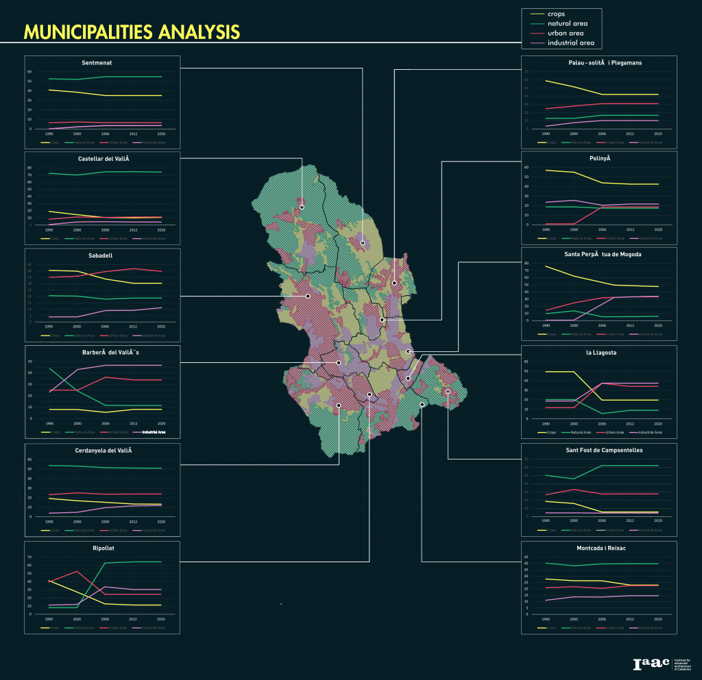
The availability of these largely abandoned croplands today becomes a great opportunity for the creation of ecological corridors capable of reconnecting existing habitats and the conservation of different ecosystem functions.
This analysis, in addition to showing the territorial trend for each municipality, has the objective of deepening the selection of the stakeholders involved.
30 years of land use trend is a project of IAAC, Institute for Advanced Architecture of Catalonia developed at Master in City & Technology 2020/21 by student: Simone Grasso and faculty: Diego Pajarito.
