This project aims to analyze the current commercial, housing, and population density of the 22@ Innovation District of Barcelona. The development of the 22@ has not been equal between the areas upper (22@ North) and below (22@ South) Av. Diagonal. This unbalance offers new opportunities to revisit and modify some crucial elements of the project, promoting a more balanced mixed urban model among uses.
Context
Since 2017, the entire project of the 22@ has been analyzed and rethought in order to identify the elements that have worked during the previous years. At the same time, this process aimed to adapt the 22@ to the new challenges and needs of the city of Barcelona. The “Pacte Cap a un Poblenou amb un 22@ més inclusiu i sostenible” represents an agreement among the main stakeholders involved into the 22@ project (Municipality, business sector, universities, neighbourhood associations…) for a more inclusive and sustainable growth. On the other hand, the “Repensem el 22@” is a bottom-up participatory process to gather the opinion and needs of the citizens.
Finally, the past 25th of November, during the 20th anniversary of the 22@, it was reaffirmed the willingness to keep promoting the 22@ as an opportunity for the city.
Methodology and process
The project has been developed in the following 5 main blocks:

Project methodology
- Data collection & cleaning: data about parcels and blocks (illes) have been downloaded mainly from the Spanish Cadastre and open data of the Municipality of Barcelona. According to the needs of the project, the data collected has been analysed and cleaned, reducing the quantity of data.
- Data calculation: The data used to represent the 3D model has been extracted and converted from the specific codes of the Spanish Cadastre, while the densities have been calculated by crossing available data (area, population, commerces, housing units).
- Elevation model 3D: The elevation has been developed using the heights of each parcel (over 8.000) and coloured them based on a gradient, having the highest value as the darkest value.
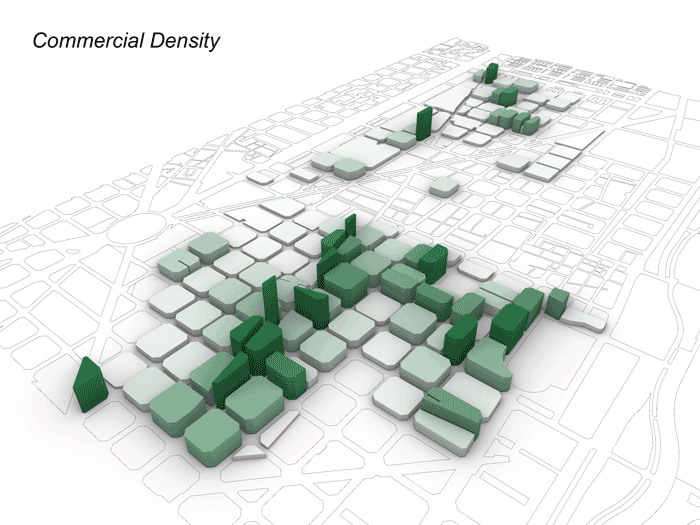
- Densities visualisation: The densities of each block are shown both in colours and height, being the tallest and the darkest, the blocks with the highest values.
- Data analysis: Each graph has shown specific peculiarities of the density distribution and the same “height concentration”.
Output
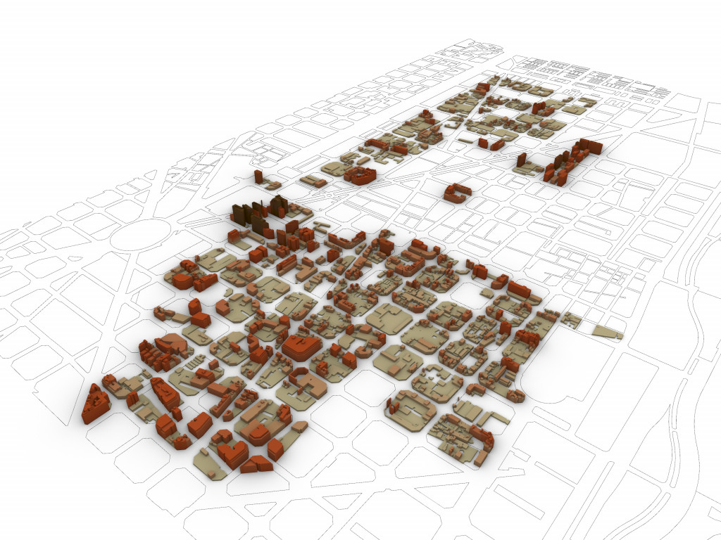
Building height
Building height: The areas with the highest buildings of the 22@ are located on the low part of the 22@, both close to AV. Diagonal. The first concentration of buildings is composed by building such as Edificio RBA, Oficinas Diagonal 197, Edificio Mediapro, Cuatrecasas Abogados, and Ciudad de Granada 150. The second concentration of building is a series of office buildings in the Sector Llull-Pujades Llevant.
22@ densities
- Commercial density: The commercial density of the 22@ is located along the Av. Pere IV. This avenue represented during a long time the main avenues of Poblenou, until the 22@ project and the urbanistic transformation extended Av. Diagonal until Forum area and practically split Pere IV with the construction of the Central Park of Poblenou. Another relevant density is on the blocks close to Rambla del Poblenou.
- Population density: Considering that the 22@ project aims to maintain and attract economic activity based on innovation and knowledge, housing has been a secondary element to be promoted. The current population density is located close to the historical main axes of Poblenou: Rambla del Poblenou and Av. Pere IV.
- Housing density: As explained in the previous graph, housing was not the main goal of the 22@ project. It is interesting to notice two blocks highly densified. The block with the highest number of housing units (Codi Illa 7130) represents mainly a housing block.
20 years of 22@: densities analysis is a project of IAAC, Institute for Advanced Architecture of Catalonia developed at Master in City & Technology in 2020/21 by student: Riccardo Palazzolo Henkes, and faculty: Eugenio Bettucchi & Iacopo Neri