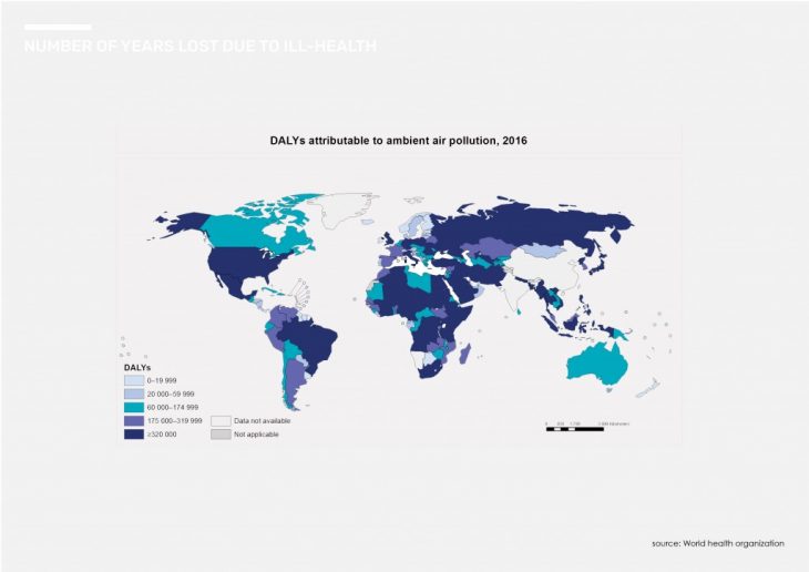
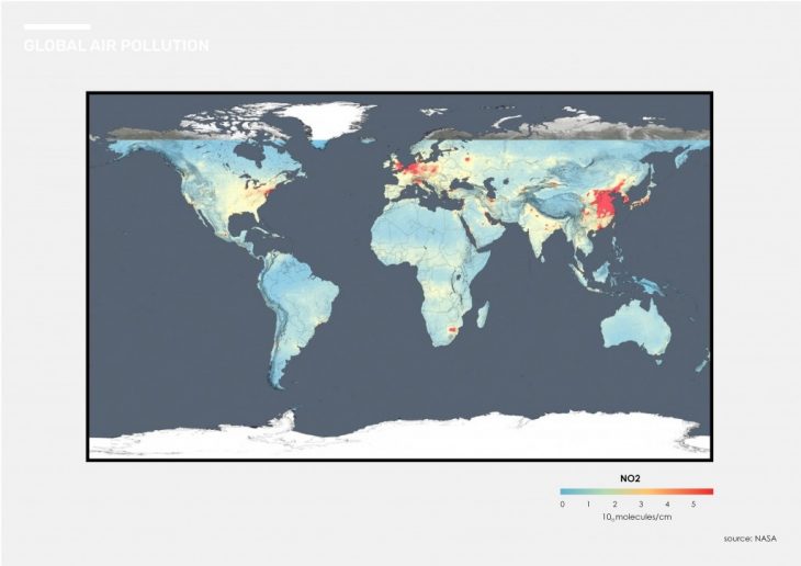
 Global air pollution is a critical issue. According to the guardian, more than 95% of the world’s population breathes unsafe air. To understand the issue from a global perspective we looked at some geolocated data concerning pollution.
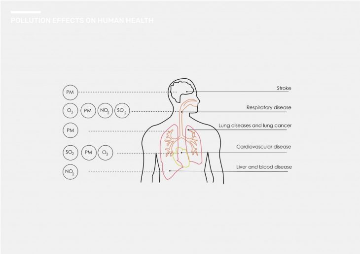
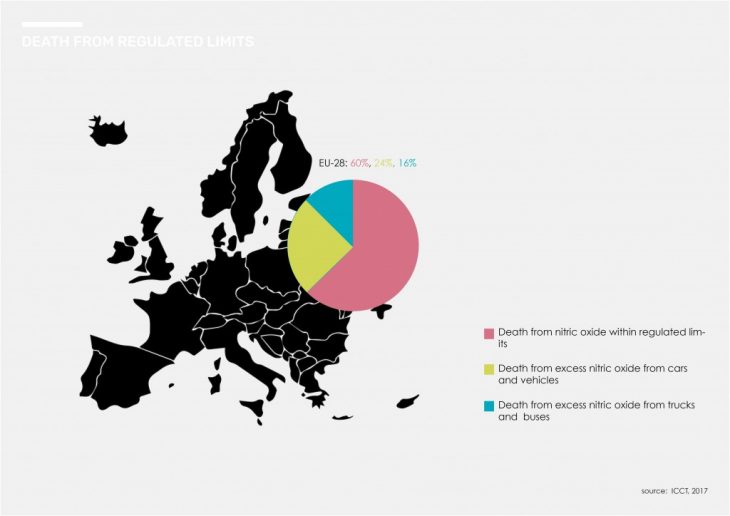
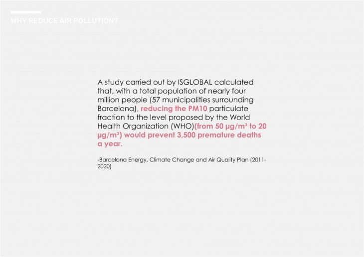
 Indeed, air pollution is a health problem. The mortality rate from air pollution is eight times larger than the mortality caused by car accidents each year. On a local level, 3500 deaths a year are caused by air pollution in catalonia. We all know air pollution is a health problem. But, How does it affect you?Pollutants with the strongest evidence for public health concern, include particulate matter (PM), ozone (O3), nitrogen dioxide (NO2) and sulphur dioxide (SO2).
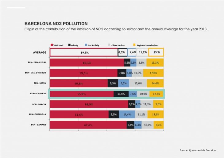
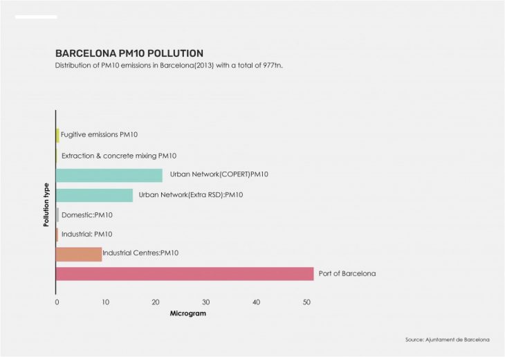
 For the sake of our research we decided to focus on PM, NO2 and CO2. Looking at the charts, Barcelona´s air pollution is decreasing. Sometimes even going below the threshold mandated by the World Health Organization.
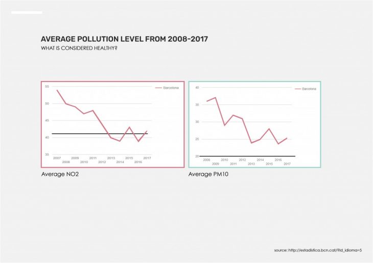 But is that healthy?
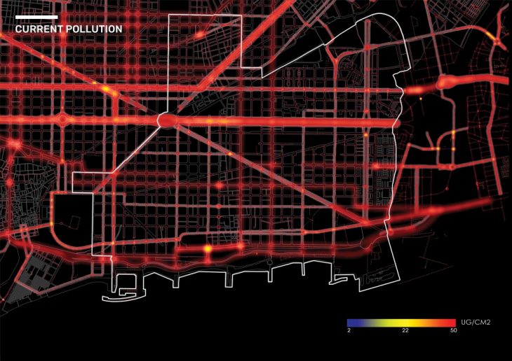
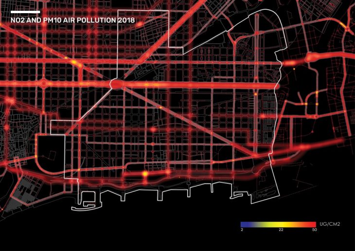
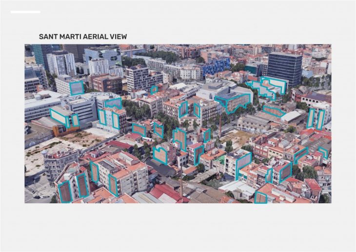
To focus our solution, we looked at the current sources of pollution in San Marti. The largest source of pollution being roads and the second being industry.
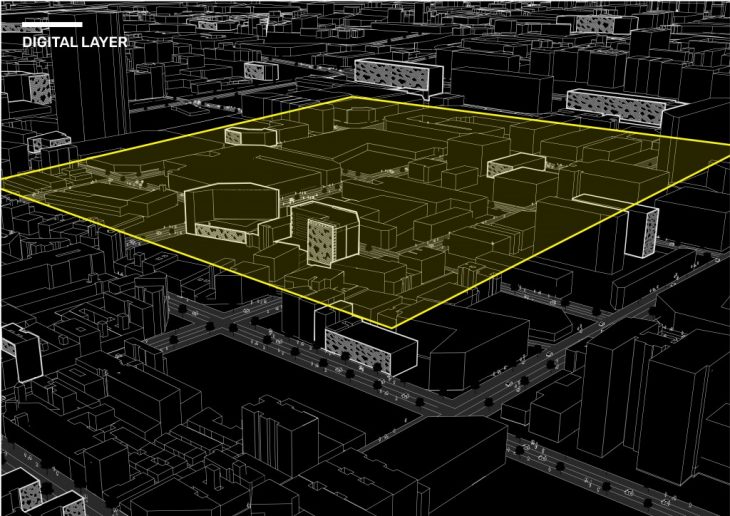
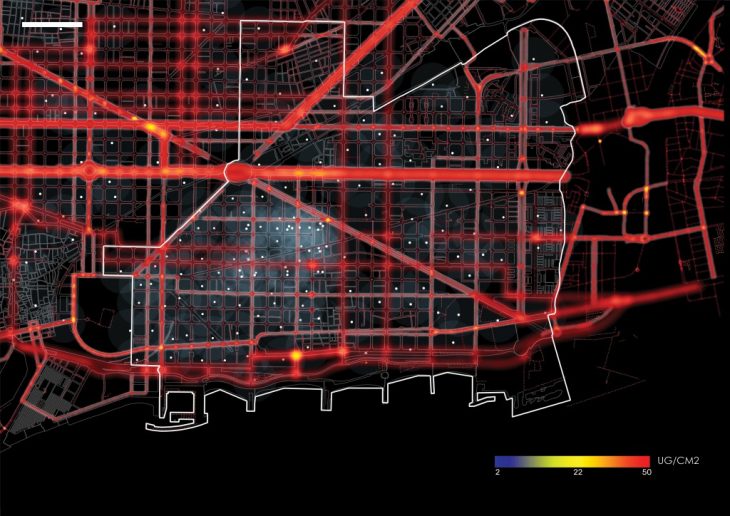
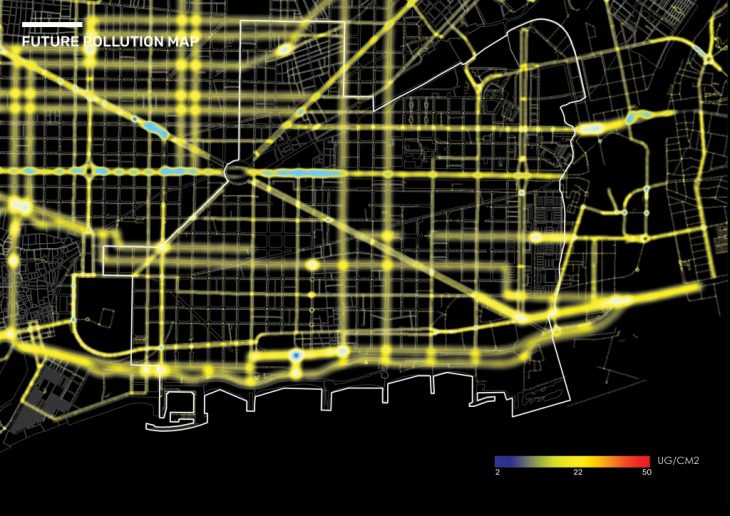
We then focused on a 28 block radius for the implementation of our solution. As we could not find specific enough data concerning NO2 and PM concentration, we went on the ground to collect the data necessary to map the concentration of air pollution on the primary, secondary, tertiary and residential roads. This allowed us to later visualize this at a street level resolution to understand how much reduction would occur from the application of our solution.
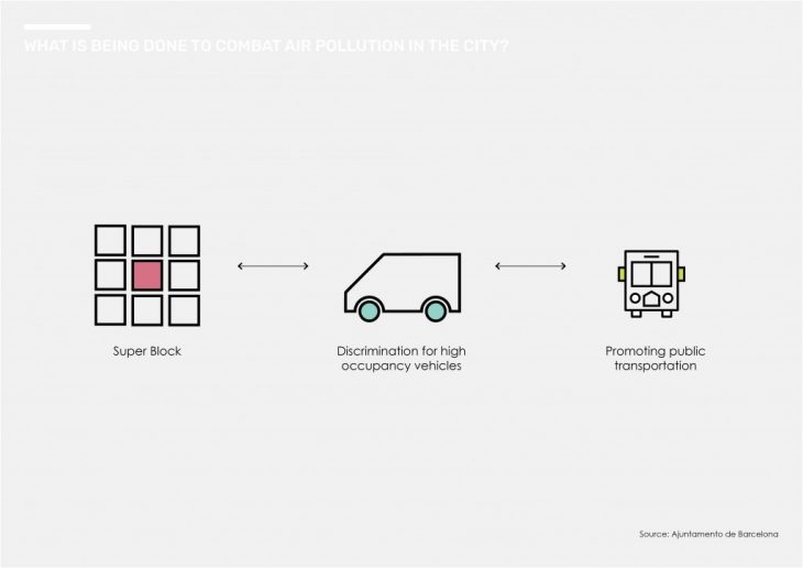
We sought to first understand the measures being taken to fight air pollution in the city.
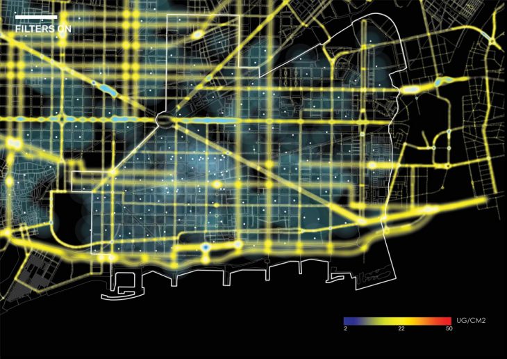
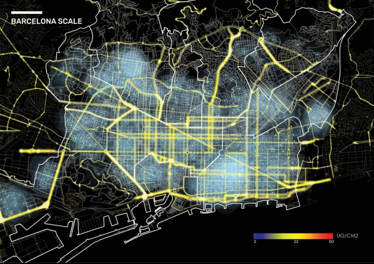
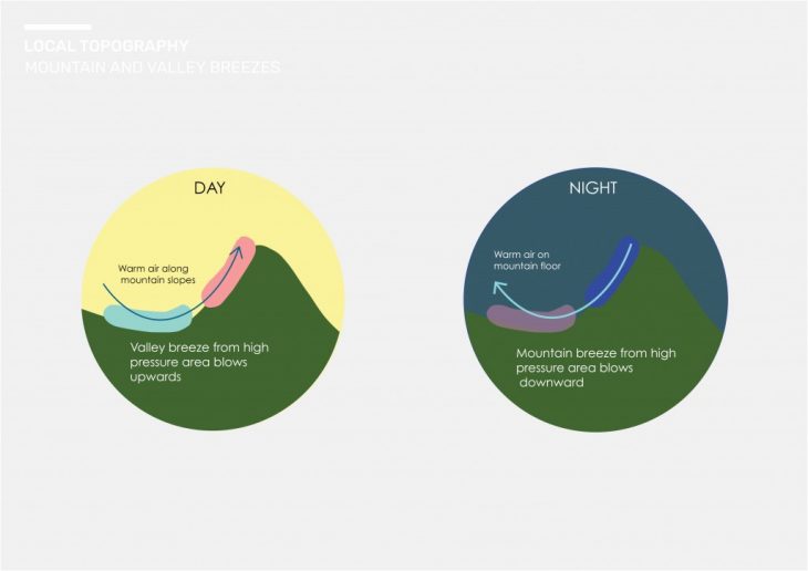
As seen in the previous maps, pollution particules are everywhere. They move fast and are influenced by a multitude of factors among which: local topography and wind. However, if we know how pollution moves we can create ways to capture it.
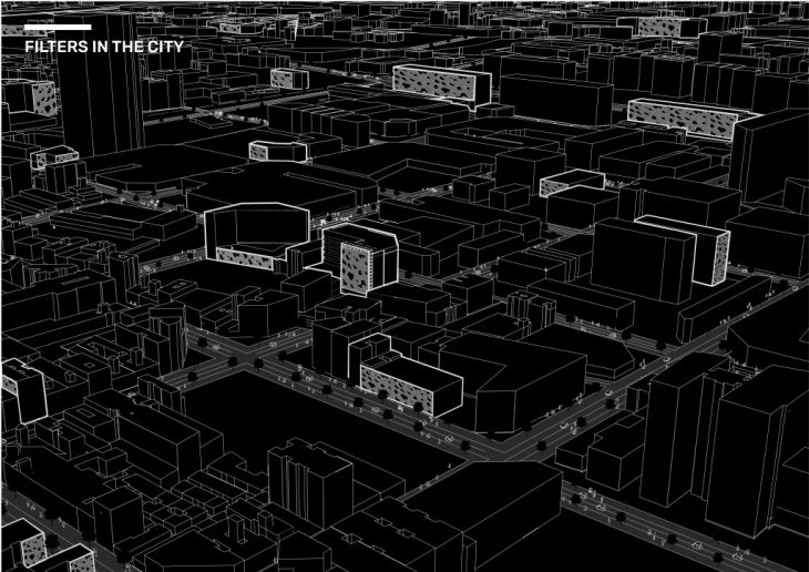
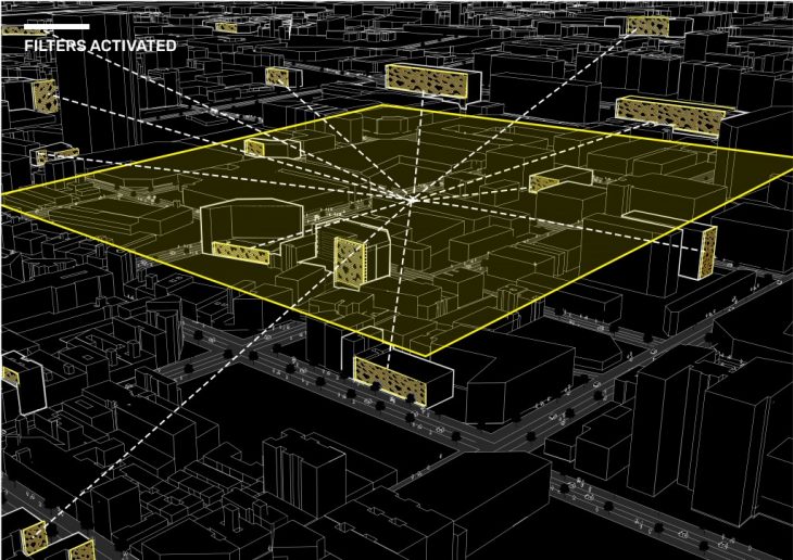
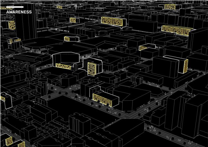
So, how do we capture something that is always moving? By activating a dormant infrastructure that is always present: blank facades. Our proposal is to use buildings as filters to capture pollution as it moves around the city.

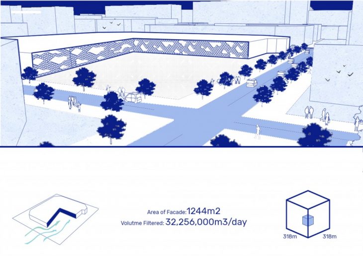
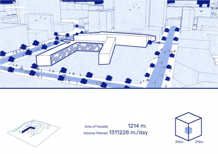
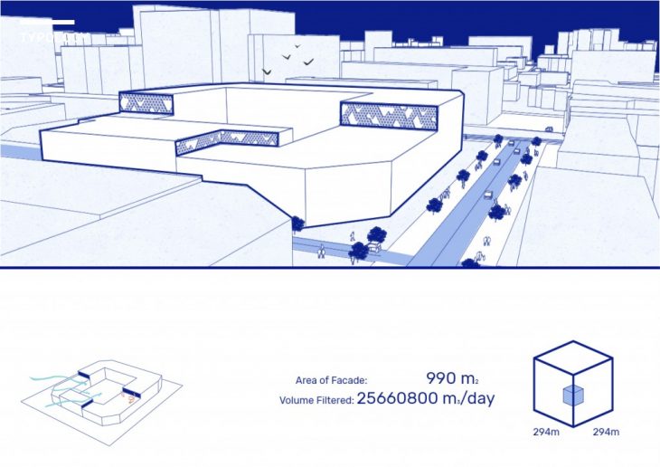
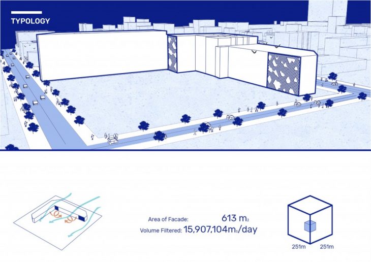
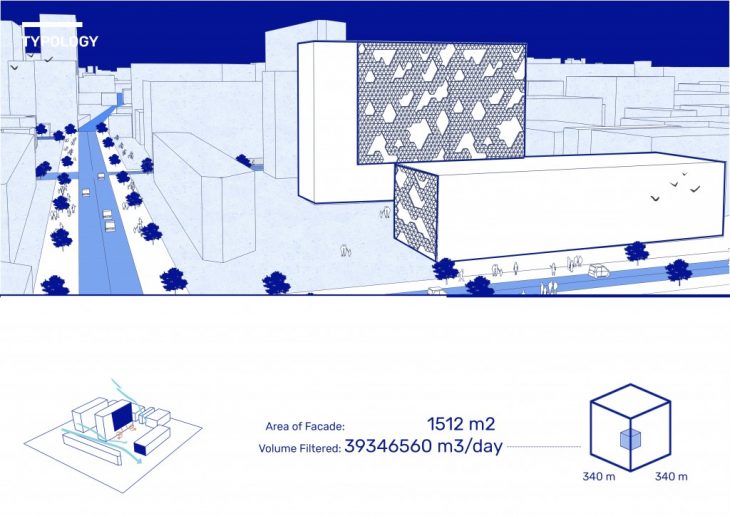
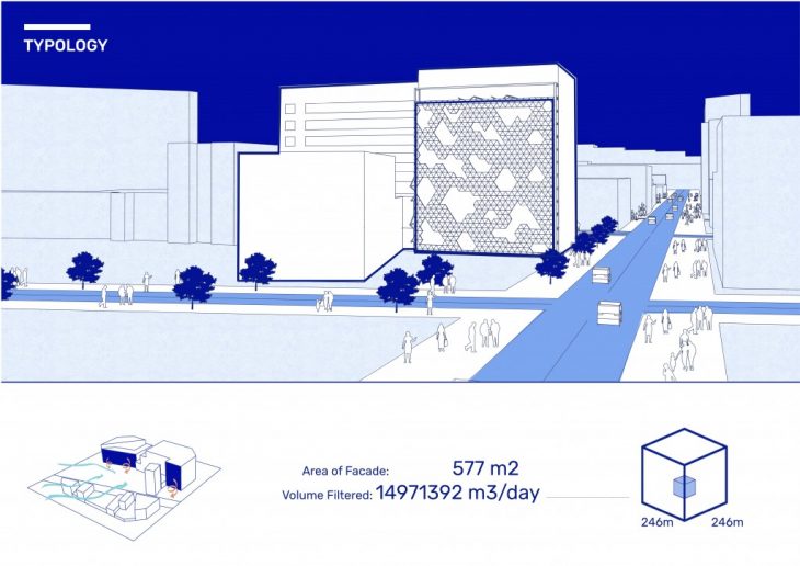
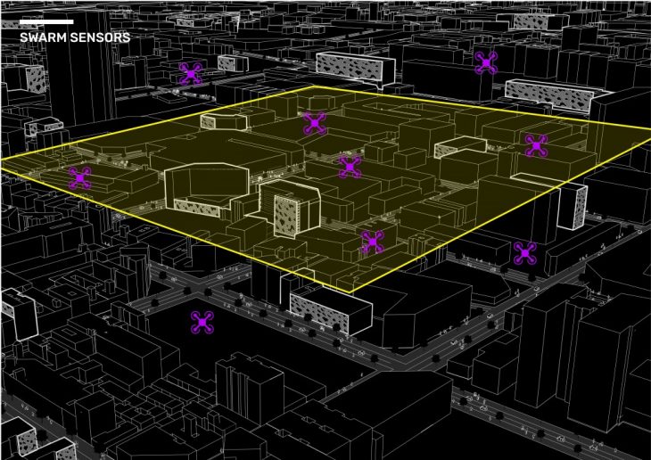
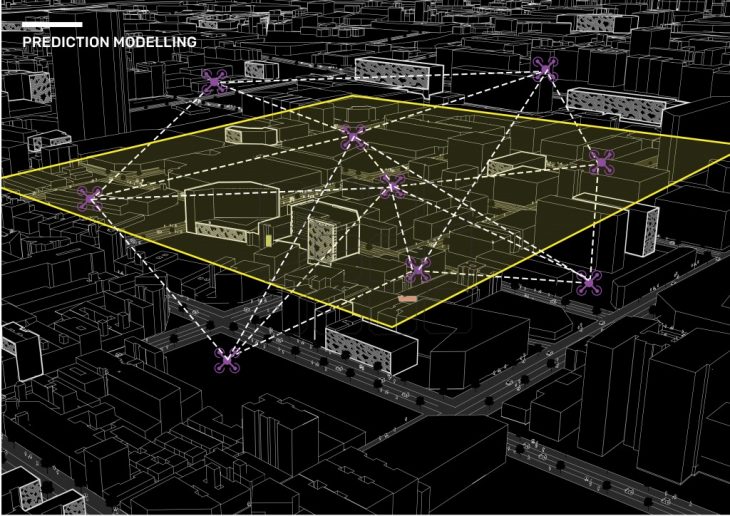
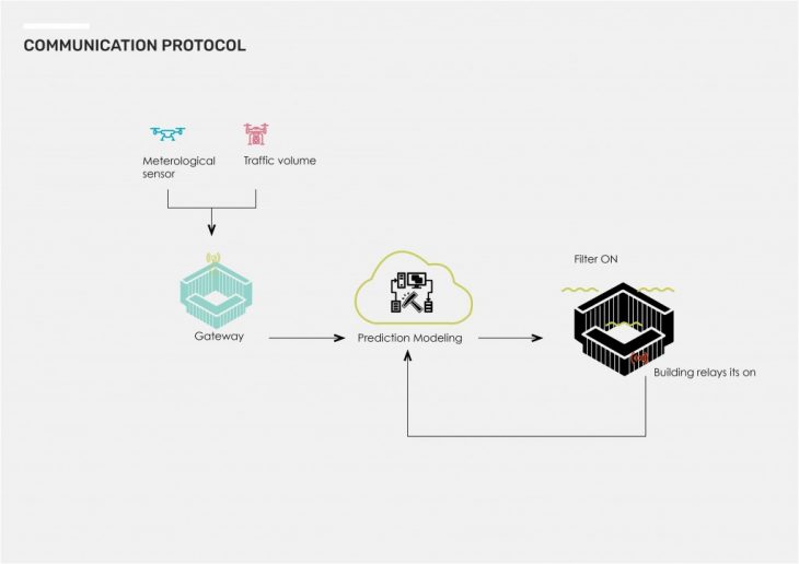
Air pollution is dynamic.It changes in concentration as it moves upwards and across the city. For this reason, drones will be used to capture both meteorological data and traffic volumes. They will send this information to a prediction modeling software. Prediction modeling allows us to activate filters before the pollution arrives.
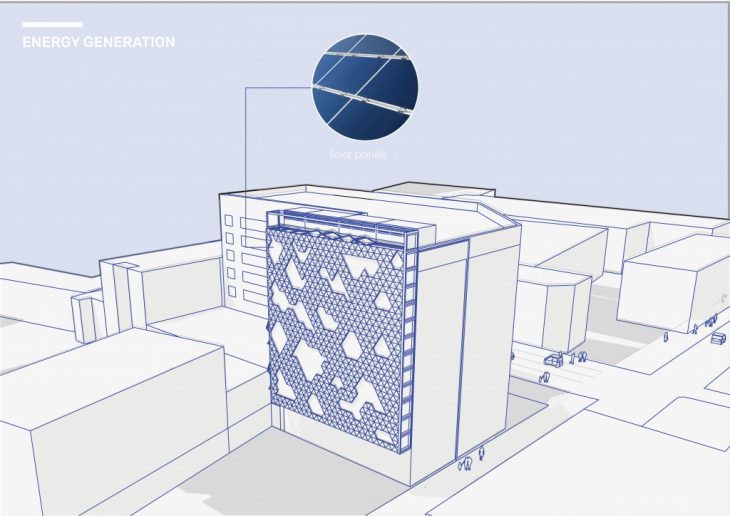
How does it work? The exterior is a series of triangular shaped, thin film solar panel for energy generation.
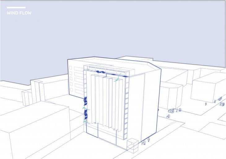
A system of shutters surrounding the filter open and close depending on wind direction in order to capture pollutants.
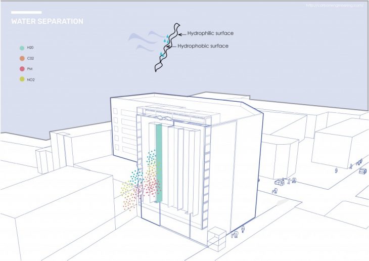
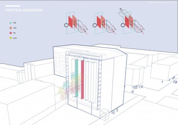
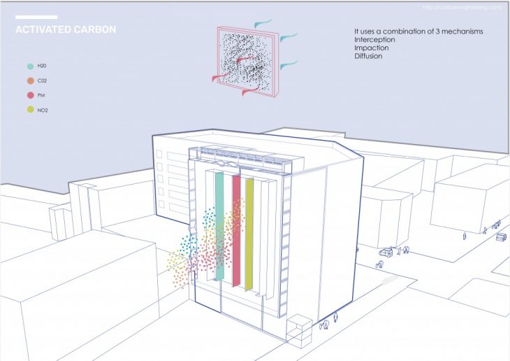
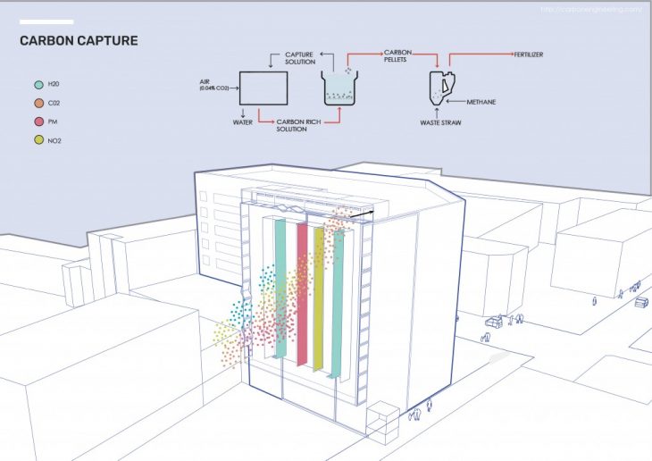
They then go through a series of filters.
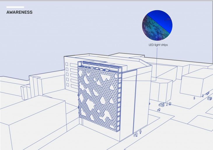
 But does the capacity to filter mean pollute more? No, the filter cover is equipped with Led Strip lights that change color based on pollution levels and whether filter is on or off.
This could potentially change not only how citizens inhabits streets but also how people view certain neighborhoods leading to price shifts of real estate based on air pollution.